Enable Location

We need your location to show you interesting places around you

Discover nearby places

Find interesting locations and hidden gems around you

Precise directions

Get accurate directions and distances to places

Your location is never shared with other users. It's only used when you tap the location button.

Stanislaus County

Log in to your account

Start exploring — it's free

Trusted by travelers worldwide

Continue with Google
Continue with Apple
or

We will send you a code to connect

By continuing, you accept our Terms and Conditions and our Privacy Policy

Check your inbox

We've sent a pincode in your inbox. Please enter the code below.

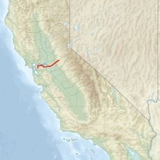
Stanislaus County, Administrative county in San Joaquin Valley, California, US

Description

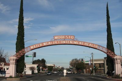
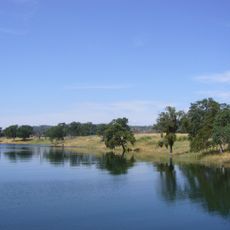
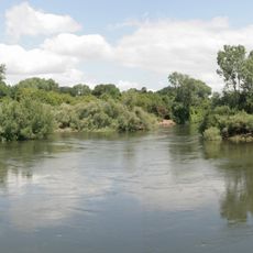
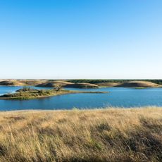
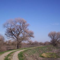
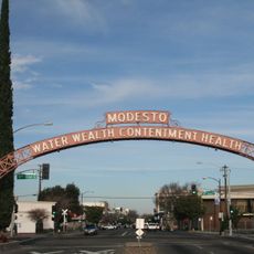
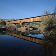
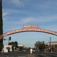
Stanislaus County stretches across wide plains in the San Joaquin Valley of central California, where fields and orchards shape the landscape. Modesto sits at the geographic center and serves as the administrative seat of this farming-focused area.

History

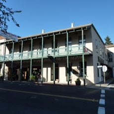
The area became a separate district in 1854 after first belonging to Tuolumne County. Before that, indigenous groups lived here until Spanish and later Mexican expeditions arrived in the first half of the 19th century.

Culture

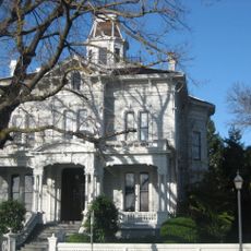
The name comes from Estanislao, an indigenous leader in the early 19th century whose memory remains part of the local identity. Many roads and places carry names that recall the original inhabitants and the Spanish colonial period.

Practical

Regional bus lines connect the main towns inside the district and also offer rides toward the San Francisco Bay Area. Roads are wide and well maintained, especially between the larger towns and the farming zones.

Did you know?

One of the largest private wineries in the world has its headquarters in Modesto and processes grapes from the entire surrounding area. Visitors can sometimes smell fermenting grapes on the outskirts of town, especially during harvest season.

Location
Inception
1854
Capital city
Modesto
Shares border with
Calaveras County, Tuolumne County, Mariposa County, Merced County, Santa Clara County, San Joaquin County, Alameda County
GPS coordinates
37.56000,-120.99000
Latest update
December 13, 2025 17:09

AroundUs brings together thousands of curated places, local tips, and hidden gems, enriched daily by 60,000 contributors worldwide. Discover all places nearby (California).

Around this place
Castle Air Museum
United States of America

Castle Air Museum

42.2 km
New Melones Lake
United States of America

New Melones Lake

63.9 km
Moaning Cavern
United States of America

Moaning Cavern

73 km
Railtown 1897 State Historic Park
United States of America

Railtown 1897 State Historic Park

66.6 km
Lake Tulloch
United States of America

Lake Tulloch

51.6 km
United States of America

Sierra Conservation Center

54.2 km
USS Lucid
United States of America

USS Lucid

53.7 km
Caswell Memorial State Park
United States of America

Caswell Memorial State Park

23.5 km
McHenry Mansion
United States of America

McHenry Mansion

9.3 km
Turlock Lake State Recreation Area
United States of America

Turlock Lake State Recreation Area

36.8 km
Stagg Memorial Stadium
United States of America

Stagg Memorial Stadium

54.7 km
Angels Hotel
United States of America

Angels Hotel

68.8 km
San Luis National Wildlife Refuge
United States of America

San Luis National Wildlife Refuge

38.3 km
Haggin Museum
United States of America

Haggin Museum

52.9 km
Merced National Wildlife Refuge
United States of America

Merced National Wildlife Refuge

40 km
United States of America

Great Valley Grasslands State Park

32.4 km
United States of America

San Joaquin River National Wildlife Refuge

19.8 km
United States of America

Kesterson Reservoir

34.7 km
United States of America

McConnell State Recreation Area

29.4 km
Modesto Arch
United States of America

Modesto Arch

8.8 km
Mokelumne Aqueduct
United States of America

Mokelumne Aqueduct

59.3 km
Wiley’s Waterpark
United States of America

Wiley’s Waterpark

34.7 km
United States of America

Kesterson National Wildlife Refuge

34.7 km
Hotel Stockton
United States of America

Hotel Stockton

51.1 km
Gallo Center for the Arts
United States of America

Gallo Center for the Arts

8.9 km
United States of America

George J. Hatfield State Recreation Area

22.7 km
Knight's Ferry Bridge
United States of America

Knight's Ferry Bridge

40.8 km
Stockton Memorial Civic Auditorium
United States of America

Stockton Memorial Civic Auditorium

51.7 km
Show the full map
Administrative divisions
« Stanislaus County - Administrative county in San Joaquin Valley, California, US » is provided by Around Us (aroundus.com). Images and texts are derived from Wikimedia project under a Creative Commons license. You are allowed to copy, distribute, and modify copies of this page, under the conditions set by the license, as long as this note is clearly visible.

Discover hidden gems everywhere you go!

From secret cafés to breathtaking viewpoints, skip the crowded tourist spots and find places that match your style. Our app makes it easy with voice search, smart filtering, route optimization, and insider tips from travelers worldwide. Download now for the complete mobile experience.

Around Us App Screenshot

A unique approach to discovering new places

Le Figaro

All the places worth exploring

France Info

A tailor-made excursion in just a few clicks

20 Minutes

Around Us
Travel Guide & Maps
Download

Send to your phone

QR Code
1

Open the camera app on your mobile.

2

Point at the QR code with your camera. A notification will appear.

3

Tap the notification to open the link.