Enable Location

We need your location to show you interesting places around you

Discover nearby places

Find interesting locations and hidden gems around you

Precise directions

Get accurate directions and distances to places

Your location is never shared with other users. It's only used when you tap the location button.

Amador City

Log in to your account

Start exploring — it's free

Trusted by 64,101 travelers worldwide

Continue with Google
Continue with Apple
or

We will send you a code to connect

By continuing, you accept our Terms and Conditions and our Privacy Policy

Check your inbox

We've sent a pincode in your inbox. Please enter the code below.

Discussion Reviews 1 Photos
15.8k Popularity

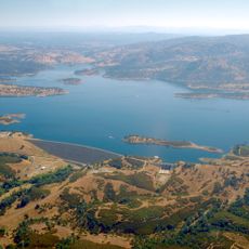
Amador City, city in Amador County, California, United States of America

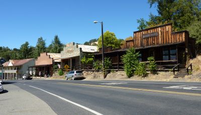
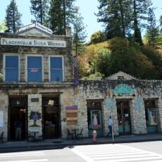
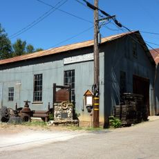
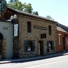
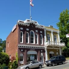
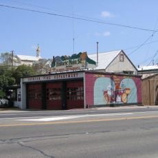
Amador City is a small town in California's Gold Country, situated along the historic Highway 49 between other Gold Rush settlements. The streets contain brick buildings from past eras, now housing shops, restaurants, museums, and overnight lodging, all set among trees and natural features.

Settlement began here in 1853 during California's Gold Rush when people arrived searching for gold. The town became officially incorporated in 1915, and many structures from those early years remain standing today, marking its connection to the mining era.

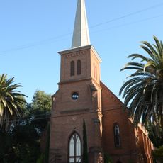
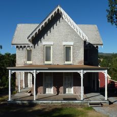
The town carries strong ties to the Gold Rush era and how that history shaped its character and appearance. You can see this heritage reflected in how locals and visitors use the historic buildings today, turning them into shops, restaurants, and gathering spaces.

The town is walkable and offers self-guided tours with signs pointing out historic mining sites and cemeteries throughout the area. Restaurants, cafes, and lodging are available on site, making it convenient for visits ranging from a few hours to overnight stays.

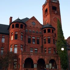
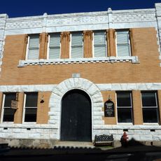
The Imperial Hotel, built around 1878, still welcomes overnight guests and lets visitors sleep in an actual historic building from the Gold Rush era. Staying in this well-maintained structure provides a direct sense of how early travelers were accommodated during that period.

The community of curious travelers

AroundUs brings together thousands of curated places, local tips, and hidden gems, enriched daily by 60,000 contributors worldwide.

Start exploring
Location
Inception
1853
Elevation above the sea
280 m
GPS coordinates
38.41944,-120.82417
Latest update
February 19, 2026 23:20
Around this place
Preston School of Industry
United States of America

Preston School of Industry

11.7 km
Camanche Reservoir
United States of America

Camanche Reservoir

26.7 km
Indian Grinding Rock State Historic Park
United States of America

Indian Grinding Rock State Historic Park

15.8 km
New Hogan Lake
United States of America

New Hogan Lake

29.9 km
SeaQuest Folsom
United States of America

SeaQuest Folsom

36.5 km
Pardee Dam
United States of America

Pardee Dam

18.2 km
Pine Hill Ecological Reserve
United States of America

Pine Hill Ecological Reserve

36.4 km
John Pearson Soda Works
United States of America

John Pearson Soda Works

34.5 km
Knight Foundry
United States of America

Knight Foundry

4.6 km
United States of America

Carpenter Hill

35.1 km
Fountain-Tallman Soda Works
United States of America

Fountain-Tallman Soda Works

34.6 km
Cooks Station
United States of America

Cooks Station

36.1 km
Combellack-Blair House
United States of America

Combellack-Blair House

34.4 km
Church of Our Saviour
United States of America

Church of Our Saviour

34.6 km
Faith Episcopal Church
United States of America

Faith Episcopal Church

30.9 km
Confidence Hall
United States of America

Confidence Hall

34.6 km
Community Methodist Church of Ione
United States of America

Community Methodist Church of Ione

12.2 km
Thorn House
United States of America

Thorn House

28 km
Calaveras County Courthouse
United States of America

Calaveras County Courthouse

27.8 km
Alta Mesa Farm Bureau Hall
United States of America

Alta Mesa Farm Bureau Hall

34.9 km
Eddy Arboretum
United States of America

Eddy Arboretum

34.6 km
D. Stewart Company Store
United States of America

D. Stewart Company Store

12.1 km
John J. Snyder House
United States of America

John J. Snyder House

27.5 km
Scully Ranch
United States of America

Scully Ranch

13.9 km
William J. Paugh House
United States of America

William J. Paugh House

8.9 km
Jackson Downtown Historic District
United States of America

Jackson Downtown Historic District

9 km
Chaparral Gardens
United States of America

Chaparral Gardens

20.9 km
Leoni Farms Wine
United States of America

Leoni Farms Wine

3.4 km
Show the full map
Reviews
Share your experience

No review yet

Discussions
Start a discussion...

No discussion yet

« Amador City - city in Amador County, California, United States of America » is provided by Around Us (aroundus.com). Images and texts are derived from Wikimedia project under a Creative Commons license. You are allowed to copy, distribute, and modify copies of this page, under the conditions set by the license, as long as this note is clearly visible.

Discover hidden gems everywhere you go!

From secret cafés to breathtaking viewpoints, skip the crowded tourist spots and find places that match your style. Our app makes it easy with voice search, smart filtering, route optimization, and insider tips from travelers worldwide. Download now for the complete mobile experience.

Around Us App Screenshot

A unique approach to discovering new places

Le Figaro

All the places worth exploring

France Info

A tailor-made excursion in just a few clicks

20 Minutes

Around Us
Travel Guide & Maps
Download

Send to your phone

QR Code
1

Open the camera app on your mobile.

2

Point at the QR code with your camera. A notification will appear.

3

Tap the notification to open the link.