Cooks Station

Log in to your account

AroundUs is a community-driven map of interesting places, built by curious explorers like you. It grows with every review, story, and photo you share.
Connect to save your favorite spots, contribute locations, and create personalized routes.
By continuing, you accept our Terms and Conditions and our Privacy Policy
Add to collection
Map
Suggest a change
Share

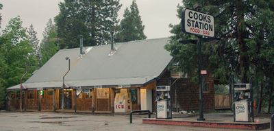
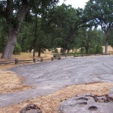
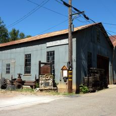
Cooks Station, Mountain roadside stop in Amador County, California.

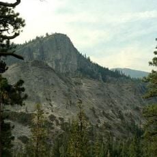
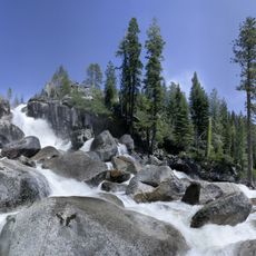
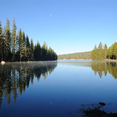
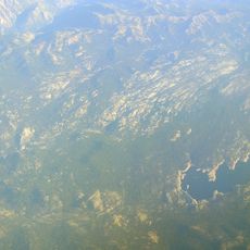
Cooks Station is a historic roadside stop along State Route 88 in California's Sierra Nevada mountains at about 5,000 feet elevation. The location serves today as a navigation reference point where road conditions change and winter driving becomes significantly more challenging.

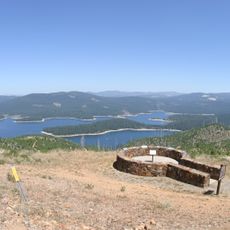
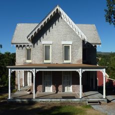
The station was established in 1863 as a stop on the Volcano section of the Carson Emigrant Trail. It remains one of just two original stations from that era still standing along this historic mountain passage route.

The station represents an essential part of California's transportation infrastructure, marking one of two remaining original stops from the 1860s Carson Pass highway.

The stop serves as a key reference point for drivers who need to understand winter road conditions and chain requirements on the mountain pass. It helps travelers gauge when driving conditions shift and what preparations they should make for the higher elevation stretch ahead.

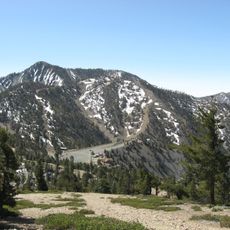
This stop shares the mountain route with Ham's Station, another old waypoint situated about 5 kilometers to the east. Together these two locations represent a rare example of preserved pioneer-era infrastructure along this important mountain crossing.

Location: California

GPS coordinates: 38.52652,-120.43341

Latest update: December 14, 2025 13:05

Photos
Around this place
Calaveras Big Trees State Park
United States of America

Calaveras Big Trees State Park

30.9 km
Pioneer Cabin Tree
United States of America

Pioneer Cabin Tree

29.7 km
Eldorado National Forest
United States of America

Eldorado National Forest

26.4 km
Indian Grinding Rock State Historic Park
United States of America

Indian Grinding Rock State Historic Park

21.5 km
Lover's Leap
United States of America

Lover's Leap

39.9 km
Mercer Caverns
United States of America

Mercer Caverns

41.9 km
Union Valley Reservoir
United States of America

Union Valley Reservoir

38.3 km
California Caverns
United States of America

California Caverns

36.6 km
Bassi Falls
United States of America

Bassi Falls

41.8 km
Lake Alpine
United States of America

Lake Alpine

38.2 km
Mokelumne Wilderness
United States of America

Mokelumne Wilderness

36.2 km
Salt Springs Reservoir
United States of America

Salt Springs Reservoir

19.3 km
John Pearson Soda Works
United States of America

John Pearson Soda Works

38.8 km
Knight Foundry
United States of America

Knight Foundry

33.9 km
New Spicer Meadow Reservoir
United States of America

New Spicer Meadow Reservoir

40.8 km
Fountain-Tallman Soda Works
United States of America

Fountain-Tallman Soda Works

38.9 km
Thunder Mountain
United States of America

Thunder Mountain

34 km
Combellack-Blair House
United States of America

Combellack-Blair House

38.6 km
Church of Our Saviour
United States of America

Church of Our Saviour

39.3 km
Confidence Hall
United States of America

Confidence Hall

39.1 km
Thorn House
United States of America

Thorn House

42.6 km
Sierra Nevada Logging Museum
United States of America

Sierra Nevada Logging Museum

30.1 km
Calaveras County Courthouse
United States of America

Calaveras County Courthouse

42.5 km
Eddy Arboretum
United States of America

Eddy Arboretum

39 km
John J. Snyder House
United States of America

John J. Snyder House

42.7 km
William J. Paugh House
United States of America

William J. Paugh House

35.3 km
Jackson Downtown Historic District
United States of America

Jackson Downtown Historic District

35.6 km
Leoni Farms Wine
United States of America

Leoni Farms Wine

35.5 km
Show the full map
Reviews

Visited this place? Tap the stars to rate it and share your experience / photos with the community! Try now! You can cancel it anytime.

« Cooks Station - Mountain roadside stop in Amador County, California » is provided by Around Us (aroundus.com). Images and texts are derived from Wikimedia project under a Creative Commons license. You are allowed to copy, distribute, and modify copies of this page, under the conditions set by the license, as long as this note is clearly visible.

Discover hidden gems everywhere you go!

From secret cafés to breathtaking viewpoints, skip the crowded tourist spots and find places that match your style. Our app makes it easy with voice search, smart filtering, route optimization, and insider tips from travelers worldwide. Download now for the complete mobile experience.

Around Us App Screenshot

A unique approach to discovering new places

Le Figaro

All the places worth exploring

France Info

A tailor-made excursion in just a few clicks

20 Minutes