Preston Peak

Log in to your account

AroundUs is a community-driven map of interesting places, built by curious explorers like you. It grows with every review, story, and photo you share.
Connect to save your favorite spots, contribute locations, and create personalized routes.
Continue with Google
Continue with Apple
Continue with X
Continue with Facebook
Continue with email
By continuing, you accept our Terms and Conditions and our Privacy Policy
Create an account
Add to collection
Map
Suggest a change
Share

Preston Peak, Mountain summit in Siskiyou County, California, US

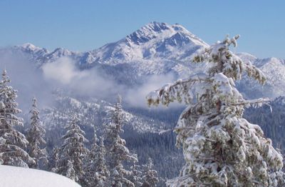
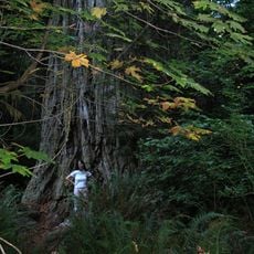
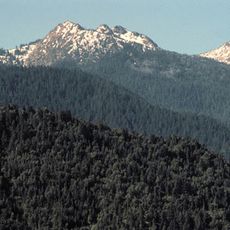
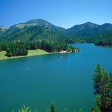
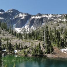
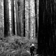
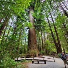
Preston Peak is a mountain summit in the Siskiyou Wilderness of Klamath National Forest, distinguished by steep granite walls and several mountain lakes at its base. The peak rises to approximately 7,313 feet and dominates the landscape of this remote northern California range.

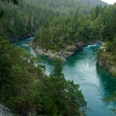
Early explorers traveling the Klamath River vastly overestimated the mountain's height, believing it to be much taller than its actual elevation. Their exaggeration reveals how visually commanding this peak appeared to travelers navigating the regional waterways.

The Karuk people call this peak keech'íihyan, reflecting their deep historical connection to the land. Local tribes continue to hold this mountain as an important part of their cultural identity and connection to the region.

Two main routes lead to the summit: the Northwest Ridge via Raspberry Lake and the West Slope through Rattlesnake Meadows, each requiring different levels of climbing experience. Check conditions before you go, as weather changes quickly in this wilderness area and trails can be steep and rocky.

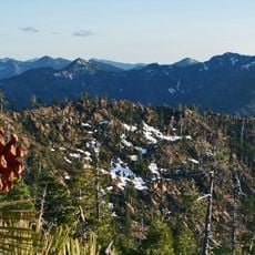
The Forest Service designated this area as a Botanical and Geological preserve because rare tree species like Alaska cedar and noble fir reach their southernmost growing limits here. These northern conifers thrive at this elevation due to specific climate conditions found nowhere else in the region.

Location: California

GPS coordinates: 41.83540,-123.61229

Latest update: December 14, 2025 11:26

Photos
Around this place
Redwood National and State Parks
United States of America

Redwood National and State Parks

50.4 km
Bigfoot trap
United States of America

Bigfoot trap

45.6 km
Jedediah Smith Redwoods State Park
United States of America

Jedediah Smith Redwoods State Park

41 km
Trees of Mystery
United States of America

Trees of Mystery

48.3 km
Del Norte Coast Redwoods State Park
United States of America

Del Norte Coast Redwoods State Park

41.2 km
Lost Monarch
United States of America

Lost Monarch

39.8 km
Smith River National Recreation Area
United States of America

Smith River National Recreation Area

22.2 km
Red Buttes Wilderness
United States of America

Red Buttes Wilderness

27.4 km
Siskiyou Wilderness
United States of America

Siskiyou Wilderness

20.3 km
Applegate Lake
United States of America

Applegate Lake

47.9 km
Oregon Caves Chateau
United States of America

Oregon Caves Chateau

33.8 km
Tolowa Dunes State Park
United States of America

Tolowa Dunes State Park

48.9 km
Great Cats World Park
United States of America

Great Cats World Park

34.3 km
Bear Mountain
United States of America

Bear Mountain

6.6 km
Good Harvest Cafe
United States of America

Good Harvest Cafe

48.3 km
Camp Lincoln
United States of America

Camp Lincoln

43.5 km
Oregon Caves Historic District
United States of America

Oregon Caves Historic District

33.7 km
Cedar Guard Station
United States of America

Cedar Guard Station

36.3 km
Redwood Experimental Forest
United States of America

Redwood Experimental Forest

48.2 km
Gasquet Ranger Station Historic District
United States of America

Gasquet Ranger Station Historic District

29.3 km
Klamath River Bridge
United States of America

Klamath River Bridge

49.6 km
Kellogg Road Beach
United States of America

Kellogg Road Beach

49.9 km
Brotherhood Tree
United States of America

Brotherhood Tree

47.9 km
Crescent Beach
United States of America

Crescent Beach

47.2 km
Wilson Creek Beach
United States of America

Wilson Creek Beach

48.2 km
Douglas Memorial Bridge
United States of America

Douglas Memorial Bridge

50 km
Crescent Beach
United States of America

Crescent Beach

46.6 km
United States of America

Wilson Creek Beach

48.2 km
Show the full map
Reviews

Visited this place? Tap the stars to rate it and share your experience / photos with the community! Try now! You can cancel it anytime.

« Preston Peak - Mountain summit in Siskiyou County, California, US » is provided by Around Us (aroundus.com). Images and texts are derived from Wikimedia project under a Creative Commons license. You are allowed to copy, distribute, and modify copies of this page, under the conditions set by the license, as long as this note is clearly visible.

Discover hidden gems everywhere you go!

From secret cafés to breathtaking viewpoints, skip the crowded tourist spots and find places that match your style. Our app makes it easy with voice search, smart filtering, route optimization, and insider tips from travelers worldwide. Download now for the complete mobile experience.

Around Us App Screenshot

A unique approach to discovering new places

Le Figaro

All the places worth exploring

France Info

A tailor-made excursion in just a few clicks

20 Minutes