Chest opened
+${chestReward.xp} XP
Explorer
NOUVEAU ×${chestReward.collectible.quantity}
tapez pour fermer

See the monuments around you in AR Open chests in the app

Around Us is built for your phone — point your camera at the streets and discover the monuments and places around you in augmented reality. Around Us is built for your phone — chests unlock when you walk, explore and capture nearby places.

•

Enable Location

We need your location to show you interesting places around you

Discover nearby places

Find interesting locations and hidden gems around you

Precise directions

Get accurate directions and distances to places

Your location is never shared with other users. It's only used when you tap the location button.

Siskiyou Wilderness

Log in to your account

Start exploring — it's free

Trusted by 94,319 travelers worldwide

Continue with Google
Continue with Apple
or

We will send you a code to connect

By continuing, you accept our Terms and Conditions and our Privacy Policy

Check your inbox

We've sent a pincode in your inbox. Please enter the code below.

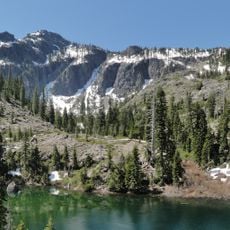
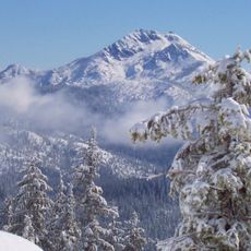
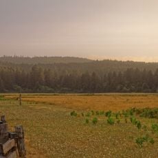
Siskiyou Wilderness, Federal wilderness area in northern California, United States.

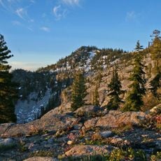
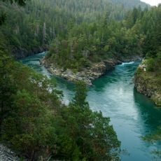
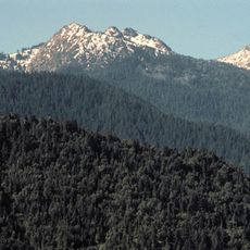
Siskiyou Wilderness covers 182,802 acres across the Six Rivers, Klamath, and Rogue River-Siskiyou National Forests. Elevations run from 770 feet to 7,309 feet at Preston Peak. The South Fork of the Smith River forms much of the western boundary, where an ophiolite exposure is visible.

The California Wilderness Act of 1984 first protected 153,000 acres of the Siskiyou Mountains, managed by the U.S. Forest Service across the Six Rivers, Klamath and Rogue River-Siskiyou National Forests. The Northern California Wild Heritage Act of 2006 added 30,122 acres, bringing the area to 182,802 acres.

The name Siskiyou has a debated origin: it may come from an Indigenous language meaning "short-tailed horse," or from the French "Six Cailloux" (six stones), given by French-Canadian trappers to a ford in the 19th century. The wilderness also holds one of the world's largest concentrations of lily species.

The terrain here is rough and demanding, requiring good physical preparation especially due to elevation changes. Summer through early autumn offers the best conditions, when trails are snow-free and weather is more stable.

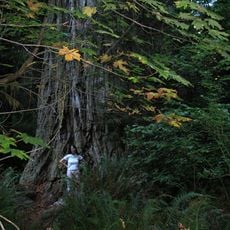
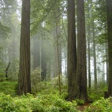
Around the South Fork of the Smith River, which forms much of the western boundary, the rock shows one of the world's best exposures of ophiolite, a slice of ancient ocean floor. The wilderness also holds one of the world's largest concentrations of lily species and up to 20 conifer species.

The community of curious travelers

AroundUs brings together thousands of curated places, local tips, and hidden gems, enriched daily by 94,319 contributors worldwide.

Start exploring
Location
GPS coordinates
41.68556,-123.75083
Latest update
October 25, 2026 22:44
Around this place
Redwood National and State Parks
United States of America

Redwood National and State Parks

17.2 mi
Redwood National and State Parks
United States of America

Redwood National and State Parks

21 mi
Jedediah Smith Redwoods State Park
United States of America

Jedediah Smith Redwoods State Park

19.4 mi
Trees of Mystery
United States of America

Trees of Mystery

18.7 mi
Prairie Creek Redwoods State Park
United States of America

Prairie Creek Redwoods State Park

24.1 mi
Del Norte Coast Redwoods State Park
United States of America

Del Norte Coast Redwoods State Park

15.8 mi
Lost Monarch
United States of America

Lost Monarch

18.8 mi
Battery Point Light
United States of America

Battery Point Light

23.7 mi
Marble Mountain Wilderness
United States of America

Marble Mountain Wilderness

28.9 mi
Smith River National Recreation Area
United States of America

Smith River National Recreation Area

7.3 mi
Red Buttes Wilderness
United States of America

Red Buttes Wilderness

29.5 mi
Castle Rock National Wildlife Refuge
United States of America

Castle Rock National Wildlife Refuge

26.3 mi
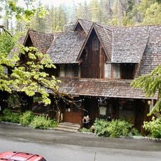
Oregon Caves Chateau
United States of America

Oregon Caves Chateau

33.6 mi
Tolowa Dunes State Park
United States of America

Tolowa Dunes State Park

26.3 mi
Bear Mountain
United States of America

Bear Mountain

8.7 mi
Preston Peak
United States of America

Preston Peak

12.6 mi
Camp Lincoln
United States of America

Camp Lincoln

21.9 mi
Oregon Caves Historic District
United States of America

Oregon Caves Historic District

33.5 mi
Redwood Experimental Forest
United States of America

Redwood Experimental Forest

18.6 mi
Crissey Field State Recreation Site
United States of America

Crissey Field State Recreation Site

32.4 mi
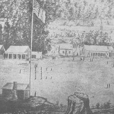
Gasquet Ranger Station Historic District
United States of America

Gasquet Ranger Station Historic District

15.6 mi
Pebble Beach
United States of America

Pebble Beach

25.4 mi
Klamath River Bridge
United States of America

Klamath River Bridge

18.6 mi
Brotherhood Tree
United States of America

Brotherhood Tree

18.5 mi
Redwood Creek Beach
United States of America

Redwood Creek Beach

32.8 mi
Douglas Memorial Bridge
United States of America

Douglas Memorial Bridge

18.9 mi
Crescent Beach
United States of America

Crescent Beach

21.1 mi
Elk Prairie
United States of America

Elk Prairie

26.8 mi
Show the full map
Reviews
Share your experience

No review yet

Discussions
Start a discussion...

No discussion yet

« Siskiyou Wilderness - Federal wilderness area in northern California, United States » is provided by Around Us (aroundus.com). Images and texts are derived from Wikimedia project under a Creative Commons license. You are allowed to copy, distribute, and modify copies of this page, under the conditions set by the license, as long as this note is clearly visible.

Discover hidden gems everywhere you go!

From secret cafés to breathtaking viewpoints, skip the crowded tourist spots and find places that match your style. Our app makes it easy with voice search, smart filtering, route optimization, and insider tips from travelers worldwide. Download now for the complete mobile experience.
Around Us App Screenshot
❝

A unique approach to discovering new places❞

— Le Figaro

❝

All the places worth exploring❞

— France Info

❝

A tailor-made excursion in just a few clicks❞

— 20 Minutes

Around Us
Travel Guide & Maps
Download

Send to your phone

QR Code
1

Open the camera app on your mobile.

2

Point at the QR code with your camera. A notification will appear.

3

Tap the notification to open the link.