Enable Location

We need your location to show you interesting places around you

Discover nearby places

Find interesting locations and hidden gems around you

Precise directions

Get accurate directions and distances to places

Your location is never shared with other users. It's only used when you tap the location button.

Salmon Mountain

Log in to your account

Start exploring — it's free

Trusted by 63,014 travelers worldwide

Continue with Google
Continue with Apple
or

We will send you a code to connect

By continuing, you accept our Terms and Conditions and our Privacy Policy

Check your inbox

We've sent a pincode in your inbox. Please enter the code below.

Salmon Mountain
Discussion Reviews 1 Photos
1.6k Popularity

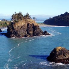
Salmon Mountain, Mountain summit in Humboldt County, California, United States.

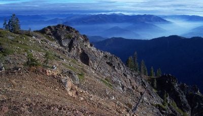
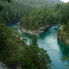
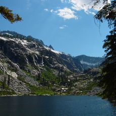
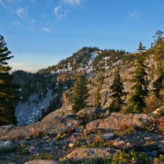
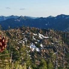
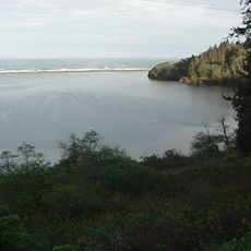
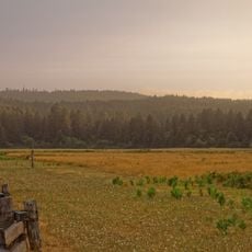
Salmon Mountain is a peak in the Klamath Mountains of Northern California that rises to approximately 6,962 feet. The summit sits within a forested landscape marked by multiple ridges and valleys that shape the terrain across the region.

The peak served as a reference point for early surveys and mapping efforts across Northern California. Over time the area became part of protected wilderness lands and remains a defined feature in the region's geography.

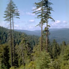
The mountain forms part of the Six Rivers National Forest, contributing to the preservation of Northern California's natural heritage and outdoor recreation traditions.

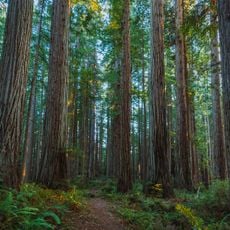
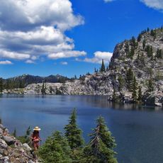
Hikers can reach this peak through established routes in the Klamath National Forest with the best conditions occurring during warmer months. The terrain is steep and hilly, requiring good physical fitness for the ascent.

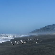
From the summit you can see across multiple watersheds and look far across neighboring mountain ranges into the landscape. The peak ranks as the highest point in Humboldt County and is noted by peak collectors.

The community of curious travelers

AroundUs brings together thousands of curated places, local tips, and hidden gems, enriched daily by 60,000 contributors worldwide.

Start exploring
Location
GPS coordinates
41.18319,-123.41116
Latest update
December 14, 2025 13:01
Around this place
Hyperion
United States of America

Hyperion

50.7 km
Redwood National and State Parks
United States of America

Redwood National and State Parks

53.5 km
Prairie Creek Redwoods State Park
United States of America

Prairie Creek Redwoods State Park

57.9 km
Six Rivers National Forest
United States of America

Six Rivers National Forest

22.9 km
Trinity Alps Wilderness
United States of America

Trinity Alps Wilderness

33 km
Marble Mountain Wilderness
United States of America

Marble Mountain Wilderness

37.5 km
Russian Wilderness
United States of America

Russian Wilderness

41.7 km
Trinidad State Beach
United States of America

Trinidad State Beach

63.3 km
Coast Guard Air Station Humboldt Bay
United States of America

Coast Guard Air Station Humboldt Bay

63.1 km
Siskiyou Wilderness
United States of America

Siskiyou Wilderness

62.7 km
Humboldt Lagoons State Park
United States of America

Humboldt Lagoons State Park

58.2 km
Azalea State Natural Reserve
United States of America

Azalea State Natural Reserve

63.4 km
Little River State Beach
United States of America

Little River State Beach

61.5 km
Arcata Community Forest
United States of America

Arcata Community Forest

64.3 km
Trinidad Head Light
United States of America

Trinidad Head Light

63.7 km
Thompson Peak
United States of America

Thompson Peak

36.6 km
Pythian Castle
United States of America

Pythian Castle

66.4 km
Russian Peak
United States of America

Russian Peak

40 km
Sawyers Bar Catholic Church
United States of America

Sawyers Bar Catholic Church

26.5 km
Humboldt State University Natural History Museum
United States of America

Humboldt State University Natural History Museum

66.3 km
The Old Arrow Tree, California
United States of America

The Old Arrow Tree, California

57.3 km
Old Jacoby Creek School
United States of America

Old Jacoby Creek School

66.5 km
Bowerman Barn
United States of America

Bowerman Barn

62.6 km
Klamath River Bridge
United States of America

Klamath River Bridge

63.8 km
Weaverville Joss House State Historic Park
United States of America

Weaverville Joss House State Historic Park

64 km
Redwood Creek Beach
United States of America

Redwood Creek Beach

58.2 km
Douglas Memorial Bridge
United States of America

Douglas Memorial Bridge

65.2 km
Elk Prairie
United States of America

Elk Prairie

55 km
Show the full map
Reviews
Share your experience

No review yet

Discussions
Start a discussion...

No discussion yet

« Salmon Mountain - Mountain summit in Humboldt County, California, United States » is provided by Around Us (aroundus.com). Images and texts are derived from Wikimedia project under a Creative Commons license. You are allowed to copy, distribute, and modify copies of this page, under the conditions set by the license, as long as this note is clearly visible.

Discover hidden gems everywhere you go!

From secret cafés to breathtaking viewpoints, skip the crowded tourist spots and find places that match your style. Our app makes it easy with voice search, smart filtering, route optimization, and insider tips from travelers worldwide. Download now for the complete mobile experience.

Around Us App Screenshot

A unique approach to discovering new places

Le Figaro

All the places worth exploring

France Info

A tailor-made excursion in just a few clicks

20 Minutes

Around Us
Travel Guide & Maps
Download

Send to your phone

QR Code
1

Open the camera app on your mobile.

2

Point at the QR code with your camera. A notification will appear.

3

Tap the notification to open the link.