Enable Location

We need your location to show you interesting places around you

Discover nearby places

Find interesting locations and hidden gems around you

Precise directions

Get accurate directions and distances to places

Your location is never shared with other users. It's only used when you tap the location button.

Bear Creek Greenway

Log in to your account

Start exploring — it's free

Trusted by 61,516 travelers worldwide

Continue with Google
Continue with Apple
or

We will send you a code to connect

By continuing, you accept our Terms and Conditions and our Privacy Policy

Check your inbox

We've sent a pincode in your inbox. Please enter the code below.

Bear Creek Greenway

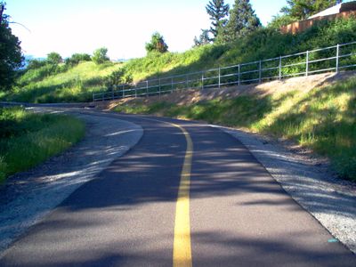
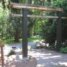
Bear Creek Greenway, National Recreation Trail in Southern Oregon, US.

Description

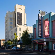
Bear Creek Greenway is a trail that stretches for approximately 20 miles through creek-side forests, connecting five communities between Central Point and Ashland in Southern Oregon. The path winds through natural areas and urban sections, offering varied landscapes along its entire length.

History

The trail system developed from a local community effort to create a connected recreational pathway through Jackson County's natural areas and towns. This project shows the growing importance of greenways and outdoor access in regional planning.

Culture

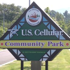
The trail connects several community parks and passes through the Medford Railroad Park, where model trains and full-size railroad cars are on display. These exhibits reflect the historical role of rail transport in the region and give walkers a sense of how trains shaped local life.

Practical

The trail has multiple entry points with parking available along the route, such as at Dean Creek Road in Central Point and West Nevada Street in Ashland. The path is accessible to various users including cyclists, walkers, wheelchair users, and horse riders with dedicated equestrian sections.

Did you know?

The trail includes dedicated horse sections, particularly in Central Point and Talent, making it an uncommon place where walkers and riders share recreational space. This design shows special consideration for the needs of different users.

Location
GPS coordinates
42.27420,-122.81500
Latest update
December 12, 2025 16:40

AroundUs brings together thousands of curated places, local tips, and hidden gems, enriched daily by 60,000 contributors worldwide. Discover all places nearby (Oregon).

Around this place
Lithia Park
United States of America

Lithia Park

12.4 km
Ashland Springs Hotel
United States of America

Ashland Springs Hotel

12.1 km
Allen Elizabethan Theatre
United States of America

Allen Elizabethan Theatre

12 km
Jacksonville Historic District
United States of America

Jacksonville Historic District

13.2 km
US Cellular Community Park
United States of America

US Cellular Community Park

4.2 km
Holly Theatre
United States of America

Holly Theatre

7.6 km
Medford Carnegie Library
United States of America

Medford Carnegie Library

7.5 km
James A. Redden Federal Courthouse
United States of America

James A. Redden Federal Courthouse

7.7 km
Patrick F. McManus House
United States of America

Patrick F. McManus House

158 m
Jackson County Courthouse
United States of America

Jackson County Courthouse

7.5 km
Ashland Masonic Lodge Building
United States of America

Ashland Masonic Lodge Building

11.8 km
First Baptist Church
United States of America

First Baptist Church

12.2 km
I.O.O.F. Building
United States of America

I.O.O.F. Building

11.8 km
Ashland Oregon National Guard Armory
United States of America

Ashland Oregon National Guard Armory

11.9 km
Frank Chamberlain Clark House
United States of America

Frank Chamberlain Clark House

6.6 km
Barnum Hotel
United States of America

Barnum Hotel

7.7 km
ScienceWorks Museum
United States of America

ScienceWorks Museum

13.7 km
Japanese Garden
United States of America

Japanese Garden

12.1 km
Jackson County Courthouse
United States of America

Jackson County Courthouse

13.2 km
Elks Lodge
United States of America

Elks Lodge

7.7 km
Trinity Episcopal Church
United States of America

Trinity Episcopal Church

12.2 km
Carter Memorial Fountain
United States of America

Carter Memorial Fountain

11.9 km
Cornelius C. Beekman House
United States of America

Cornelius C. Beekman House

13 km
Craterian Theater
United States of America

Craterian Theater

7.5 km
Women's Civic Improvement Clubhouse
United States of America

Women's Civic Improvement Clubhouse

11.9 km
Varsity Theater
United States of America

Varsity Theater

12.1 km
Angus Bowmer Theatre
United States of America

Angus Bowmer Theatre

11.9 km
Sparta Building
United States of America

Sparta Building

7.5 km
Show the full map
« Bear Creek Greenway - National Recreation Trail in Southern Oregon, US » is provided by Around Us (aroundus.com). Images and texts are derived from Wikimedia project under a Creative Commons license. You are allowed to copy, distribute, and modify copies of this page, under the conditions set by the license, as long as this note is clearly visible.

Discover hidden gems everywhere you go!

From secret cafés to breathtaking viewpoints, skip the crowded tourist spots and find places that match your style. Our app makes it easy with voice search, smart filtering, route optimization, and insider tips from travelers worldwide. Download now for the complete mobile experience.

Around Us App Screenshot

A unique approach to discovering new places

Le Figaro

All the places worth exploring

France Info

A tailor-made excursion in just a few clicks

20 Minutes

Around Us
Travel Guide & Maps
Download

Send to your phone

QR Code
1

Open the camera app on your mobile.

2

Point at the QR code with your camera. A notification will appear.

3

Tap the notification to open the link.