Enable Location

We need your location to show you interesting places around you

Discover nearby places

Find interesting locations and hidden gems around you

Precise directions

Get accurate directions and distances to places

Your location is never shared with other users. It's only used when you tap the location button.

Log in to your account

Start exploring — it's free

Trusted by 62,469 travelers worldwide

Continue with Google
Continue with Apple
or

We will send you a code to connect

By continuing, you accept our Terms and Conditions and our Privacy Policy

Check your inbox

We've sent a pincode in your inbox. Please enter the code below.

Geisel Monument State Heritage Site

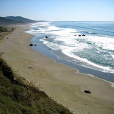
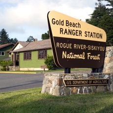
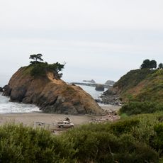
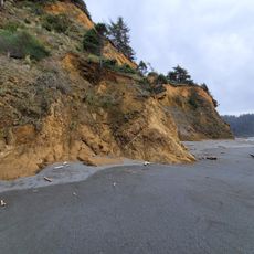
Geisel Monument State Heritage Site, Historic memorial site in Curry County, United States

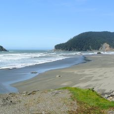
The Geisel Monument State Heritage Site is a memorial location on Oregon's coast featuring gravestones and interpretive displays alongside Highway 101. The grounds occupy an open area with parking available and informational materials accessible year-round.

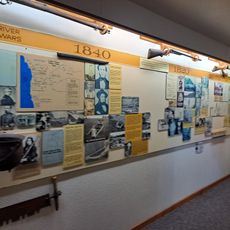
The site is connected to an 1856 event when several family members lost their lives at this location. This incident occurred during a period of conflict between European settlers and indigenous groups in territorial Oregon.

The site honors a family whose story connects to Oregon's early European settlement period. Visitors encounter gravestones and explanatory materials that document the lives and experiences of the pioneers buried there.

The grounds are accessible daily from sunrise to sunset, with parking available throughout the year. The informational displays help visitors explore the site independently and learn more about its history.

The burial ground holds graves of multiple generations of a family, including a family member who survived the original tragedy. This detail makes the site a testament to how conflicts left lasting marks on family histories.

The community of curious travelers

AroundUs brings together thousands of curated places, local tips, and hidden gems, enriched daily by 60,000 contributors worldwide.

Start exploring
Location
GPS coordinates
42.49070,-124.41700
Latest update
December 14, 2025 11:04
Around this place
Oregon Islands National Wildlife Refuge
United States of America

Oregon Islands National Wildlife Refuge

26.9 km
Humbug Mountain State Park
United States of America

Humbug Mountain State Park

21.9 km
Thomas Creek Bridge
United States of America

Thomas Creek Bridge

36.5 km
Isaac Lee Patterson Bridge
United States of America

Isaac Lee Patterson Bridge

7.1 km
Cape Blanco Light
United States of America

Cape Blanco Light

40.3 km
Humbug Mountain
United States of America

Humbug Mountain

21 km
Wild Rogue Wilderness
United States of America

Wild Rogue Wilderness

33.2 km
Cape Sebastian State Scenic Corridor
United States of America

Cape Sebastian State Scenic Corridor

17.7 km
Port Orford Heads State Park
United States of America

Port Orford Heads State Park

28.9 km
Arizona Beach State Recreation Site
United States of America

Arizona Beach State Recreation Site

13.9 km
Grassy Knob Wilderness
United States of America

Grassy Knob Wilderness

28.8 km
Pistol River State Scenic Viewpoint
United States of America

Pistol River State Scenic Viewpoint

24.1 km
Paradise Point State Recreation Site
United States of America

Paradise Point State Recreation Site

31.2 km
Battle Rock Wayside Park

Battle Rock Wayside Park

28.7 km
Patrick Hughes House
United States of America

Patrick Hughes House

40.4 km
Cape Blanco State Park
United States of America

Cape Blanco State Park

39.8 km
Ophir Beach
United States of America

Ophir Beach

6.8 km
Gold Beach Ranger Station
United States of America

Gold Beach Ranger Station

9.9 km
Rogue River Museum & Gift shop
United States of America

Rogue River Museum & Gift shop

7.7 km
Secret Beach
United States of America

Secret Beach

33.1 km
Meyers Creek Beach Viewpoint
United States of America

Meyers Creek Beach Viewpoint

19.9 km
Whaleshead Beach
United States of America

Whaleshead Beach

39.7 km
Meyers Creek Pullout South
United States of America

Meyers Creek Pullout South

20.6 km
Agate Beach
United States of America

Agate Beach

2.3 km
Redfish Rocks Marine Reserve
United States of America

Redfish Rocks Marine Reserve

23.8 km
Battle Rock
United States of America

Battle Rock

28.3 km
Arizona Beach
United States of America

Arizona Beach

13.9 km
Agate Beach
United States of America

Agate Beach

29.7 km
Show the full map
« Geisel Monument State Heritage Site - Historic memorial site in Curry County, United States » is provided by Around Us (aroundus.com). Images and texts are derived from Wikimedia project under a Creative Commons license. You are allowed to copy, distribute, and modify copies of this page, under the conditions set by the license, as long as this note is clearly visible.

Discover hidden gems everywhere you go!

From secret cafés to breathtaking viewpoints, skip the crowded tourist spots and find places that match your style. Our app makes it easy with voice search, smart filtering, route optimization, and insider tips from travelers worldwide. Download now for the complete mobile experience.

Around Us App Screenshot

A unique approach to discovering new places

Le Figaro

All the places worth exploring

France Info

A tailor-made excursion in just a few clicks

20 Minutes

Around Us
Travel Guide & Maps
Download

Send to your phone

QR Code
1

Open the camera app on your mobile.

2

Point at the QR code with your camera. A notification will appear.

3

Tap the notification to open the link.