Cape Sebastian State Scenic Corridor

Log in to your account

AroundUs is a community-driven map of interesting places, built by curious explorers like you. It grows with every review, story, and photo you share.
Connect to save your favorite spots, contribute locations, and create personalized routes.
Continue with Google
Continue with Apple
Continue with X
Continue with Facebook
Continue with email
By continuing, you accept our Terms and Conditions and our Privacy Policy
Create an account

Cape Sebastian State Scenic Corridor

Add to collection
Map
Suggest a change
Share

Cape Sebastian State Scenic Corridor, Coastal state park in Southern Oregon, United States.

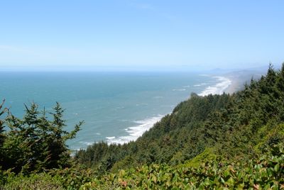
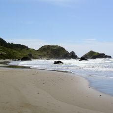
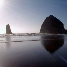
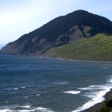
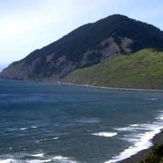
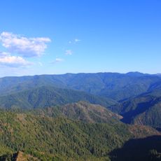
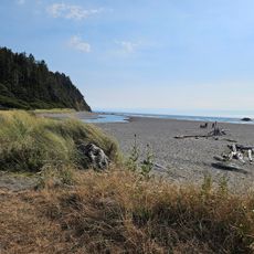
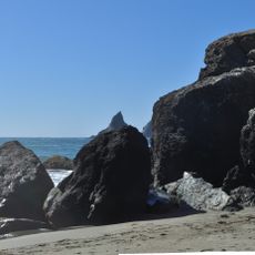
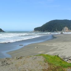
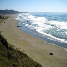
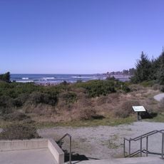
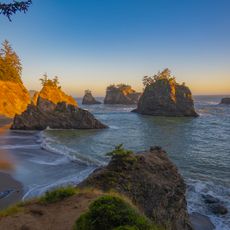
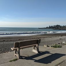
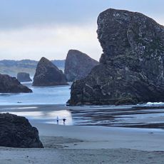
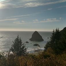
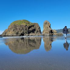
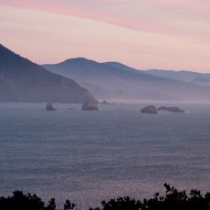
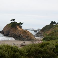
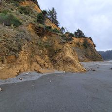
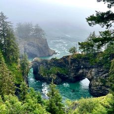
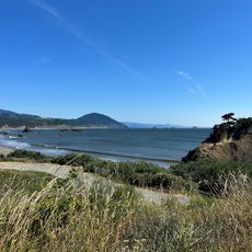
Cape Sebastian is a coastal park in southern Oregon that rises dramatically above the Pacific Ocean with multiple vantage points for visitors to explore. The park features forested areas and rocky terrain that descend toward the shoreline, creating a landscape where ocean views are visible from many spots.

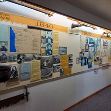
The headland was named in 1603 by Spanish explorer Sebastian Vizcaino during his voyage along the Pacific coast. The name reflects early European contact with this stretch of Oregon, marking one of the first documented visits by outsiders to the area.

Birdwatchers and nature lovers gather here to observe marine mammals and migrating seabirds throughout the year. The promontory is a gathering place for those seeking to experience the rhythm of Pacific wildlife moving through this stretch of coast.

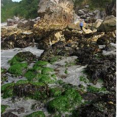
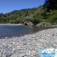
The park offers free access with parking available at the trailhead, making it easy to arrive and explore at your own pace. A marked trail guides visitors through different sections of the park, from forest areas to open viewpoints and down to the beach below.

During World War Two, workers at the park reported spotting a Japanese submarine in the waters off this coast. This incident is now part of the area's wartime history and reminds visitors of how close the Pacific conflict came to American shores.

Location: Oregon

Website: https://stateparks.oregon.gov/index.cfm?do=park.profile&parkId=52

GPS coordinates: 42.33230,-124.42800

Latest update: December 12, 2025 14:40

Photos
Around this place
Harris Beach State Park
United States of America

Harris Beach State Park

31.2 km
Samuel H. Boardman State Scenic Corridor
United States of America

Samuel H. Boardman State Scenic Corridor

24.4 km
Kalmiopsis Wilderness
United States of America

Kalmiopsis Wilderness

38.7 km
Oregon Islands National Wildlife Refuge
United States of America

Oregon Islands National Wildlife Refuge

9.4 km
Humbug Mountain State Park
United States of America

Humbug Mountain State Park

39.4 km
Thomas Creek Bridge
United States of America

Thomas Creek Bridge

19.4 km
Isaac Lee Patterson Bridge
United States of America

Isaac Lee Patterson Bridge

10.6 km
Humbug Mountain
United States of America

Humbug Mountain

38.6 km
Wild Rogue Wilderness
United States of America

Wild Rogue Wilderness

43.8 km
Alfred A. Loeb State Park
United States of America

Alfred A. Loeb State Park

31.4 km
Arizona Beach State Recreation Site
United States of America

Arizona Beach State Recreation Site

31.6 km
Lone Ranch Beach
United States of America

Lone Ranch Beach

27 km
Pistol River State Scenic Viewpoint
United States of America

Pistol River State Scenic Viewpoint

6.7 km
Ophir Beach
United States of America

Ophir Beach

24.4 km
Gold Beach Ranger Station
United States of America

Gold Beach Ranger Station

7.8 km
Crissey Field State Recreation Site

Crissey Field State Recreation Site

41 km
Rogue River Museum & Gift shop
United States of America

Rogue River Museum & Gift shop

9.9 km
Secret Beach
United States of America

Secret Beach

16 km
Sporthaven Beach
United States of America

Sporthaven Beach

35.2 km
Meyers Creek Beach Viewpoint
United States of America

Meyers Creek Beach Viewpoint

2.5 km
Whaleshead Beach
United States of America

Whaleshead Beach

22.6 km
Redwood Theatre
United States of America

Redwood Theatre

33.4 km
Meyers Creek Pullout South
United States of America

Meyers Creek Pullout South

3.3 km
Redfish Rocks Marine Reserve
United States of America

Redfish Rocks Marine Reserve

41.2 km
Battle Rock
United States of America

Battle Rock

45.6 km
Arizona Beach
United States of America

Arizona Beach

31.6 km
Natural Bridges Cove
United States of America

Natural Bridges Cove

16.7 km
Battle Rock Arch
United States of America

Battle Rock Arch

45.8 km
Show the full map
Reviews

Visited this place? Tap the stars to rate it and share your experience / photos with the community! Try now! You can cancel it anytime.

« Cape Sebastian State Scenic Corridor - Coastal state park in Southern Oregon, United States » is provided by Around Us (aroundus.com). Images and texts are derived from Wikimedia project under a Creative Commons license. You are allowed to copy, distribute, and modify copies of this page, under the conditions set by the license, as long as this note is clearly visible.

Discover hidden gems everywhere you go!

From secret cafés to breathtaking viewpoints, skip the crowded tourist spots and find places that match your style. Our app makes it easy with voice search, smart filtering, route optimization, and insider tips from travelers worldwide. Download now for the complete mobile experience.

Around Us App Screenshot

A unique approach to discovering new places

Le Figaro

All the places worth exploring

France Info

A tailor-made excursion in just a few clicks

20 Minutes