Alfred A. Loeb State Park

Log in to your account

AroundUs is a community-driven map of interesting places, built by curious explorers like you. It grows with every review, story, and photo you share.
Connect to save your favorite spots, contribute locations, and create personalized routes.
Continue with Google
Continue with Apple
Continue with X
Continue with Facebook
Continue with email
By continuing, you accept our Terms and Conditions and our Privacy Policy
Create an account

Alfred A. Loeb State Park

Add to collection
Map
Suggest a change
Share

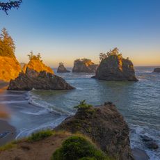
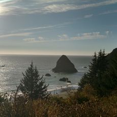
Alfred A. Loeb State Park, State park along Chetco River in Brookings, Oregon, US.

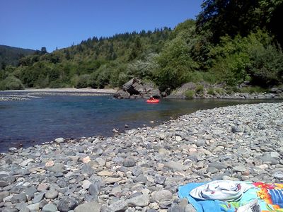
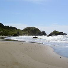
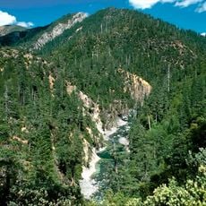
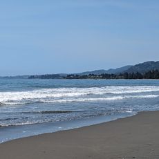
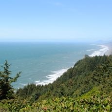
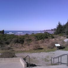
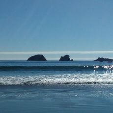
Alfred A. Loeb State Park is a 320-acre riverside reserve along the Chetco River known for its stands of ancient Myrtlewood trees. The park provides camping and cabin lodging, boat access, and walking paths through a forest setting that feels removed from everyday life.

The land was purchased from Alfred A. Loeb in 1948, and in 1958 the State Board of Forestry donated 160 additional acres to establish the park. These acquisitions created a protected space where native forests and river habitats could be preserved for future generations.

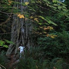
The park centers on Myrtlewood trees, which are native to this corner of Oregon and carry deep local meaning as a symbol of the region. The riverbank setting connects visitors to how this place has shaped the daily rhythm and identity of the surrounding community.

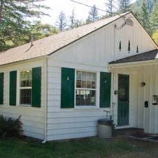
The park is open year-round with campgrounds and cabin rentals positioned along the river, plus basic facilities like showers and restrooms. Well-maintained trails guide visitors through the forest, and a boat launch provides direct water access for those wanting to explore by canoe or kayak.

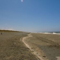
A trail of roughly 0.75 mile leads to the farthest northern grove of coast redwoods in the United States, a botanical surprise in this region. This stand of tall trees represents a rare northward extension of a species more commonly found hundreds of miles to the south.

Location: Oregon

Website: https://stateparks.oregon.gov/index.cfm?do=park.profile&parkId=51

GPS coordinates: 42.11280,-124.18900

Latest update: December 12, 2025 12:03

Photos
Around this place
Jedediah Smith Redwoods State Park
United States of America

Jedediah Smith Redwoods State Park

37.6 km
St. George Reef Light
United States of America

St. George Reef Light

34.5 km
Lost Monarch
United States of America

Lost Monarch

37 km
Harris Beach State Park
United States of America

Harris Beach State Park

11 km
Samuel H. Boardman State Scenic Corridor
United States of America

Samuel H. Boardman State Scenic Corridor

13.6 km
Kalmiopsis Wilderness
United States of America

Kalmiopsis Wilderness

26.5 km
Oregon Islands National Wildlife Refuge
United States of America

Oregon Islands National Wildlife Refuge

23.5 km
Castle Rock National Wildlife Refuge
United States of America

Castle Rock National Wildlife Refuge

39.4 km
Pelican State Beach
United States of America

Pelican State Beach

13.5 km
Thomas Creek Bridge
United States of America

Thomas Creek Bridge

15.2 km
Tolowa Dunes State Park
United States of America

Tolowa Dunes State Park

27.4 km
Cape Sebastian State Scenic Corridor
United States of America

Cape Sebastian State Scenic Corridor

31.4 km
Lone Ranch Beach
United States of America

Lone Ranch Beach

12.8 km
Pistol River State Scenic Viewpoint
United States of America

Pistol River State Scenic Viewpoint

25.3 km
Camp Lincoln
United States of America

Camp Lincoln

32.9 km
Gold Beach Ranger Station
United States of America

Gold Beach Ranger Station

37.3 km
Gasquet Ranger Station Historic District
United States of America

Gasquet Ranger Station Historic District

35.1 km
Crissey Field State Recreation Site

Crissey Field State Recreation Site

12.5 km
Pebble Beach
United States of America

Pebble Beach

38.9 km
Rogue River Museum & Gift shop
United States of America

Rogue River Museum & Gift shop

39.2 km
Secret Beach
United States of America

Secret Beach

17.6 km
Sporthaven Beach
United States of America

Sporthaven Beach

10.2 km
Meyers Creek Beach Viewpoint
United States of America

Meyers Creek Beach Viewpoint

29 km
Harris Sate Park Campground
United States of America

Harris Sate Park Campground

11.1 km
Whaleshead Beach
United States of America

Whaleshead Beach

13.8 km
Kellogg Road Beach
United States of America

Kellogg Road Beach

27.2 km
Meyers Creek Pullout South
United States of America

Meyers Creek Pullout South

28.2 km
Harris Beach
United States of America

Harris Beach

11 km
Show the full map
Reviews

Visited this place? Tap the stars to rate it and share your experience / photos with the community! Try now! You can cancel it anytime.

« Alfred A. Loeb State Park - State park along Chetco River in Brookings, Oregon, US » is provided by Around Us (aroundus.com). Images and texts are derived from Wikimedia project under a Creative Commons license. You are allowed to copy, distribute, and modify copies of this page, under the conditions set by the license, as long as this note is clearly visible.

Discover hidden gems everywhere you go!

From secret cafés to breathtaking viewpoints, skip the crowded tourist spots and find places that match your style. Our app makes it easy with voice search, smart filtering, route optimization, and insider tips from travelers worldwide. Download now for the complete mobile experience.

Around Us App Screenshot

A unique approach to discovering new places

Le Figaro

All the places worth exploring

France Info

A tailor-made excursion in just a few clicks

20 Minutes