Meyers Creek Pullout South

Log in to your account

AroundUs is a community-driven map of interesting places, built by curious explorers like you. It grows with every review, story, and photo you share.
Connect to save your favorite spots, contribute locations, and create personalized routes.
Continue with Google
Continue with Apple
Continue with X
Continue with Facebook
Continue with email
By continuing, you accept our Terms and Conditions and our Privacy Policy
Create an account

Meyers Creek Pullout South

Add to collection
Map
Suggest a change
Share

Meyers Creek Pullout South, Pacific coast viewpoint in Curry County, United States

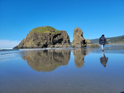
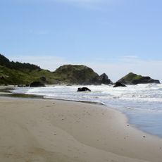
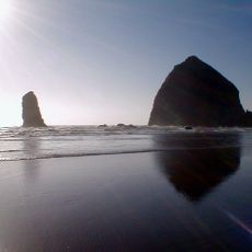
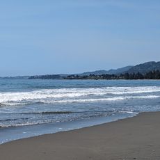
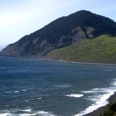
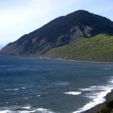
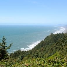
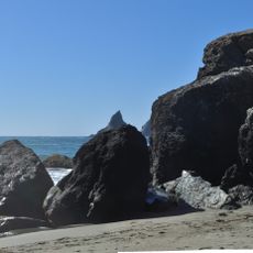
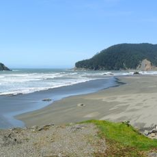
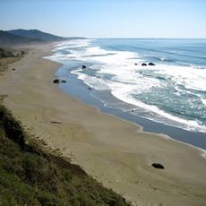
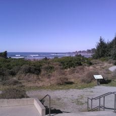
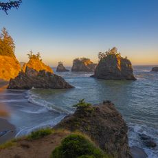
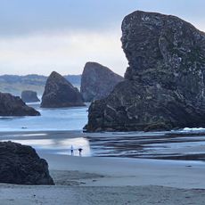
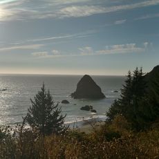
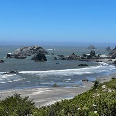
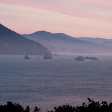
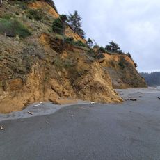
Meyers Creek Pullout South is a viewpoint on the Oregon coast where you can see large rock formations rising from the ocean and the curve of the shoreline. From this spot along Highway 101, you have a clear view of the beach below and the coastal landscape stretching in both directions.

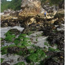
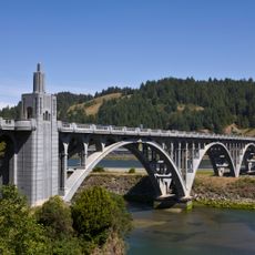
Native peoples of the Tututni tribe historically gathered resources along this coast and maintained trade networks with neighboring communities. The Highway 101 was later constructed, making the viewpoint easily accessible to travelers.

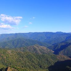
Local photographers and artists regularly gather at this Highway 101 viewpoint to capture the interplay of light and shadow across the expansive coastal landscape.

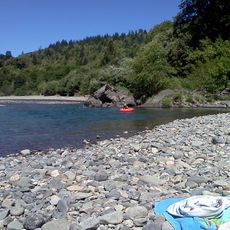
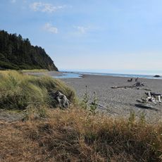
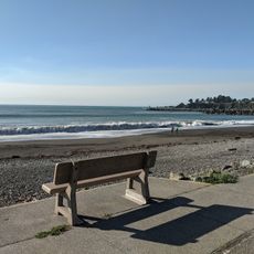
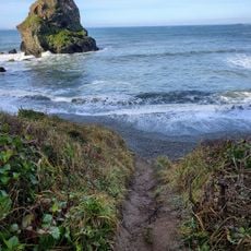
The viewpoint has a spacious gravel parking area where multiple vehicles fit easily, with walking paths leading down to the beach and creek below. The location is straightforward to explore on foot and offers clear views without obstacles.

During winter months, the location transforms into a premier surfing destination where waves reach exceptional heights due to specific ocean current patterns.

Location: Curry County

Address: Gold Beach, OR 97444, USA

Website: http://myers-south.keeq.io

GPS coordinates: 42.30549,-124.41026

Latest update: December 15, 2025 13:28

Photos
Around this place
Harris Beach State Park
United States of America

Harris Beach State Park

27.9 km
Samuel H. Boardman State Scenic Corridor
United States of America

Samuel H. Boardman State Scenic Corridor

21.2 km
Kalmiopsis Wilderness
United States of America

Kalmiopsis Wilderness

36.9 km
Oregon Islands National Wildlife Refuge
United States of America

Oregon Islands National Wildlife Refuge

6.2 km
Pelican State Beach
United States of America

Pelican State Beach

38.6 km
Humbug Mountain State Park
United States of America

Humbug Mountain State Park

42.5 km
Thomas Creek Bridge
United States of America

Thomas Creek Bridge

16.1 km
Isaac Lee Patterson Bridge
United States of America

Isaac Lee Patterson Bridge

13.6 km
Humbug Mountain
United States of America

Humbug Mountain

41.6 km
Wild Rogue Wilderness
United States of America

Wild Rogue Wilderness

44.9 km
Alfred A. Loeb State Park
United States of America

Alfred A. Loeb State Park

28.2 km
Cape Sebastian State Scenic Corridor
United States of America

Cape Sebastian State Scenic Corridor

3.3 km
Arizona Beach State Recreation Site
United States of America

Arizona Beach State Recreation Site

34.5 km
Lone Ranch Beach
United States of America

Lone Ranch Beach

23.7 km
Pistol River State Scenic Viewpoint
United States of America

Pistol River State Scenic Viewpoint

3.4 km
Ophir Beach
United States of America

Ophir Beach

27.2 km
Gold Beach Ranger Station
United States of America

Gold Beach Ranger Station

10.8 km
Crissey Field State Recreation Site

Crissey Field State Recreation Site

37.6 km
Rogue River Museum & Gift shop
United States of America

Rogue River Museum & Gift shop

12.9 km
Secret Beach
United States of America

Secret Beach

12.7 km
Sporthaven Beach
United States of America

Sporthaven Beach

31.9 km
Meyers Creek Beach Viewpoint
United States of America

Meyers Creek Beach Viewpoint

858 m
Harris Sate Park Campground
United States of America

Harris Sate Park Campground

27.7 km
Whaleshead Beach
United States of America

Whaleshead Beach

19.4 km
Harris Beach
United States of America

Harris Beach

28.2 km
Agate Beach
United States of America

Agate Beach

18.4 km
Redfish Rocks Marine Reserve
United States of America

Redfish Rocks Marine Reserve

44.3 km
Arizona Beach
United States of America

Arizona Beach

34.5 km
Show the full map
Reviews

Visited this place? Tap the stars to rate it and share your experience / photos with the community! Try now! You can cancel it anytime.

« Meyers Creek Pullout South - Pacific coast viewpoint in Curry County, United States » is provided by Around Us (aroundus.com). Images and texts are derived from Wikimedia project under a Creative Commons license. You are allowed to copy, distribute, and modify copies of this page, under the conditions set by the license, as long as this note is clearly visible.

Discover hidden gems everywhere you go!

From secret cafés to breathtaking viewpoints, skip the crowded tourist spots and find places that match your style. Our app makes it easy with voice search, smart filtering, route optimization, and insider tips from travelers worldwide. Download now for the complete mobile experience.

Around Us App Screenshot

A unique approach to discovering new places

Le Figaro

All the places worth exploring

France Info

A tailor-made excursion in just a few clicks

20 Minutes