Enable Location

We need your location to show you interesting places around you

Discover nearby places

Find interesting locations and hidden gems around you

Precise directions

Get accurate directions and distances to places

Your location is never shared with other users. It's only used when you tap the location button.

Humbug Mountain State Park

Log in to your account

Start exploring — it's free

Trusted by 63,038 travelers worldwide

Continue with Google
Continue with Apple
or

We will send you a code to connect

By continuing, you accept our Terms and Conditions and our Privacy Policy

Check your inbox

We've sent a pincode in your inbox. Please enter the code below.

Humbug Mountain State Park
Discussion Reviews 1 Photos 1 Collections
4.4k Popularity

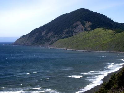
Humbug Mountain State Park, State park with coastal mountain in Curry County, Oregon.

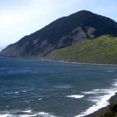
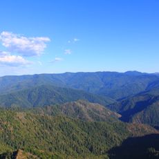
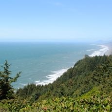
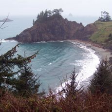
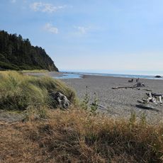
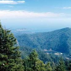
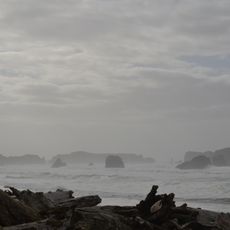
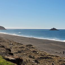
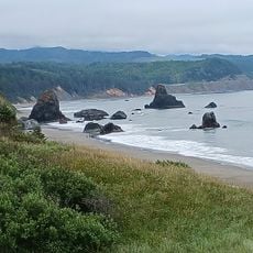
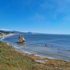
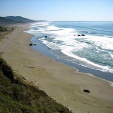
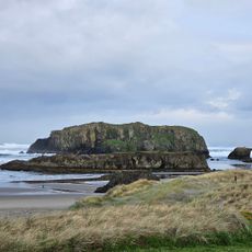
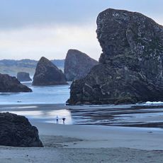
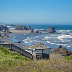
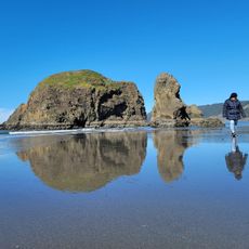
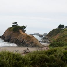
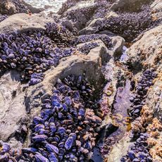
Humbug Mountain State Park is a coastal park in Curry County featuring a 1,756-foot peak surrounded by dense forest. Multiple trail systems lead through the woodland to the summit and connect to beach areas along the shore.

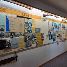
Land for the park was acquired in the 1920s, with major development occurring during the 1930s through the Civilian Conservation Corps. Their work established trails and facilities that visitors still use today.

The mountain received its name from an early exploration party who called it Tichenor's Humbug after a confusing navigation incident.

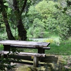
The campground has sites with electrical hookups and tent-only options, plus hot showers and restroom facilities available. A dedicated area serves hikers and cyclists who need basic overnight accommodations.

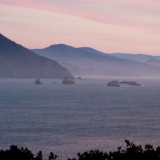
The surrounding mountains create a natural barrier that shelters this coastal section and makes it warmer than neighboring areas. This pocket of milder climate supports vegetation and conditions you would not expect to find so far north on the Oregon coast.

The community of curious travelers

AroundUs brings together thousands of curated places, local tips, and hidden gems, enriched daily by 60,000 contributors worldwide.

Start exploring
Location
GPS coordinates
42.68650,-124.43600
Latest update
December 6, 2025 17:42
Natural and historical sites across Oregon

Oregon offers a notable diversity of geological formations and natural landscapes ranging from the Pacific coastline to the volcanic plateaus of the eastern portion of the state. The Cascade Range dominates western Oregon with dense forests, waterfalls, and thermal springs, while the dry east...

Around this place
Isaac Lee Patterson Bridge
United States of America

Isaac Lee Patterson Bridge

28.9 km
West Coast Game Park Safari
United States of America

West Coast Game Park Safari

36 km
Cape Blanco Light
United States of America

Cape Blanco Light

19.6 km
Humbug Mountain
United States of America

Humbug Mountain

882 m
Wild Rogue Wilderness
United States of America

Wild Rogue Wilderness

33.5 km
Rogue River Ranch
United States of America

Rogue River Ranch

45.5 km
Cape Sebastian State Scenic Corridor
United States of America

Cape Sebastian State Scenic Corridor

39.4 km
Port Orford Heads State Park
United States of America

Port Orford Heads State Park

8.7 km
Arizona Beach State Recreation Site
United States of America

Arizona Beach State Recreation Site

8.5 km
Grassy Knob Wilderness
United States of America

Grassy Knob Wilderness

10.8 km
Bandon State Natural Area
United States of America

Bandon State Natural Area

41.2 km
Paradise Point State Recreation Site
United States of America

Paradise Point State Recreation Site

10.6 km
Coquille Myrtle Grove State Natural Site
United States of America

Coquille Myrtle Grove State Natural Site

40.8 km
Battle Rock Wayside Park

Battle Rock Wayside Park

7.8 km
Patrick Hughes House
United States of America

Patrick Hughes House

19.2 km
Cape Blanco State Park
United States of America

Cape Blanco State Park

18.8 km
Ophir Beach
United States of America

Ophir Beach

15.6 km
Gold Beach Ranger Station
United States of America

Gold Beach Ranger Station

31.7 km
Devils Kitchen
United States of America

Devils Kitchen

44.1 km
Rogue River Museum & Gift shop
United States of America

Rogue River Museum & Gift shop

29.6 km
Meyers Creek Beach Viewpoint
United States of America

Meyers Creek Beach Viewpoint

41.7 km
Bandon Beach
United States of America

Bandon Beach

45.7 km
Something Awesome
United States of America

Something Awesome

37.9 km
Meyers Creek Pullout South
United States of America

Meyers Creek Pullout South

42.5 km
Battle Rock
United States of America

Battle Rock

7.3 km
Redfish Rocks Marine Reserve
United States of America

Redfish Rocks Marine Reserve

3.1 km
Arizona Beach
United States of America

Arizona Beach

8.5 km
Agate Beach
United States of America

Agate Beach

9.3 km
Show the full map
Reviews
Share your experience

No review yet

Discussions
Start a discussion...

No discussion yet

« Humbug Mountain State Park - State park with coastal mountain in Curry County, Oregon » is provided by Around Us (aroundus.com). Images and texts are derived from Wikimedia project under a Creative Commons license. You are allowed to copy, distribute, and modify copies of this page, under the conditions set by the license, as long as this note is clearly visible.

Discover hidden gems everywhere you go!

From secret cafés to breathtaking viewpoints, skip the crowded tourist spots and find places that match your style. Our app makes it easy with voice search, smart filtering, route optimization, and insider tips from travelers worldwide. Download now for the complete mobile experience.

Around Us App Screenshot

A unique approach to discovering new places

Le Figaro

All the places worth exploring

France Info

A tailor-made excursion in just a few clicks

20 Minutes

Around Us
Travel Guide & Maps
Download

Send to your phone

QR Code
1

Open the camera app on your mobile.

2

Point at the QR code with your camera. A notification will appear.

3

Tap the notification to open the link.