Port Orford Heads State Park

Log in to your account

AroundUs is a community-driven map of interesting places, built by curious explorers like you. It grows with every review, story, and photo you share.
Connect to save your favorite spots, contribute locations, and create personalized routes.
Continue with Google
Continue with Apple
Continue with X
Continue with Facebook
Continue with email
By continuing, you accept our Terms and Conditions and our Privacy Policy
Create an account

Port Orford Heads State Park

Add to collection
Map
Suggest a change
Share

Port Orford Heads State Park, Coastal state park in Port Orford, United States.

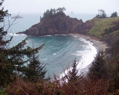
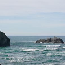
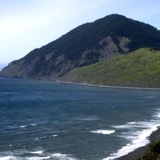
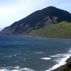
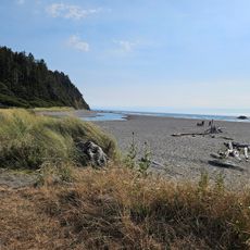
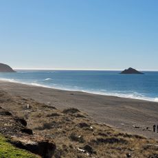
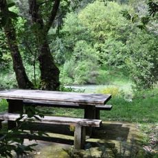
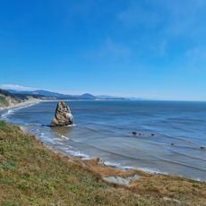
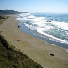
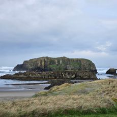
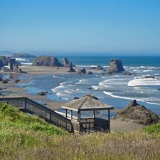
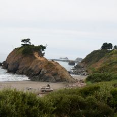
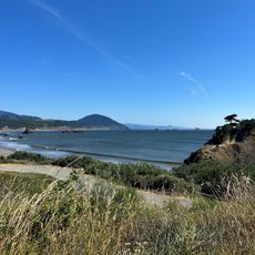
Port Orford Heads State Park is a coastal reserve on elevated headlands with walking trails to overlook points. The paths lead to views of Cape Blanco, the Pacific Ocean, and the surrounding Oregon coastline.

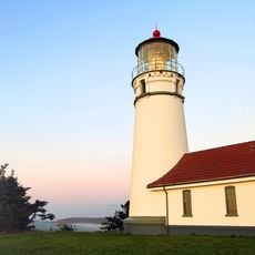
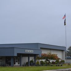
The lifeboat station was established in 1934 and served the Coast Guard with maritime rescue operations until its closure in 1970. The facility connected to the lower landing through a long stairway down the bluff.

The lifeboat station museum displays vessels and rescue equipment that tell the story of maritime safety efforts. You can observe how coastal communities depended on these operations to survive challenging waters.

The park is open daily and access to the trails is free. Wear comfortable shoes as the site involves climbing stairs to reach different viewpoints and museum areas.

During World War II, personnel at the station grew from 13 to over 100 to watch for enemy activity from the lookout tower. This expansion reveals how critical the coast was to national defense during wartime.

Location: Curry County

Inception: 1976

Website: https://stateparks.oregon.gov/index.cfm?do=park.profile&parkId=43

GPS coordinates: 42.74011,-124.51372

Latest update: December 6, 2025 17:44

Photos
Natural and historical sites across Oregon

Oregon offers a notable diversity of geological formations and natural landscapes ranging from the Pacific coastline to the volcanic plateaus of the eastern portion of the state. The Cascade Range dominates western Oregon with dense forests, waterfalls, and thermal springs, while the dry east...

Around this place
Face Rock State Scenic Viewpoint
United States of America

Face Rock State Scenic Viewpoint

41.3 km
Humbug Mountain State Park
United States of America

Humbug Mountain State Park

8.7 km
Isaac Lee Patterson Bridge
United States of America

Isaac Lee Patterson Bridge

35.8 km
West Coast Game Park Safari
United States of America

West Coast Game Park Safari

31.1 km
Cape Blanco Light
United States of America

Cape Blanco Light

11.4 km
Humbug Mountain
United States of America

Humbug Mountain

9.4 km
Wild Rogue Wilderness
United States of America

Wild Rogue Wilderness

41.4 km
Arizona Beach State Recreation Site
United States of America

Arizona Beach State Recreation Site

16.8 km
Grassy Knob Wilderness
United States of America

Grassy Knob Wilderness

15.3 km
Bandon State Natural Area
United States of America

Bandon State Natural Area

35.8 km
Paradise Point State Recreation Site
United States of America

Paradise Point State Recreation Site

2.3 km
Coquille Myrtle Grove State Natural Site
United States of America

Coquille Myrtle Grove State Natural Site

41.4 km
Face Rock Viewpoint
United States of America

Face Rock Viewpoint

41.1 km
Battle Rock Wayside Park

Battle Rock Wayside Park

1.8 km
Patrick Hughes House
United States of America

Patrick Hughes House

11.6 km
Bandon Senior High School
United States of America

Bandon Senior High School

42.5 km
Cape Blanco State Park
United States of America

Cape Blanco State Park

10.9 km
Ophir Beach
United States of America

Ophir Beach

23.3 km
Gold Beach Ranger Station
United States of America

Gold Beach Ranger Station

38.4 km
Devils Kitchen
United States of America

Devils Kitchen

38.7 km
Rogue River Museum & Gift shop
United States of America

Rogue River Museum & Gift shop

36.4 km
Bandon Beach
United States of America

Bandon Beach

40.2 km
Something Awesome
United States of America

Something Awesome

32.9 km
Redfish Rocks Marine Reserve
United States of America

Redfish Rocks Marine Reserve

5.7 km
Battle Rock
United States of America

Battle Rock

2.1 km
Arizona Beach
United States of America

Arizona Beach

16.7 km
Agate Beach
United States of America

Agate Beach

866 m
Battle Rock Arch
United States of America

Battle Rock Arch

1.7 km
Show the full map
Reviews

Visited this place? Tap the stars to rate it and share your experience / photos with the community! Try now! You can cancel it anytime.

« Port Orford Heads State Park - Coastal state park in Port Orford, United States » is provided by Around Us (aroundus.com). Images and texts are derived from Wikimedia project under a Creative Commons license. You are allowed to copy, distribute, and modify copies of this page, under the conditions set by the license, as long as this note is clearly visible.

Discover hidden gems everywhere you go!

From secret cafés to breathtaking viewpoints, skip the crowded tourist spots and find places that match your style. Our app makes it easy with voice search, smart filtering, route optimization, and insider tips from travelers worldwide. Download now for the complete mobile experience.

Around Us App Screenshot

A unique approach to discovering new places

Le Figaro

All the places worth exploring

France Info

A tailor-made excursion in just a few clicks

20 Minutes