Natural Bridges Cove

Log in to your account

AroundUs is a community-driven map of interesting places, built by curious explorers like you. It grows with every review, story, and photo you share.
Connect to save your favorite spots, contribute locations, and create personalized routes.
Continue with Google
Continue with Apple
Continue with X
Continue with Facebook
Continue with email
By continuing, you accept our Terms and Conditions and our Privacy Policy
Create an account
Add to collection
Map
Suggest a change
Share

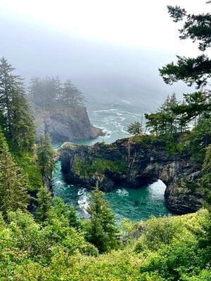
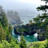
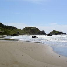
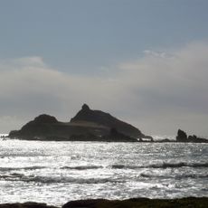
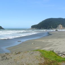
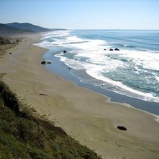
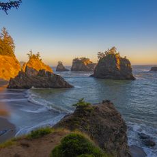
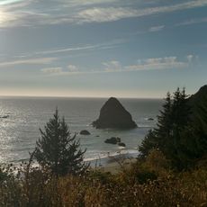
Natural Bridges Cove, Natural viewpoint and rock arch in Curry County, Oregon, United States.

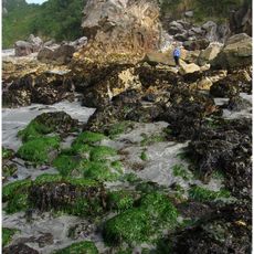
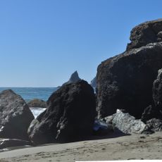
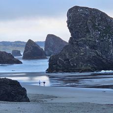
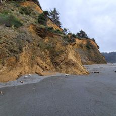
Natural Bridges Cove is a viewpoint featuring multiple stone arches that rise from the Pacific Ocean, shaped by erosion from waves and wind over time. The rock formations continue to change as natural forces shape the coastline.

The site became part of the Samuel H. Boardman State Scenic Corridor through acquisitions between 1949 and 1957, preserving it for public access. Its designation as a protected area marked an important moment for coastal conservation.

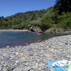
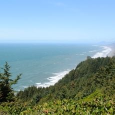
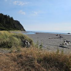
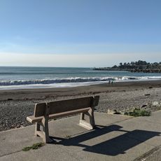
Photographers and nature observers gather at this location throughout the year to document the geological formations and marine wildlife in their natural habitat.

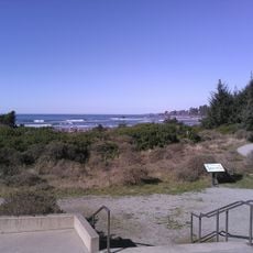
A short trail of about half a mile connects the Highway 101 parking area to the viewpoint with minimal elevation gain, making access easy for most visitors. The path is straightforward and suitable for casual walking.

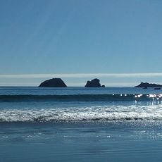
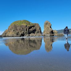
Two stone arches stand parallel to each other, creating an uncommon geological arrangement where waves flow through both openings at different patterns. This dual formation offers an unusual perspective on the ocean's power.

Location: Curry County

GPS coordinates: 42.18943,-124.36603

Latest update: December 6, 2025 19:09

Photos
Natural and historical sites across Oregon

Oregon offers a notable diversity of geological formations and natural landscapes ranging from the Pacific coastline to the volcanic plateaus of the eastern portion of the state. The Cascade Range dominates western Oregon with dense forests, waterfalls, and thermal springs, while the dry east...

Around this place
St. George Reef Light
United States of America

St. George Reef Light

39.3 km
Lost Monarch
United States of America

Lost Monarch

50.1 km
Harris Beach State Park
United States of America

Harris Beach State Park

14.5 km
Samuel H. Boardman State Scenic Corridor
United States of America

Samuel H. Boardman State Scenic Corridor

7.8 km
Kalmiopsis Wilderness
United States of America

Kalmiopsis Wilderness

34.8 km
Oregon Islands National Wildlife Refuge
United States of America

Oregon Islands National Wildlife Refuge

7.4 km
Castle Rock National Wildlife Refuge
United States of America

Castle Rock National Wildlife Refuge

48.6 km
Thomas Creek Bridge
United States of America

Thomas Creek Bridge

2.7 km
Tolowa Dunes State Park
United States of America

Tolowa Dunes State Park

38.5 km
Isaac Lee Patterson Bridge
United States of America

Isaac Lee Patterson Bridge

26.7 km
Alfred A. Loeb State Park
United States of America

Alfred A. Loeb State Park

16.9 km
Cape Sebastian State Scenic Corridor
United States of America

Cape Sebastian State Scenic Corridor

16.7 km
Arizona Beach State Recreation Site
United States of America

Arizona Beach State Recreation Site

47.5 km
Lone Ranch Beach
United States of America

Lone Ranch Beach

10.3 km
Pistol River State Scenic Viewpoint
United States of America

Pistol River State Scenic Viewpoint

10 km
Camp Lincoln
United States of America

Camp Lincoln

45.3 km
Ophir Beach
United States of America

Ophir Beach

40.2 km
Gold Beach Ranger Station
United States of America

Gold Beach Ranger Station

24.1 km
Crissey Field State Recreation Site

Crissey Field State Recreation Site

24.5 km
Pebble Beach
United States of America

Pebble Beach

48.6 km
Rogue River Museum & Gift shop
United States of America

Rogue River Museum & Gift shop

26.2 km
Secret Beach
United States of America

Secret Beach

784 m
Sporthaven Beach
United States of America

Sporthaven Beach

18.6 km
Meyers Creek Beach Viewpoint
United States of America

Meyers Creek Beach Viewpoint

14.3 km
Whaleshead Beach
United States of America

Whaleshead Beach

6 km
Redwood Theatre
United States of America

Redwood Theatre

16.8 km
Meyers Creek Pullout South
United States of America

Meyers Creek Pullout South

13.4 km
Arizona Beach
United States of America

Arizona Beach

47.5 km
Show the full map
Reviews

Visited this place? Tap the stars to rate it and share your experience / photos with the community! Try now! You can cancel it anytime.

« Natural Bridges Cove - Natural viewpoint and rock arch in Curry County, Oregon, United States » is provided by Around Us (aroundus.com). Images and texts are derived from Wikimedia project under a Creative Commons license. You are allowed to copy, distribute, and modify copies of this page, under the conditions set by the license, as long as this note is clearly visible.

Discover hidden gems everywhere you go!

From secret cafés to breathtaking viewpoints, skip the crowded tourist spots and find places that match your style. Our app makes it easy with voice search, smart filtering, route optimization, and insider tips from travelers worldwide. Download now for the complete mobile experience.

Around Us App Screenshot

A unique approach to discovering new places

Le Figaro

All the places worth exploring

France Info

A tailor-made excursion in just a few clicks

20 Minutes