Enable Location

We need your location to show you interesting places around you

Discover nearby places

Find interesting locations and hidden gems around you

Precise directions

Get accurate directions and distances to places

Your location is never shared with other users. It's only used when you tap the location button.

Row River National Recreation Trail

Log in to your account

Start exploring — it's free

Trusted by 65,090 travelers worldwide

Continue with Google
Continue with Apple
or

We will send you a code to connect

By continuing, you accept our Terms and Conditions and our Privacy Policy

Check your inbox

We've sent a pincode in your inbox. Please enter the code below.

Row River National Recreation Trail
Discussion Reviews 1 Photos
3.1k Popularity

Row River National Recreation Trail, Rail trail in Cottage Grove, Oregon, US.

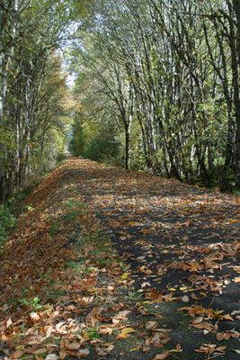
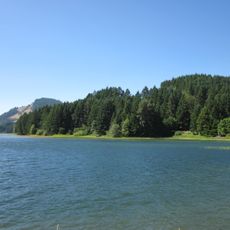
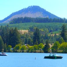
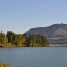
The Row River National Recreation Trail is a paved path in southern Oregon that follows a former railway corridor alongside the Row River and the Dorena Reservoir. It connects several small communities around Cottage Grove and stays nearly flat for its entire length, making it easy to travel by foot or by bike.

The railway line that this trail follows was built in 1912 to serve gold mining communities in the Bohemia district of the Oregon Cascades. When train service ended in 1994, the corridor was gradually transformed into the recreational path visitors use today.

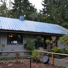
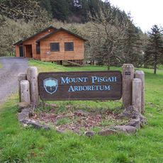
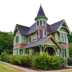
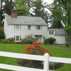
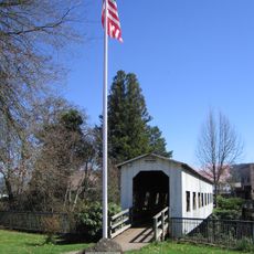
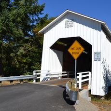
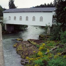
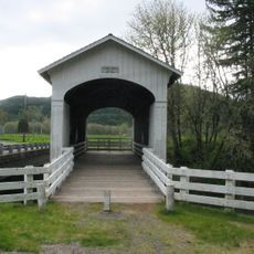
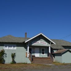
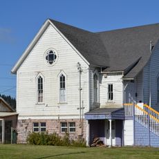
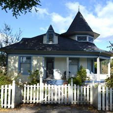
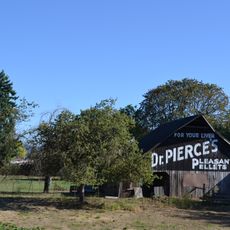
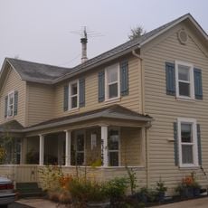
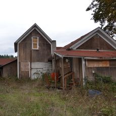
The trail passes through small communities where local people once relied on the railway for their daily needs. Some older structures along the route are still visible and give a sense of what life in the valley looked like before the tracks went silent.

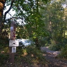
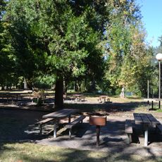
The trail has several access points with parking areas and restrooms spread along its length, so visitors can start or finish at whichever spot suits them best. The flat surface works well for people of all fitness levels, whether on foot or on a bike.

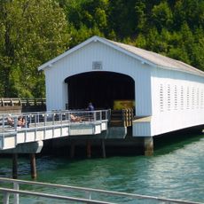
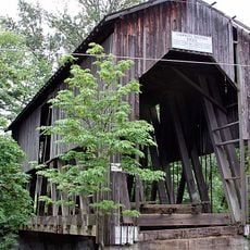
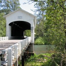
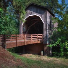
The old trestle bridge near Harms Park was used as a filming location for scenes in Stand By Me and The General, two films that needed real railway structures. The bridge is still standing and easy to spot from the trail, making it a recognizable stop for anyone interested in movie history.

The community of curious travelers

AroundUs brings together thousands of curated places, local tips, and hidden gems, enriched daily by 60,000 contributors worldwide.

Start exploring
Location
Inception
1998
GPS coordinates
43.79780,-123.05700
Latest update
March 3, 2026 13:53
Around this place
Cascades Raptor Center
United States of America

Cascades Raptor Center

21.2 km
Dexter Reservoir
United States of America

Dexter Reservoir

24.5 km
King Estate Winery
United States of America

King Estate Winery

15.7 km
Temple Beth Israel
United States of America

Temple Beth Israel

25.4 km
Dorena Reservoir
United States of America

Dorena Reservoir

8.3 km
Mount Pisgah Arboretum
United States of America

Mount Pisgah Arboretum

24.2 km
Elijah Bristow State Park
United States of America

Elijah Bristow State Park

24 km
Dexter State Recreation Site
United States of America

Dexter State Recreation Site

23.8 km
Lowell State Recreation Site
United States of America

Lowell State Recreation Site

25 km
Jasper State Recreation Site
United States of America

Jasper State Recreation Site

24.1 km
Charles and Anna Drain House
United States of America

Charles and Anna Drain House

25.6 km
Lowell Bridge
United States of America

Lowell Bridge

25.5 km
Chambers Covered Bridge
United States of America

Chambers Covered Bridge

1.1 km
Wayne Morse Farm
United States of America

Wayne Morse Farm

25.3 km
Mosby Creek Bridge
United States of America

Mosby Creek Bridge

4.7 km
Currin Bridge
United States of America

Currin Bridge

5 km
Centennial Covered Bridge
United States of America

Centennial Covered Bridge

564 m
Pengra Bridge
United States of America

Pengra Bridge

25.3 km
Parvin Bridge
United States of America

Parvin Bridge

22.1 km
Dorena Bridge
United States of America

Dorena Bridge

15.4 km
Stewart Bridge
United States of America

Stewart Bridge

6.2 km
Pass Creek Bridge
United States of America

Pass Creek Bridge

25.9 km
Lowell Grange
United States of America

Lowell Grange

26 km
Methodist Episcopal Church of Goshen
United States of America

Methodist Episcopal Church of Goshen

22.4 km
Horace J. and Ann S. Shinn Cottage
United States of America

Horace J. and Ann S. Shinn Cottage

1 km
Cochran-Rice Farm Complex
United States of America

Cochran-Rice Farm Complex

908 m
John Sutherland House
United States of America

John Sutherland House

19.9 km
Dorris Ranch Living History Farm
United States of America

Dorris Ranch Living History Farm

25.9 km
Show the full map
Reviews
Share your experience

No review yet

Discussions
Start a discussion...

No discussion yet

« Row River National Recreation Trail - Rail trail in Cottage Grove, Oregon, US » is provided by Around Us (aroundus.com). Images and texts are derived from Wikimedia project under a Creative Commons license. You are allowed to copy, distribute, and modify copies of this page, under the conditions set by the license, as long as this note is clearly visible.

Discover hidden gems everywhere you go!

From secret cafés to breathtaking viewpoints, skip the crowded tourist spots and find places that match your style. Our app makes it easy with voice search, smart filtering, route optimization, and insider tips from travelers worldwide. Download now for the complete mobile experience.

Around Us App Screenshot

A unique approach to discovering new places

Le Figaro

All the places worth exploring

France Info

A tailor-made excursion in just a few clicks

20 Minutes

Around Us
Travel Guide & Maps
Download

Send to your phone

QR Code
1

Open the camera app on your mobile.

2

Point at the QR code with your camera. A notification will appear.

3

Tap the notification to open the link.