Enable Location

We need your location to show you interesting places around you

Discover nearby places

Find interesting locations and hidden gems around you

Precise directions

Get accurate directions and distances to places

Your location is never shared with other users. It's only used when you tap the location button.

Cooper Creek Reservoir

Log in to your account

Start exploring — it's free

Trusted by 62,478 travelers worldwide

Continue with Google
Continue with Apple
or

We will send you a code to connect

By continuing, you accept our Terms and Conditions and our Privacy Policy

Check your inbox

We've sent a pincode in your inbox. Please enter the code below.

Cooper Creek Reservoir

Cooper Creek Reservoir, body of water

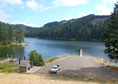
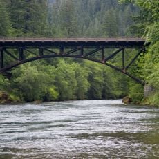
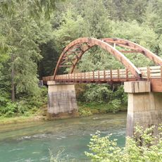
Cooper Creek Reservoir is a large body of water nestled in Oregon's landscape, surrounded by dense forests and open spaces. The water stretches smoothly, with grassy shorelines and two main visitor access areas, the West Day Use area on Edgewater Drive and the East Day Use area on Cooper Creek Road.

The reservoir was built many years ago to store water for local farms and towns, playing an important role in the area's development. Over time, it transformed from a water storage system into a popular gathering place for community activities and recreation.

The reservoir is part of local life, where families and neighbors gather to enjoy nature and spend time outdoors. This habit reflects the simple pleasures of rural Oregon and shows itself especially in summer through picnics and fishing.

Bring comfortable walking shoes and pack water and snacks for the day, since access to shops is limited. The paths around the water are flat and easy to walk, with free parking close to both access areas that have picnic tables and facilities.

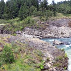
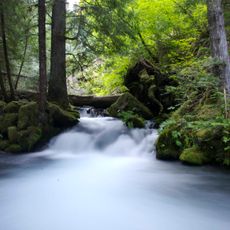
A complete trail around the water of about 4 miles was created by many volunteers who wanted to show how outdoor activities support health and happiness. This well-built loop was finished in mid-2022 and offers continuous views of water and forest.

The community of curious travelers

AroundUs brings together thousands of curated places, local tips, and hidden gems, enriched daily by 60,000 contributors worldwide.

Start exploring
Location
GPS coordinates
43.38000,-123.28200
Latest update
February 9, 2026 08:21
Around this place
Wildlife Safari
United States of America

Wildlife Safari

29 km
Fort Umpqua
United States of America

Fort Umpqua

36.6 km
Colliding Rivers
United States of America

Colliding Rivers

17.2 km
Charles and Anna Drain House
United States of America

Charles and Anna Drain House

31.2 km
North Umpqua Trail
United States of America

North Umpqua Trail

23.2 km
Methodist Episcopal Church South
United States of America

Methodist Episcopal Church South

20 km
Floed–Lane House
United States of America

Floed–Lane House

19.4 km
Horse Creek Bridge
United States of America

Horse Creek Bridge

39.7 km
Roaring Camp Bridge
United States of America

Roaring Camp Bridge

34.1 km
Neal Lane Bridge
United States of America

Neal Lane Bridge

40.4 km
Roseburg National Guard Armory
United States of America

Roseburg National Guard Armory

19.7 km
Rochester Covered Bridge
United States of America

Rochester Covered Bridge

7 km
Judge James Watson Hamilton House
United States of America

Judge James Watson Hamilton House

20 km
James Wimer Octagonal Barn
United States of America

James Wimer Octagonal Barn

28.8 km
Cavitt Creek Bridge
United States of America

Cavitt Creek Bridge

25.9 km
Glide Ranger Station
United States of America

Glide Ranger Station

17.3 km
U.S. Post Office
United States of America

U.S. Post Office

19.9 km
Pass Creek Bridge
United States of America

Pass Creek Bridge

31.4 km
Stearns Hardware Store
United States of America

Stearns Hardware Store

4.9 km
Oakland Historic District
United States of America

Oakland Historic District

4.9 km
Kohlhagen Building
United States of America

Kohlhagen Building

19.7 km
Charles Applegate House
United States of America

Charles Applegate House

25.7 km
English Settlement School
United States of America

English Settlement School

11.3 km
Sutherlin Bank Building
United States of America

Sutherlin Bank Building

2.7 km
Mott Bridge
United States of America

Mott Bridge

44.5 km
Douglas County Museum
United States of America

Douglas County Museum

21.7 km
Tioga Bridge
United States of America

Tioga Bridge

30.9 km
Oakland Bridge
United States of America

Oakland Bridge

5.3 km
Show the full map
« Cooper Creek Reservoir - body of water » is provided by Around Us (aroundus.com). Images and texts are derived from Wikimedia project under a Creative Commons license. You are allowed to copy, distribute, and modify copies of this page, under the conditions set by the license, as long as this note is clearly visible.

Discover hidden gems everywhere you go!

From secret cafés to breathtaking viewpoints, skip the crowded tourist spots and find places that match your style. Our app makes it easy with voice search, smart filtering, route optimization, and insider tips from travelers worldwide. Download now for the complete mobile experience.

Around Us App Screenshot

A unique approach to discovering new places

Le Figaro

All the places worth exploring

France Info

A tailor-made excursion in just a few clicks

20 Minutes

Around Us
Travel Guide & Maps
Download

Send to your phone

QR Code
1

Open the camera app on your mobile.

2

Point at the QR code with your camera. A notification will appear.

3

Tap the notification to open the link.