Enable Location

We need your location to show you interesting places around you

Discover nearby places

Find interesting locations and hidden gems around you

Precise directions

Get accurate directions and distances to places

Your location is never shared with other users. It's only used when you tap the location button.

Fort Umpqua

Log in to your account

Start exploring — it's free

Trusted by 62,475 travelers worldwide

Continue with Google
Continue with Apple
or

We will send you a code to connect

By continuing, you accept our Terms and Conditions and our Privacy Policy

Check your inbox

We've sent a pincode in your inbox. Please enter the code below.

Fort Umpqua, Military trading post in Elkton, Oregon, US

Fort Umpqua was a trading post located along the Umpqua River in Oregon with a square defensive stockade and diagonal corner bastions. The grounds included extensive cultivated land used for growing various crops and orchards.

The fort was established in 1836 by the Hudson's Bay Company as their southernmost trading post and operated for about 15 years. It was destroyed by fire in 1851, ending the fur trading operation at this location.

The site served as a meeting place between French-Canadian traders and local Native American tribes of the region. These interactions shaped the early settlement history of Douglas County.

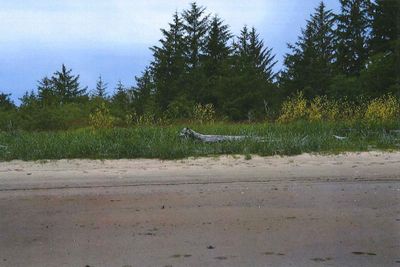
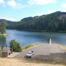
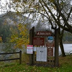
The site is now an archaeological location with no original standing structures, though visitors can explore the grounds and see the ruins. Visit during good weather and wear suitable shoes, as the terrain is uneven in places.

A Naval officer named George Emmons created detailed drawings of the fort in 1841, providing rare visual documentation of the structure during its active years. These sketches remain valuable records for understanding the exact design and layout.

The community of curious travelers

AroundUs brings together thousands of curated places, local tips, and hidden gems, enriched daily by 60,000 contributors worldwide.

Start exploring
Location
GPS coordinates
43.63330,-123.57100
Latest update
December 12, 2025 14:20
Around this place
Siuslaw National Forest
United States of America

Siuslaw National Forest

38.5 km
Elliott State Forest
United States of America

Elliott State Forest

36.4 km
King Estate Winery
United States of America

King Estate Winery

36.3 km
Devil's Staircase Wilderness
United States of America

Devil's Staircase Wilderness

29.7 km
Golden and Silver Falls State Natural Area
United States of America

Golden and Silver Falls State Natural Area

33.5 km
Cooper Creek Reservoir
United States of America

Cooper Creek Reservoir

36.6 km
Umpqua State Scenic Corridor
United States of America

Umpqua State Scenic Corridor

27.1 km
Umpqua River Bridge
United States of America

Umpqua River Bridge

43.5 km
Charles and Anna Drain House
United States of America

Charles and Anna Drain House

21.2 km
Dean Creek Wildlife Area
United States of America

Dean Creek Wildlife Area

38.3 km
Chambers Covered Bridge
United States of America

Chambers Covered Bridge

44.2 km
Coyote Creek Bridge
United States of America

Coyote Creek Bridge

42.6 km
Wildcat Creek Bridge
United States of America

Wildcat Creek Bridge

41.7 km
Roaring Camp Bridge
United States of America

Roaring Camp Bridge

11.1 km
Rochester Covered Bridge
United States of America

Rochester Covered Bridge

30.8 km
Beaver Creek Falls
United States of America

Beaver Creek Falls

43 km
Pass Creek Bridge
United States of America

Pass Creek Bridge

20.7 km
Stearns Hardware Store
United States of America

Stearns Hardware Store

32.2 km
Oakland Historic District
United States of America

Oakland Historic District

32.2 km
Horace J. and Ann S. Shinn Cottage
United States of America

Horace J. and Ann S. Shinn Cottage

44.4 km
Charles Applegate House
United States of America

Charles Applegate House

24.2 km
English Settlement School
United States of America

English Settlement School

33.3 km
Sutherlin Bank Building
United States of America

Sutherlin Bank Building

34.2 km
John Sutherland House
United States of America

John Sutherland House

41.4 km
Scottsburg Bridge
United States of America

Scottsburg Bridge

20.6 km
Scottsburg Bridge
United States of America

Scottsburg Bridge

20.7 km
Oakland Bridge
United States of America

Oakland Bridge

31.7 km
Sweet Creek Falls
United States of America

Sweet Creek Falls

43.9 km
Show the full map
« Fort Umpqua - Military trading post in Elkton, Oregon, US » is provided by Around Us (aroundus.com). Images and texts are derived from Wikimedia project under a Creative Commons license. You are allowed to copy, distribute, and modify copies of this page, under the conditions set by the license, as long as this note is clearly visible.

Discover hidden gems everywhere you go!

From secret cafés to breathtaking viewpoints, skip the crowded tourist spots and find places that match your style. Our app makes it easy with voice search, smart filtering, route optimization, and insider tips from travelers worldwide. Download now for the complete mobile experience.

Around Us App Screenshot

A unique approach to discovering new places

Le Figaro

All the places worth exploring

France Info

A tailor-made excursion in just a few clicks

20 Minutes

Around Us
Travel Guide & Maps
Download

Send to your phone

QR Code
1

Open the camera app on your mobile.

2

Point at the QR code with your camera. A notification will appear.

3

Tap the notification to open the link.