Enable Location

We need your location to show you interesting places around you

Discover nearby places

Find interesting locations and hidden gems around you

Precise directions

Get accurate directions and distances to places

Your location is never shared with other users. It's only used when you tap the location button.

Elliott State Forest

Log in to your account

Start exploring — it's free

Trusted by 63,056 travelers worldwide

Continue with Google
Continue with Apple
or

We will send you a code to connect

By continuing, you accept our Terms and Conditions and our Privacy Policy

Check your inbox

We've sent a pincode in your inbox. Please enter the code below.

Elliott State Forest
Discussion Reviews 1 Photos
4.6k Popularity

Elliott State Forest, State forest in Oregon Coast Range, United States.

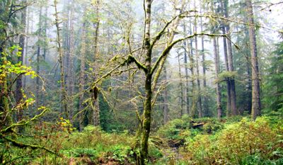
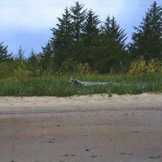
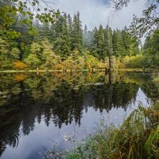
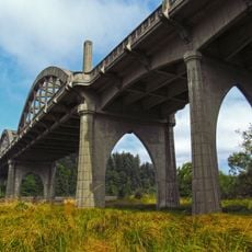
Elliott State Forest is a large forest spanning about 93,000 acres along the Oregon coast between Coos Bay and Reedsport. The land consists mainly of Douglas-fir, western hemlock, western redcedar, and red alder trees.

The forest was established in 1930 by the Oregon Department of Forestry and named after Francis Elliott, the first state forester. Its creation reflected efforts to secure and manage forest lands across the state.

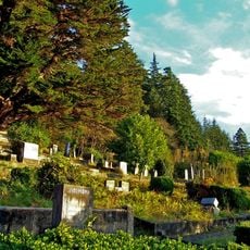
The Hanis and Quuiich peoples lived on these lands for centuries and built strong connections with the forest and its resources. Their heritage remains part of the region's identity today.

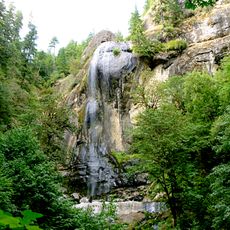
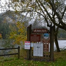
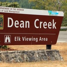
The forest is open for activities like hiking and wildlife viewing, with marked trails for visitors to follow. Some areas may be temporarily closed due to timber operations, so checking conditions ahead of your visit is advisable.

Revenue from timber operations in the forest directly funds the Oregon Common School Fund, contributing over 284 million dollars to public education since 1955. This connection ties forest management directly to school funding across the state.

The community of curious travelers

AroundUs brings together thousands of curated places, local tips, and hidden gems, enriched daily by 60,000 contributors worldwide.

Start exploring
Location
Inception
1930
GPS coordinates
43.58470,-124.01800
Latest update
December 10, 2025 20:06
Around this place
Oregon Dunes National Recreation Area
United States of America

Oregon Dunes National Recreation Area

20.1 km
Siuslaw National Forest
United States of America

Siuslaw National Forest

37.1 km
Jessie M. Honeyman Memorial State Park
United States of America

Jessie M. Honeyman Memorial State Park

39 km
Conde McCullough Memorial Bridge
United States of America

Conde McCullough Memorial Bridge

24.1 km
Umpqua River Light
United States of America

Umpqua River Light

16.9 km
William M. Tugman State Park
United States of America

William M. Tugman State Park

12.9 km
Coast Guard Air Station North Bend
United States of America

Coast Guard Air Station North Bend

26.5 km
Egyptian Theatre
United States of America

Egyptian Theatre

28.9 km
Fort Umpqua
United States of America

Fort Umpqua

36.4 km
Devil's Staircase Wilderness
United States of America

Devil's Staircase Wilderness

17 km
Golden and Silver Falls State Natural Area
United States of America

Golden and Silver Falls State Natural Area

13.1 km
Umpqua State Scenic Corridor
United States of America

Umpqua State Scenic Corridor

11.7 km
Umpqua River Bridge
United States of America

Umpqua River Bridge

15.4 km
Dean Creek Wildlife Area
United States of America

Dean Creek Wildlife Area

12.4 km
Haynes Inlet Bridge
United States of America

Haynes Inlet Bridge

22.9 km
Coos Bay National Bank Building
United States of America

Coos Bay National Bank Building

28.9 km
Coos History Museum
United States of America

Coos History Museum

28.1 km
Marine life center
United States of America

Marine life center

36.6 km
J. S. Coke Building
United States of America

J. S. Coke Building

28.8 km
Chandler Hotel and Annex
United States of America

Chandler Hotel and Annex

28.9 km
Eye of the Needle
United States of America

Eye of the Needle

39.2 km
Port Theater
United States of America

Port Theater

25.9 km
Liberty Theatre
United States of America

Liberty Theatre

26 km
Chandler Bridge
United States of America

Chandler Bridge

26.7 km
Jessie M. Honeyman Memorial State Park Historic District
United States of America

Jessie M. Honeyman Memorial State Park Historic District

39.3 km
Gardiner Historic District
United States of America

Gardiner Historic District

17.8 km
Gardiner Cemetery
United States of America

Gardiner Cemetery

18.3 km
Scottsburg Bridge
United States of America

Scottsburg Bridge

17.4 km
Show the full map
Reviews
Share your experience

No review yet

Discussions
Start a discussion...

No discussion yet

« Elliott State Forest - State forest in Oregon Coast Range, United States » is provided by Around Us (aroundus.com). Images and texts are derived from Wikimedia project under a Creative Commons license. You are allowed to copy, distribute, and modify copies of this page, under the conditions set by the license, as long as this note is clearly visible.

Discover hidden gems everywhere you go!

From secret cafés to breathtaking viewpoints, skip the crowded tourist spots and find places that match your style. Our app makes it easy with voice search, smart filtering, route optimization, and insider tips from travelers worldwide. Download now for the complete mobile experience.

Around Us App Screenshot

A unique approach to discovering new places

Le Figaro

All the places worth exploring

France Info

A tailor-made excursion in just a few clicks

20 Minutes

Around Us
Travel Guide & Maps
Download

Send to your phone

QR Code
1

Open the camera app on your mobile.

2

Point at the QR code with your camera. A notification will appear.

3

Tap the notification to open the link.