Enable Location

We need your location to show you interesting places around you

Discover nearby places

Find interesting locations and hidden gems around you

Precise directions

Get accurate directions and distances to places

Your location is never shared with other users. It's only used when you tap the location button.

Jessie M. Honeyman Memorial State Park

Log in to your account

Start exploring — it's free

Trusted by 63,065 travelers worldwide

Continue with Google
Continue with Apple
or

We will send you a code to connect

By continuing, you accept our Terms and Conditions and our Privacy Policy

Check your inbox

We've sent a pincode in your inbox. Please enter the code below.

Jessie M. Honeyman Memorial State Park
Discussion Reviews 1 Photos
8.6k Popularity

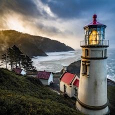
Jessie M. Honeyman Memorial State Park, State park with lakes and dunes in Lane County, United States

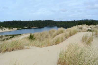
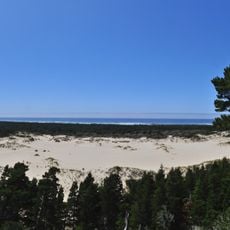
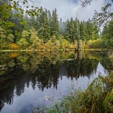
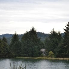
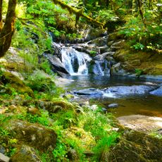
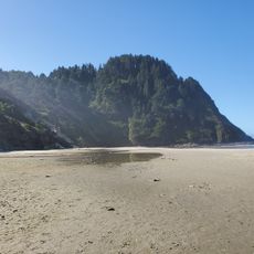
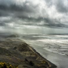
Jessie M. Honeyman Memorial State Park is a coastal preserve in Oregon featuring two freshwater lakes bordered by sand dunes and forest. The site covers roughly 1,400 acres and connects different habitats from open beach areas to wooded hillsides.

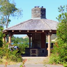
The site was developed in the 1930s by the Civilian Conservation Corps, which built bathing facilities and shelter structures. This Depression-era infrastructure now forms a recognized historic district within the park.

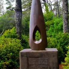
The park honors Jessie M. Honeyman, a key figure in Oregon's efforts to protect its coastline from development. Her name represents a commitment to keeping these natural spaces accessible to the public and safe from commercial use.

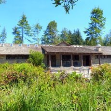
The park offers multiple lodging options from tent sites to cabin-style accommodations for different preferences and budgets. Visitors should check ahead to learn which areas allow vehicle access and which are meant for walking only.

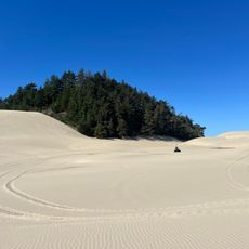
From October through April, visitors can drive all-terrain vehicles directly onto North America's largest coastal sand dunes from the H Loop camping zone. This seasonal adventure draws people specifically looking for this kind of outdoor activity.

The community of curious travelers

AroundUs brings together thousands of curated places, local tips, and hidden gems, enriched daily by 60,000 contributors worldwide.

Start exploring
Location
GPS coordinates
43.92889,-124.10694
Latest update
December 8, 2025 19:57
Around this place
Oregon Dunes National Recreation Area
United States of America

Oregon Dunes National Recreation Area

23.5 km
Heceta Head Light
United States of America

Heceta Head Light

23.3 km
Siuslaw National Forest
United States of America

Siuslaw National Forest

18.9 km
Darlingtonia State Natural Site
United States of America

Darlingtonia State Natural Site

13.1 km
Umpqua River Light
United States of America

Umpqua River Light

30.6 km
Siuslaw River Bridge
United States of America

Siuslaw River Bridge

4 km
Rock Creek Wilderness
United States of America

Rock Creek Wilderness

28.3 km
Carl G. Washburne Memorial State Park
United States of America

Carl G. Washburne Memorial State Park

25.5 km
Cape Creek Bridge
United States of America

Cape Creek Bridge

22.8 km
Devil's Staircase Wilderness
United States of America

Devil's Staircase Wilderness

27.7 km
Heceta Head Lighthouse
United States of America

Heceta Head Lighthouse

22.9 km
Muriel O. Ponsler Memorial State Scenic Viewpoint
United States of America

Muriel O. Ponsler Memorial State Scenic Viewpoint

26.9 km
Umpqua River Bridge
United States of America

Umpqua River Bridge

24.4 km
Big Creek Bridge
United States of America

Big Creek Bridge

27.3 km
Dean Creek Wildlife Area
United States of America

Dean Creek Wildlife Area

26.6 km
Sandland Adventures
United States of America

Sandland Adventures

2.8 km
Edwin E. Benedict House
United States of America

Edwin E. Benedict House

6.2 km
Beaver Creek Falls
United States of America

Beaver Creek Falls

17.3 km
Sand Dunes Frontier
United States of America

Sand Dunes Frontier

1.7 km
Hobbit Beach
United States of America

Hobbit Beach

24.3 km
Eye of the Needle
United States of America

Eye of the Needle

280 m
Baker Beach
United States of America

Baker Beach

16.5 km
Jessie M. Honeyman Memorial State Park Hexagonal Kitchen Shelter
United States of America

Jessie M. Honeyman Memorial State Park Hexagonal Kitchen Shelter

515 m
Jessie M. Honeyman Memorial State Park Historic District
United States of America

Jessie M. Honeyman Memorial State Park Historic District

443 m
Gardiner Historic District
United States of America

Gardiner Historic District

22.1 km
Siuslaw River Bridge
United States of America

Siuslaw River Bridge

23 km
Gardiner Cemetery
United States of America

Gardiner Cemetery

21.6 km
Sweet Creek Falls
United States of America

Sweet Creek Falls

16.4 km
Show the full map
Reviews
Share your experience

No review yet

Discussions
Start a discussion...

No discussion yet

« Jessie M. Honeyman Memorial State Park - State park with lakes and dunes in Lane County, United States » is provided by Around Us (aroundus.com). Images and texts are derived from Wikimedia project under a Creative Commons license. You are allowed to copy, distribute, and modify copies of this page, under the conditions set by the license, as long as this note is clearly visible.

Discover hidden gems everywhere you go!

From secret cafés to breathtaking viewpoints, skip the crowded tourist spots and find places that match your style. Our app makes it easy with voice search, smart filtering, route optimization, and insider tips from travelers worldwide. Download now for the complete mobile experience.

Around Us App Screenshot

A unique approach to discovering new places

Le Figaro

All the places worth exploring

France Info

A tailor-made excursion in just a few clicks

20 Minutes

Around Us
Travel Guide & Maps
Download

Send to your phone

QR Code
1

Open the camera app on your mobile.

2

Point at the QR code with your camera. A notification will appear.

3

Tap the notification to open the link.