Heceta Head Lighthouse, Historic lighthouse on Oregon Coast, United States.
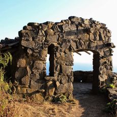
Heceta Head Lighthouse is a lighthouse complex on Oregon's rocky coastline, positioned roughly 206 feet (63 m) above the Pacific Ocean with a tower standing about 56 feet (17 m) tall. The station includes several historical buildings constructed at the cliff's edge, along with pathways and viewing areas overlooking the water.
The station was built in 1894 to guide ships safely along this dangerous coastline. Over its years of operation, it transitioned from open fires and kerosene lamps to electric power, reflecting advances in navigation technology.
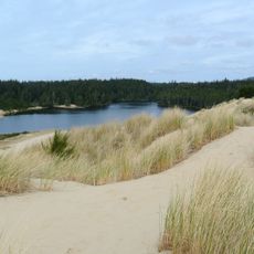
The site draws visitors interested in maritime heritage and coastal landscape exploration, particularly those wanting to observe seabirds on the cliffs. The buildings and pathways convey how lighthouse keepers and their families lived at this isolated location.
Access is from a parking area at the cliff top, from which visitors walk to the tower and viewpoints. Paths can be steep and coastal winds are often strong, so sturdy shoes and a windproof jacket are recommended.
The cliffs surrounding the tower host one of Oregon's largest nesting colonies of seabirds, particularly common murres that breed in dense clusters on the rocky slopes. This bird population transforms the site into a natural observatory during breeding season.
Address: 97439 US-101, Florence, OR 97439, USA
Opening Hours: Dimanche: 08:00 - 19:00
Phone: +(800)5516949
Website: http://oregonstateparks.org/index.cfm?do=parkPage.dsp_parkPage&parkId=86
GPS coordinates: 44.13494,-124.11391
Latest update: December 12, 2025 17:43
Heceta Head Light
1.1 km
Jessie M. Honeyman Memorial State Park
22.9 km
Devils Churn
16.6 km
Darlingtonia State Natural Site
10 km
Siuslaw River Bridge
19 km
Cleft of the Rock Light
17.3 km
Cummins Creek Wilderness
14.2 km
Rock Creek Wilderness
6.8 km
Carl G. Washburne Memorial State Park
2.6 km
Cape Creek Bridge
679 m
Neptune State Scenic Viewpoint
14.1 km
Yachats State Recreation Area
19.6 km
Muriel O. Ponsler Memorial State Scenic Viewpoint
4 km
Smelt Sands State Recreation Site
20.8 km
Yachats Ocean Road State Natural Site
19.1 km
Stonefield Beach State Recreation Site
10 km
Tokatee Klootchman State Natural Site
8.2 km
Big Creek Bridge
4.4 km
Ten Mile Creek Bridge
9.9 km
North Fork of the Yachats Bridge
22.6 km
Edwin E. Benedict House
18.2 km
Thor's Well
16 km
Eye of the Needle
22.7 km
Cape Perpetua Shelter and Parapet
17 km
Jessie M. Honeyman Memorial State Park Hexagonal Kitchen Shelter
22.6 km
Jessie M. Honeyman Memorial State Park Historic District
22.7 km
Siuslaw River Bridge
23.5 km
Sweet Creek Falls
26.9 kmVisited this place? Tap the stars to rate it and share your experience / photos with the community! Try now! You can cancel it anytime.
Discover hidden gems everywhere you go!
From secret cafés to breathtaking viewpoints, skip the crowded tourist spots and find places that match your style. Our app makes it easy with voice search, smart filtering, route optimization, and insider tips from travelers worldwide. Download now for the complete mobile experience.
A unique approach to discovering new places❞
— Le Figaro
All the places worth exploring❞
— France Info
A tailor-made excursion in just a few clicks❞
— 20 Minutes