Cleft of the Rock Light, Wooden lighthouse in Lincoln County, Oregon, United States
Cleft of the Rock Light is a wooden lighthouse rising 11 meters high on a rocky cliff. The structure features two fourth-order Fresnel lenses that emit alternating white and red flashes every ten seconds.
James Gibbs, a former Coast Guard member and maritime historian, built this lighthouse in 1976 using the Fiddle Reef Light in British Columbia as his model. The project was a personal endeavor drawing on his knowledge of lighthouse design.
The name references a biblical passage from Exodus 33:22 that also inspired the hymn 'He Hideth My Soul in the Cleft of the Rock'. You can sense this spiritual meaning in the building's title.
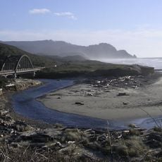
The lighthouse is closed to visitors but can be viewed and photographed from a designated pullout area along Highway 101 near mile marker 166. The spot provides clear viewing and photo opportunities from the roadside.
The structure incorporates authentic maritime elements, including a stair railing salvaged from Yaquina Head Light and Fresnel lenses from Semiahmoo and Patos Island lighthouses. These reclaimed components come from different stations along the coast.
Location: Lincoln County
Height: 11 m
Made from material: lumber
GPS coordinates: 44.29048,-124.11077
Latest update: December 12, 2025 09:03
Heceta Head Light
17.1 km
Oregon Coast Trail
13.4 km
Devils Churn
673 m
Alsea Bay Bridge
16.1 km
Drift Creek Wilderness
24.1 km
Cummins Creek Wilderness
7 km
Rock Creek Wilderness
13 km
Carl G. Washburne Memorial State Park
14.7 km
Cape Creek Bridge
17.5 km
Driftwood Beach State Recreation Site
19.4 km
Heceta Head Lighthouse
17.3 km
Beachside State Recreation Site
10.3 km
Neptune State Scenic Viewpoint
3.3 km
Seal Rock State Recreation Site
23.1 km
Alsea Bay Historic Interpretive Center
15.7 km
Yachats State Recreation Area
2.3 km
Muriel O. Ponsler Memorial State Scenic Viewpoint
13.3 km
Smelt Sands State Recreation Site
3.5 km
Yachats Ocean Road State Natural Site
1.8 km
Stonefield Beach State Recreation Site
7.3 km
Tokatee Klootchman State Natural Site
9.2 km
W. B. Nelson State Recreation Site
15.1 km
Big Creek Bridge
12.9 km
Governor Patterson Memorial State Recreation Site
13.9 km
Ten Mile Creek Bridge
7.4 km
North Fork of the Yachats Bridge
11.4 km
Fisher School Bridge
21.5 km
Thor's Well
1.4 kmVisited this place? Tap the stars to rate it and share your experience / photos with the community! Try now! You can cancel it anytime.
Discover hidden gems everywhere you go!
From secret cafés to breathtaking viewpoints, skip the crowded tourist spots and find places that match your style. Our app makes it easy with voice search, smart filtering, route optimization, and insider tips from travelers worldwide. Download now for the complete mobile experience.
A unique approach to discovering new places❞
— Le Figaro
All the places worth exploring❞
— France Info
A tailor-made excursion in just a few clicks❞
— 20 Minutes