Yachats Ocean Road State Natural Site, State natural site along Pacific Ocean in Yachats, Oregon.
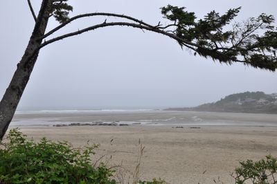
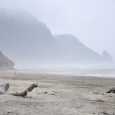
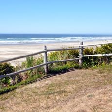
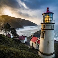
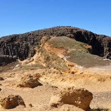
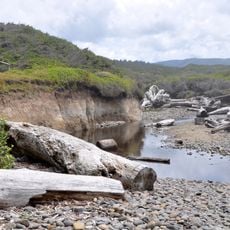
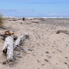
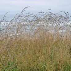
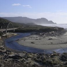
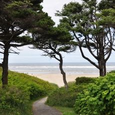
Yachats Ocean Road State Natural Site is a coastal protected area featuring a scenic loop road with multiple observation points. The route winds along cliffs and beaches where visitors encounter ocean views, rock formations, and the meeting point of river and sea.
The land entered Oregon's state parks system through gradual acquisitions from private owners and Lincoln County between 1931 and 1962. These transfers transformed it into a protected public destination for visitors to explore.
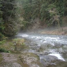
Local residents and visitors gather at this coastal location to observe marine wildlife, fish for Chinook salmon, and participate in beach activities.
Several parking areas along the loop provide year-round access to the beach and river mouth without needing reservations. Most sections are walkable, though visitors should come prepared for changing coastal weather and surf conditions.
The natural site sits at the confluence of the Yachats River and Pacific Ocean, creating varied water conditions for different recreational activities.
Location: Oregon
Website: https://stateparks.oregon.gov/index.cfm?do=park.profile&parkId=93
GPS coordinates: 44.30620,-124.10500
Latest update: December 14, 2025 11:03
Heceta Head Light
18.9 km
Devils Churn
2.5 km
Alsea Bay Bridge
14.3 km
Drift Creek Wilderness
22.4 km
Cleft of the Rock Light
1.8 km
Cummins Creek Wilderness
7.9 km
Rock Creek Wilderness
14.6 km
Carl G. Washburne Memorial State Park
16.5 km
Cape Creek Bridge
19.3 km
Driftwood Beach State Recreation Site
17.7 km
Heceta Head Lighthouse
19.1 km
Beachside State Recreation Site
8.5 km
Neptune State Scenic Viewpoint
5 km
Seal Rock State Recreation Site
21.4 km
Alsea Bay Historic Interpretive Center
13.9 km
Yachats State Recreation Area
641 m
Muriel O. Ponsler Memorial State Scenic Viewpoint
15.1 km
Smelt Sands State Recreation Site
1.8 km
Stonefield Beach State Recreation Site
9.1 km
Tokatee Klootchman State Natural Site
10.9 km
W. B. Nelson State Recreation Site
13.3 km
Big Creek Bridge
14.7 km
Governor Patterson Memorial State Recreation Site
12.1 km
Ten Mile Creek Bridge
9.1 km
North Fork of the Yachats Bridge
10.8 km
Fisher School Bridge
21.1 km
Thor's Well
3.2 km
Cape Perpetua Shelter and Parapet
2.1 kmVisited this place? Tap the stars to rate it and share your experience / photos with the community! Try now! You can cancel it anytime.
Discover hidden gems everywhere you go!
From secret cafés to breathtaking viewpoints, skip the crowded tourist spots and find places that match your style. Our app makes it easy with voice search, smart filtering, route optimization, and insider tips from travelers worldwide. Download now for the complete mobile experience.
A unique approach to discovering new places❞
— Le Figaro
All the places worth exploring❞
— France Info
A tailor-made excursion in just a few clicks❞
— 20 Minutes