Alsea Bay Historic Interpretive Center

Log in to your account

AroundUs is a community-driven map of interesting places, built by curious explorers like you. It grows with every review, story, and photo you share.
Connect to save your favorite spots, contribute locations, and create personalized routes.
Continue with Google
Continue with Apple
Continue with X
Continue with Facebook
Continue with email
By continuing, you accept our Terms and Conditions and our Privacy Policy
Create an account

Alsea Bay Historic Interpretive Center

Add to collection
Map
Suggest a change
Share

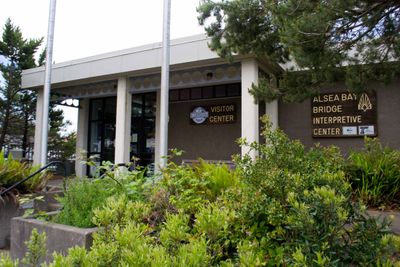
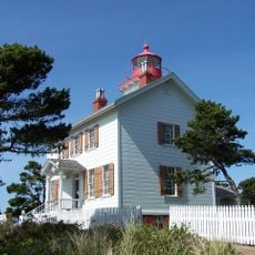
Alsea Bay Historic Interpretive Center, State park interpretive center in Waldport, Oregon, United States.

The Alsea Bay Historic Interpretive Center is an interpretive facility in Waldport featuring displays about bridge engineering and local transportation history. The exhibits also cover the marine ecosystems found along this section of the Oregon coast.

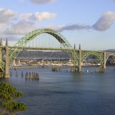
The facility was built by Oregon's transportation department during the Alsea Bay Bridge replacement project. The city of Waldport took over management of the center in 2020.

Native American artifacts and photographs on display show the long relationship between indigenous communities and the Pacific coast. Visitors can explore how these peoples have connected with and shaped this region through the generations.

The center sits on NW Highway 101 in Waldport and is easy to access for travelers passing through town. Staff members are available to give tours and explain the displays in more detail.

The center brings together transportation engineering history with marine biology education in an unusual combination. This dual focus reveals how human infrastructure and natural systems have intersected along this stretch of coast.

Location: Oregon

GPS coordinates: 44.42790,-124.06752

Latest update: December 13, 2025 17:03

Photos
Around this place
Oregon Coast Aquarium
United States of America

Oregon Coast Aquarium

21.2 km
Yaquina Bay Bridge
United States of America

Yaquina Bay Bridge

21.7 km
Devils Churn
United States of America

Devils Churn

16.3 km
South Beach State Park
United States of America

South Beach State Park

19.6 km
Yaquina Bay Light
United States of America

Yaquina Bay Light

21.9 km
Alsea Bay Bridge
United States of America

Alsea Bay Bridge

509 m
Drift Creek Wilderness
United States of America

Drift Creek Wilderness

11.8 km
Cleft of the Rock Light
United States of America

Cleft of the Rock Light

15.7 km
Cummins Creek Wilderness
United States of America

Cummins Creek Wilderness

19.8 km
Driftwood Beach State Recreation Site
United States of America

Driftwood Beach State Recreation Site

4.1 km
Beachside State Recreation Site
United States of America

Beachside State Recreation Site

5.4 km
Yaquina Bay State Recreation Site
United States of America

Yaquina Bay State Recreation Site

21.8 km
Neptune State Scenic Viewpoint
United States of America

Neptune State Scenic Viewpoint

18.8 km
Seal Rock State Recreation Site
United States of America

Seal Rock State Recreation Site

7.8 km
Yachats State Recreation Area
United States of America

Yachats State Recreation Area

13.4 km
Ona Beach State Park
United States of America

Ona Beach State Park

10.1 km
Lost Creek State Recreation Site
United States of America

Lost Creek State Recreation Site

13.1 km
Smelt Sands State Recreation Site
United States of America

Smelt Sands State Recreation Site

12.2 km
Beaver Creek State Natural Area
United States of America

Beaver Creek State Natural Area

9.8 km
Yachats Ocean Road State Natural Site
United States of America

Yachats Ocean Road State Natural Site

13.9 km
W. B. Nelson State Recreation Site
United States of America

W. B. Nelson State Recreation Site

2.9 km
Governor Patterson Memorial State Recreation Site
United States of America

Governor Patterson Memorial State Recreation Site

2.1 km
Oregon Undersea Gardens
United States of America

Oregon Undersea Gardens

22.6 km
North Fork of the Yachats Bridge
United States of America

North Fork of the Yachats Bridge

15.3 km
South Jetty
United States of America

South Jetty

21 km
Charles and Theresa Roper House
United States of America

Charles and Theresa Roper House

22.9 km
Thor's Well
United States of America

Thor's Well

17 km
Cape Perpetua Shelter and Parapet
United States of America

Cape Perpetua Shelter and Parapet

16 km
Show the full map
Reviews

Visited this place? Tap the stars to rate it and share your experience / photos with the community! Try now! You can cancel it anytime.

« Alsea Bay Historic Interpretive Center - State park interpretive center in Waldport, Oregon, United States » is provided by Around Us (aroundus.com). Images and texts are derived from Wikimedia project under a Creative Commons license. You are allowed to copy, distribute, and modify copies of this page, under the conditions set by the license, as long as this note is clearly visible.

Discover hidden gems everywhere you go!

From secret cafés to breathtaking viewpoints, skip the crowded tourist spots and find places that match your style. Our app makes it easy with voice search, smart filtering, route optimization, and insider tips from travelers worldwide. Download now for the complete mobile experience.

Around Us App Screenshot

A unique approach to discovering new places

Le Figaro

All the places worth exploring

France Info

A tailor-made excursion in just a few clicks

20 Minutes