Enable Location

We need your location to show you interesting places around you

Discover nearby places

Find interesting locations and hidden gems around you

Precise directions

Get accurate directions and distances to places

Your location is never shared with other users. It's only used when you tap the location button.

Lost Creek State Recreation Site

Log in to your account

Start exploring — it's free

Trusted by 61,867 travelers worldwide

Continue with Google
Continue with Apple
or

We will send you a code to connect

By continuing, you accept our Terms and Conditions and our Privacy Policy

Check your inbox

We've sent a pincode in your inbox. Please enter the code below.

Lost Creek State Recreation Site

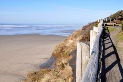
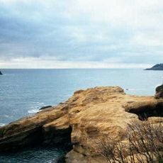
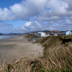
Lost Creek State Recreation Site, State recreation site on Pacific coast in Lincoln County, Oregon.

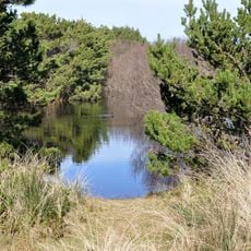
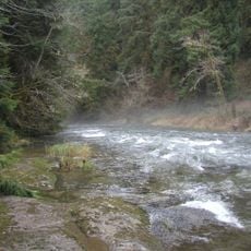
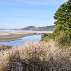
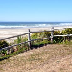
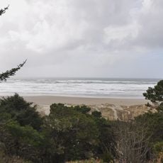
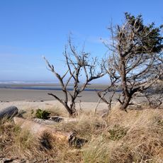
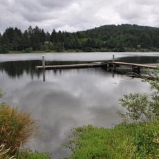
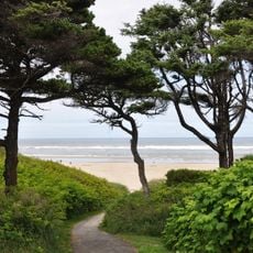
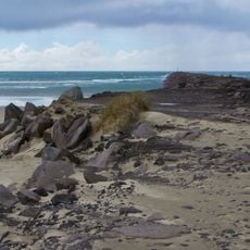
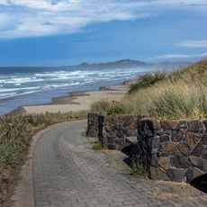
Lost Creek State Recreation Site is a coastal park in Oregon with forest trails, picnic areas, and direct beach access. The grounds feature wooded sections, open spaces for activities, and several viewpoints overlooking the ocean.

The site came into being in 1933 through land donations from Ben E. Smith and Lincoln County to protect shore pine vegetation. These contributions secured lasting public access to the coastline.

The recreation site represents Oregon's commitment to preserving natural spaces while providing opportunities for outdoor recreation and environmental education to residents.

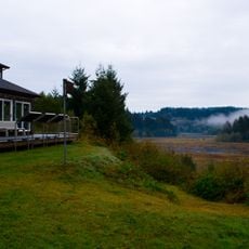
The park lies about 7 miles south of Newport and is open year-round for day visits. Designated parking areas and picnic facilities are available to help with your visit planning.

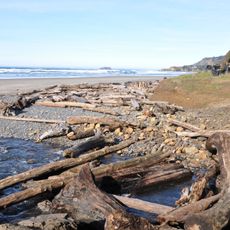
An old railroad track once ran through the current park grounds from 1918 to 1920 and was used to transport spruce timber during World War I. This quiet reminder of past industrial activity is barely visible today within the peaceful forest setting.

The community of curious travelers

AroundUs brings together thousands of curated places, local tips, and hidden gems, enriched daily by 60,000 contributors worldwide.

Start exploring
Location
GPS coordinates
44.54570,-124.07300
Latest update
December 14, 2025 09:40
Around this place
Devils Punch Bowl State Natural Area
United States of America

Devils Punch Bowl State Natural Area

22.3 km
Oregon Coast Aquarium
United States of America

Oregon Coast Aquarium

8.3 km
Yaquina Head Light
United States of America

Yaquina Head Light

14.6 km
Yaquina Bay Bridge
United States of America

Yaquina Bay Bridge

8.7 km
Beverly Beach State Park
United States of America

Beverly Beach State Park

20.5 km
Devils Punchbowl State Natural Area
United States of America

Devils Punchbowl State Natural Area

22.4 km
South Beach State Park
United States of America

South Beach State Park

6.5 km
Yaquina Bay Light
United States of America

Yaquina Bay Light

8.8 km
United States of America

Jumpoff Joe

11.1 km
Alsea Bay Bridge
United States of America

Alsea Bay Bridge

12.7 km
Drift Creek Wilderness
United States of America

Drift Creek Wilderness

14.7 km
Agate Beach State Recreation Site
United States of America

Agate Beach State Recreation Site

12.6 km
Driftwood Beach State Recreation Site
United States of America

Driftwood Beach State Recreation Site

9.1 km
Beachside State Recreation Site
United States of America

Beachside State Recreation Site

18.3 km
Yaquina Bay State Recreation Site
United States of America

Yaquina Bay State Recreation Site

8.7 km
Seal Rock State Recreation Site
United States of America

Seal Rock State Recreation Site

5.4 km
Alsea Bay Historic Interpretive Center
United States of America

Alsea Bay Historic Interpretive Center

13.1 km
Ona Beach State Park
United States of America

Ona Beach State Park

3 km
Beaver Creek State Natural Area
United States of America

Beaver Creek State Natural Area

3.9 km
W. B. Nelson State Recreation Site
United States of America

W. B. Nelson State Recreation Site

14.8 km
Governor Patterson Memorial State Recreation Site
United States of America

Governor Patterson Memorial State Recreation Site

14.7 km
Oregon Undersea Gardens
United States of America

Oregon Undersea Gardens

9.6 km
South Jetty
United States of America

South Jetty

8 km
Charles and Theresa Roper House
United States of America

Charles and Theresa Roper House

9.8 km
St. John's Episcopal Church
United States of America

St. John's Episcopal Church

13.8 km
Nye Beach
United States of America

Nye Beach

10.8 km
Newport Visual Arts Center
United States of America

Newport Visual Arts Center

10.4 km
Nye Beach
United States of America

Nye Beach

10.8 km
Show the full map
« Lost Creek State Recreation Site - State recreation site on Pacific coast in Lincoln County, Oregon » is provided by Around Us (aroundus.com). Images and texts are derived from Wikimedia project under a Creative Commons license. You are allowed to copy, distribute, and modify copies of this page, under the conditions set by the license, as long as this note is clearly visible.

Discover hidden gems everywhere you go!

From secret cafés to breathtaking viewpoints, skip the crowded tourist spots and find places that match your style. Our app makes it easy with voice search, smart filtering, route optimization, and insider tips from travelers worldwide. Download now for the complete mobile experience.

Around Us App Screenshot

A unique approach to discovering new places

Le Figaro

All the places worth exploring

France Info

A tailor-made excursion in just a few clicks

20 Minutes

Around Us
Travel Guide & Maps
Download

Send to your phone

QR Code
1

Open the camera app on your mobile.

2

Point at the QR code with your camera. A notification will appear.

3

Tap the notification to open the link.