Thor's Well

Log in to your account

AroundUs is a community-driven map of interesting places, built by curious explorers like you. It grows with every review, story, and photo you share.
Connect to save your favorite spots, contribute locations, and create personalized routes.
By continuing, you accept our Terms and Conditions and our Privacy Policy
Add to collection
Map
Suggest a change
Share

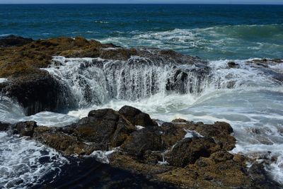
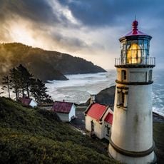
Thor's Well, Natural pit at Cape Perpetua, Oregon, US.

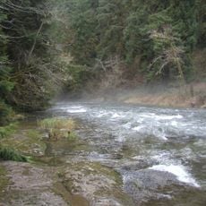
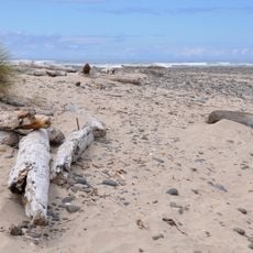
A circular depression in basalt rock connects to subterranean passages where seawater flows according to tidal cycles. The formation sits within the intertidal zone where waves meet porous volcanic bedrock. During incoming swells, water fills the opening and drains back through vertical channels, creating temporary fountains when conditions align with higher tides and strong Pacific currents.

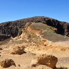
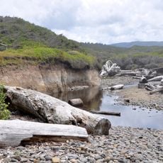
Wave action carved a sea cave into the basalt coastline over many centuries. The roof eventually collapsed, leaving the vertical opening visible today. Geological surveys conducted in the latter half of the twentieth century documented ongoing changes to the structure as coastal erosion continues to reshape this section of the shoreline south of Yachats.

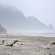
Naturalists and coastal researchers frequent this section of the Oregon shoreline to study tidal dynamics and erosion patterns. The formation serves as an educational example of marine geology for regional institutions. During periods of strong surf, observers witness powerful water columns that highlight the force of coastal processes at work along this stretch of coastline.

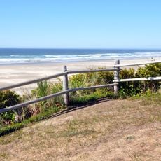
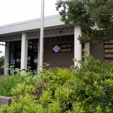
Access from the Cape Perpetua Visitor Center parking area along Highway 101 via a paved trail leads to viewing spots. Arrival one hour before to one hour after high tide offers the most activity. Stepping onto rocks near the opening is dangerous due to unpredictable waves that can sweep individuals into the ocean without warning.

Timing between incoming waves and drainage through underground passages creates water columns that occasionally shoot up to 20 feet (6 m) above the surrounding rock surface. These brief eruptions occur irregularly depending on wave height, tidal stage, and wind direction, making each visit yield different displays of force and volume.

Location: Oregon

GPS coordinates: 44.27842,-124.11352

Latest update: November 27, 2025 21:02

Geological formations: rock structures, caves, thermal springs

This collection presents geological formations created through natural processes over millions of years. From layered sandstone waves in Arizona to volcanic basalt columns in Northern Ireland, these locations demonstrate Earth's geological diversity. Erosion, tectonic activity, and mineral deposits have shaped landscapes that provide insights into our planet's history. The selection includes limestone caves in New Zealand with glowworms, thermal springs in Turkey with travertine terraces, and colored rock formations in China created by iron-rich minerals. Visitors will find glacier caves in Iceland, canyons in Utah, and salt pans in Namibia. Each location documents specific geological processes and offers opportunities to explore different rock formations and natural phenomena.

Unusual places around the world: abandoned sites, mysterious locations, natural phenomena

This collection brings together locations that challenge the norms of conventional tourism. It offers the chance to discover places where nature, history, and human activities have created astonishing sites: a complex of 732 unfinished villas in Turkey, a Mexican island where hundreds of dolls are hung in trees, a Canadian lake with mineral-formed multicolored basins, and a Polish forest of 400 pines with mysteriously bent trunks facing north. The route also includes unique human-made creations, such as an art installation representing an isolated Prada store in the Texas desert, or the Japanese village of Nagoro where an artist populated the streets with 350 dolls after the residents left. Geological phenomena are also featured, including Darvaza crater in Turkmenistan, which has been burning continuously since 1971, the Great Blue Hole in Belize, a 124-meter-deep underwater cavity, and Colombia’s Caño Cristales river that changes color to red, yellow, and green from July to November. These destinations provide a different perspective on our planet and invite exploration of lesser-known facets of our world.

Around this place
Show the full map
Heceta Head Light
United States of America

Heceta Head Light

15.7 km
Oregon Coast Trail
United States of America

Oregon Coast Trail

12.6 km
Devils Churn
United States of America

Devils Churn

697 m
Alsea Bay Bridge
United States of America

Alsea Bay Bridge

17.4 km
Drift Creek Wilderness
United States of America

Drift Creek Wilderness

25.3 km
Cleft of the Rock Light
United States of America

Cleft of the Rock Light

1.4 km
Cummins Creek Wilderness
United States of America

Cummins Creek Wilderness

6.4 km
Rock Creek Wilderness
United States of America

Rock Creek Wilderness

11.8 km
Carl G. Washburne Memorial State Park
United States of America

Carl G. Washburne Memorial State Park

13.4 km
Cape Creek Bridge
United States of America

Cape Creek Bridge

16.1 km
Driftwood Beach State Recreation Site
United States of America

Driftwood Beach State Recreation Site

20.8 km
Heceta Head Lighthouse
United States of America

Heceta Head Lighthouse

16 km
Beachside State Recreation Site
United States of America

Beachside State Recreation Site

11.6 km
Neptune State Scenic Viewpoint
United States of America

Neptune State Scenic Viewpoint

2 km
Seal Rock State Recreation Site
United States of America

Seal Rock State Recreation Site

24.5 km
Alsea Bay Historic Interpretive Center
United States of America

Alsea Bay Historic Interpretive Center

17 km
Yachats State Recreation Area
United States of America

Yachats State Recreation Area

3.7 km
Muriel O. Ponsler Memorial State Scenic Viewpoint
United States of America

Muriel O. Ponsler Memorial State Scenic Viewpoint

12 km
Smelt Sands State Recreation Site
United States of America

Smelt Sands State Recreation Site

4.9 km
Yachats Ocean Road State Natural Site
United States of America

Yachats Ocean Road State Natural Site

3.2 km
Stonefield Beach State Recreation Site
United States of America

Stonefield Beach State Recreation Site

6 km
Tokatee Klootchman State Natural Site
United States of America

Tokatee Klootchman State Natural Site

7.8 km
W. B. Nelson State Recreation Site
United States of America

W. B. Nelson State Recreation Site

16.4 km
Big Creek Bridge
United States of America

Big Creek Bridge

11.6 km
Governor Patterson Memorial State Recreation Site
United States of America

Governor Patterson Memorial State Recreation Site

15.3 km
Ten Mile Creek Bridge
United States of America

Ten Mile Creek Bridge

6.1 km
North Fork of the Yachats Bridge
United States of America

North Fork of the Yachats Bridge

12 km
Fisher School Bridge
United States of America

Fisher School Bridge

21.8 km
Show the full map

Reviews

Visited this place? Tap the stars to rate it and share your experience / photos with the community! Try now! You can cancel it anytime.

« Thor's Well: Natural pit at Cape Perpetua, Oregon, US » is provided by Around Us (aroundus.com). Images and texts are derived from Wikimedia project under a Creative Commons license. You are allowed to copy, distribute, and modify copies of this page, under the conditions set by the license, as long as this note is clearly visible.

Discover hidden gems everywhere you go!

From secret cafés to breathtaking viewpoints, skip the crowded tourist spots and find places that match your style. Our app makes it easy with voice search, smart filtering, route optimization, and insider tips from travelers worldwide. Download now for the complete mobile experience.

Around Us App Screenshot

A unique approach to discovering new places

Le Figaro

All the places worth exploring

France Info

A tailor-made excursion in just a few clicks

20 Minutes