Yachats State Recreation Area

Log in to your account

AroundUs is a community-driven map of interesting places, built by curious explorers like you. It grows with every review, story, and photo you share.
Connect to save your favorite spots, contribute locations, and create personalized routes.
Continue with Google
Continue with Apple
Continue with X
Continue with Facebook
Continue with email
By continuing, you accept our Terms and Conditions and our Privacy Policy
Create an account
Add to collection
Map
Suggest a change
Share

Yachats State Recreation Area, State recreation area at Pacific coast in Lincoln County, United States.

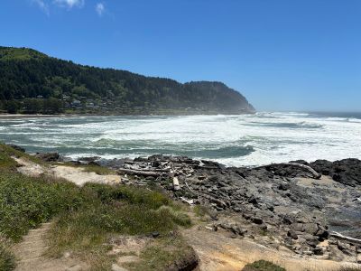
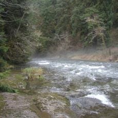
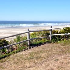
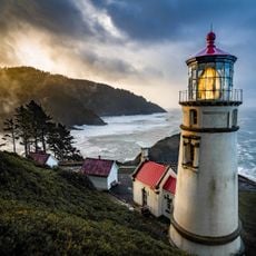
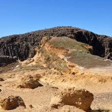
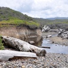
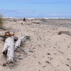
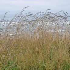
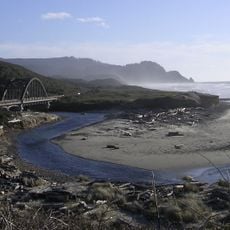
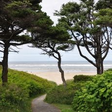
Yachats State Recreation Area sits where the Yachats River meets the Pacific Ocean, featuring rocky shores, tide pools and varied marine environments. The coastal landscape creates different habitats for plants and sea life.

The recreation area developed through several land purchases from private owners and donations from Lincoln County between 1928 and 1986. These gradual additions created the park as it exists today.

The name comes from an indigenous language referring to a location at the mountain base, showing the original connection between this land and the people who first lived here. That link remains woven into how the place appears and feels today.

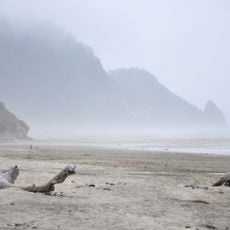
The tide pools are best explored during low tide, and you may see migrating whales passing by during certain times. The grounds include picnic tables and fishing spots scattered throughout.

The shoreline contains important fish spawning grounds with special sand formations along the water's edge. These natural features play a key role in supporting local marine species.

Location: Lincoln County

Address: Yachats State Park, 429 W 1st St, Yachats, OR 97498, USA

Phone: +(800)5516949

Website: https://stateparks.oregon.gov/index.cfm?do=park.profile&parkId=94

GPS coordinates: 44.31120,-124.10900

Latest update: December 14, 2025 09:47

Photos
Around this place
Heceta Head Light
United States of America

Heceta Head Light

19.4 km
Devils Churn
United States of America

Devils Churn

3 km
Alsea Bay Bridge
United States of America

Alsea Bay Bridge

13.8 km
Drift Creek Wilderness
United States of America

Drift Creek Wilderness

22.2 km
Cleft of the Rock Light
United States of America

Cleft of the Rock Light

2.3 km
Cummins Creek Wilderness
United States of America

Cummins Creek Wilderness

8.5 km
Rock Creek Wilderness
United States of America

Rock Creek Wilderness

15.2 km
Carl G. Washburne Memorial State Park
United States of America

Carl G. Washburne Memorial State Park

17 km
Cape Creek Bridge
United States of America

Cape Creek Bridge

19.8 km
Driftwood Beach State Recreation Site
United States of America

Driftwood Beach State Recreation Site

17.1 km
Heceta Head Lighthouse
United States of America

Heceta Head Lighthouse

19.6 km
Beachside State Recreation Site
United States of America

Beachside State Recreation Site

8 km
Neptune State Scenic Viewpoint
United States of America

Neptune State Scenic Viewpoint

5.6 km
Seal Rock State Recreation Site
United States of America

Seal Rock State Recreation Site

20.8 km
Alsea Bay Historic Interpretive Center
United States of America

Alsea Bay Historic Interpretive Center

13.4 km
Muriel O. Ponsler Memorial State Scenic Viewpoint
United States of America

Muriel O. Ponsler Memorial State Scenic Viewpoint

15.6 km
Smelt Sands State Recreation Site
United States of America

Smelt Sands State Recreation Site

1.2 km
Yachats Ocean Road State Natural Site
United States of America

Yachats Ocean Road State Natural Site

641 m
Stonefield Beach State Recreation Site
United States of America

Stonefield Beach State Recreation Site

9.6 km
Tokatee Klootchman State Natural Site
United States of America

Tokatee Klootchman State Natural Site

11.5 km
W. B. Nelson State Recreation Site
United States of America

W. B. Nelson State Recreation Site

12.9 km
Big Creek Bridge
United States of America

Big Creek Bridge

15.2 km
Governor Patterson Memorial State Recreation Site
United States of America

Governor Patterson Memorial State Recreation Site

11.6 km
Ten Mile Creek Bridge
United States of America

Ten Mile Creek Bridge

9.7 km
North Fork of the Yachats Bridge
United States of America

North Fork of the Yachats Bridge

11.1 km
Fisher School Bridge
United States of America

Fisher School Bridge

21.4 km
Thor's Well
United States of America

Thor's Well

3.7 km
Cape Perpetua Shelter and Parapet
United States of America

Cape Perpetua Shelter and Parapet

2.6 km
Show the full map
Reviews

Visited this place? Tap the stars to rate it and share your experience / photos with the community! Try now! You can cancel it anytime.

« Yachats State Recreation Area - State recreation area at Pacific coast in Lincoln County, United States » is provided by Around Us (aroundus.com). Images and texts are derived from Wikimedia project under a Creative Commons license. You are allowed to copy, distribute, and modify copies of this page, under the conditions set by the license, as long as this note is clearly visible.

Discover hidden gems everywhere you go!

From secret cafés to breathtaking viewpoints, skip the crowded tourist spots and find places that match your style. Our app makes it easy with voice search, smart filtering, route optimization, and insider tips from travelers worldwide. Download now for the complete mobile experience.

Around Us App Screenshot

A unique approach to discovering new places

Le Figaro

All the places worth exploring

France Info

A tailor-made excursion in just a few clicks

20 Minutes