Madras

Log in to your account

AroundUs is a community-driven map of interesting places, built by curious explorers like you. It grows with every review, story, and photo you share.
Connect to save your favorite spots, contribute locations, and create personalized routes.
By continuing, you accept our Terms and Conditions and our Privacy Policy
Add to collection
Map
Suggest a change
Share

Madras, County seat in Central Oregon, United States.

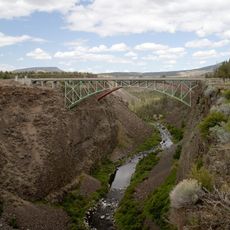
Madras is a county seat in central Oregon resting in a circular valley at 683 meters elevation surrounded by high desert landscape. The terrain extends between farmland to the north and commercial districts to the south, while the Cascade range defines the western horizon.

John A. Palmehn founded the settlement in 1902 under a different name, but the postal service rejected the original designation and assigned the current one. Railroad connection in the early 20th century transformed the location into a regional hub for grain and livestock from Jefferson County.

The July agricultural fair brings ranchers and fruit growers from across the high desert plateau and displays traditional crafts alongside modern cultivation methods. Visitors watch livestock competitions and sample regional specialties at stands along the fairground lanes.

The municipal airfield southeast of town sits roughly a 15-minute drive from the center and receives regular charter flights during fire season. Most visitors reach the town via overland routes connecting from the Columbia River to the north and from central Oregon regions.

In August 2017, roughly 100,000 people flocked to town to witness the total solar eclipse directly within the path of complete darkness. Hotels and campsites booked months in advance, while many visitors slept in public parking lots and on sports fields.

Location: Jefferson County

Inception: 1911

Elevation above the sea: 683 m

Address: Madras, OR 97741, USA

Website: http://ci.madras.or.us

GPS coordinates: 44.63345,-121.12949

Latest update: December 5, 2025 16:35

Around this place
Show the full map
Smith Rock State Park
United States of America

Smith Rock State Park

29.4 km
Lake Billy Chinook
United States of America

Lake Billy Chinook

19.3 km
The Cove Palisades State Park
United States of America

The Cove Palisades State Park

12.1 km
Petersen Rock Garden
United States of America

Petersen Rock Garden

49 km
Cline Falls State Scenic Viewpoint
United States of America

Cline Falls State Scenic Viewpoint

41.8 km
Crooked River High Bridge
United States of America

Crooked River High Bridge

27.4 km
Peter Skene Ogden State Scenic Viewpoint
United States of America

Peter Skene Ogden State Scenic Viewpoint

27.4 km
Crooked River Railroad Bridge
United States of America

Crooked River Railroad Bridge

27.5 km
Pelton Dam
United States of America

Pelton Dam

10.5 km
Crooked River Gorge
United States of America

Crooked River Gorge

25.4 km
Rex T. Barber Veterans Memorial Bridge
United States of America

Rex T. Barber Veterans Memorial Bridge

27.2 km
Ochoco State Scenic Viewpoint
United States of America

Ochoco State Scenic Viewpoint

42.5 km
Milton Odem House
United States of America

Milton Odem House

40.5 km
The Museum at Warm Springs
United States of America

The Museum at Warm Springs

17.3 km
First Presbyterian Church of Redmond
United States of America

First Presbyterian Church of Redmond

40.1 km
Grizzly Mountain
United States of America

Grizzly Mountain

25.7 km
Crook County Courthouse
United States of America

Crook County Courthouse

43.3 km
A. R. Bowman Memorial Museum
United States of America

A. R. Bowman Memorial Museum

43.1 km
Camp Sherman Community Hall
United States of America

Camp Sherman Community Hall

46.6 km
Thomas M. Baldwin House
United States of America

Thomas M. Baldwin House

43.3 km
Old First National Bank of Prineville
United States of America

Old First National Bank of Prineville

43.1 km
Crook County Bank Building
United States of America

Crook County Bank Building

43.1 km
Marion Reed Elliott House
United States of America

Marion Reed Elliott House

43.2 km
Lamonta Compound
United States of America

Lamonta Compound

42.1 km
Max and Ollie Lueddemann House
United States of America

Max and Ollie Lueddemann House

415 m
Pine Theater
United States of America

Pine Theater

43.2 km
Pilot Butte Canal Downtown Redmond Segment
United States of America

Pilot Butte Canal Downtown Redmond Segment

38.5 km
Stein's Pillar
United States of America

Stein's Pillar

47.4 km
Show the full map

Reviews

Visited this place? Tap the stars to rate it and share your experience / photos with the community! Try now! You can cancel it anytime.

« Madras - County seat in Central Oregon, United States » is provided by Around Us (aroundus.com). Images and texts are derived from Wikimedia project under a Creative Commons license. You are allowed to copy, distribute, and modify copies of this page, under the conditions set by the license, as long as this note is clearly visible.

Discover hidden gems everywhere you go!

From secret cafés to breathtaking viewpoints, skip the crowded tourist spots and find places that match your style. Our app makes it easy with voice search, smart filtering, route optimization, and insider tips from travelers worldwide. Download now for the complete mobile experience.

Around Us App Screenshot

A unique approach to discovering new places

Le Figaro

All the places worth exploring

France Info

A tailor-made excursion in just a few clicks

20 Minutes