Eagle Peak

Log in to your account

AroundUs is a community-driven map of interesting places, built by curious explorers like you. It grows with every review, story, and photo you share.
Connect to save your favorite spots, contribute locations, and create personalized routes.
By continuing, you accept our Terms and Conditions and our Privacy Policy
Add to collection
Map
Suggest a change
Share

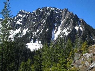
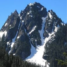
Eagle Peak, Mountain summit in Lewis County, Washington, United States.

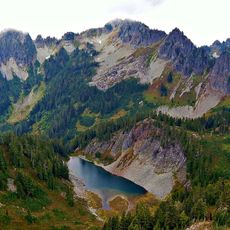
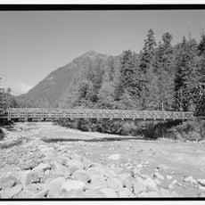
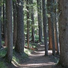
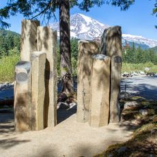
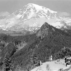
Eagle Peak is a mountain summit located in Mount Rainier National Park that rises above thick coniferous forests and opens into alpine meadows. The landscape changes significantly as hikers climb higher, moving from dense woodland into more open terrain.

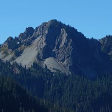
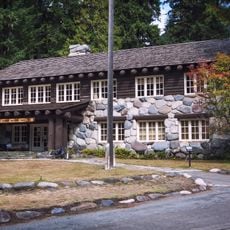
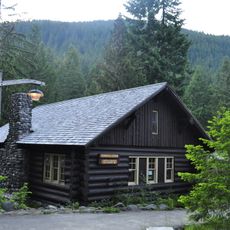
The summit was named by early settlers who borrowed the term from Native American languages to describe the mountain. Exploration and development of trails in this area became part of the park's early infrastructure during the 1900s.

The mountain received its current name from settler George Longmire, who adapted it from the Native American term Sim-layshe, meaning eagle.

The hike demands good physical fitness and proper mountain gear for steep terrain. Visitors should prepare for changing weather and start early to have enough daylight for the entire route.

Wild strawberries grow along the trail during late summer months and can be spotted by hikers. The summit offers views of several neighboring peaks in the Cascade Range that create a memorable panorama.

Location: Washington

Location: Lewis County

GPS coordinates: 46.75570,-121.77920

Latest update: December 14, 2025 20:30

Photos
Around this place
Christine Falls
United States of America

Christine Falls

2.8 km
Christine Falls Bridge
United States of America

Christine Falls Bridge

2.8 km
Longmire Buildings
United States of America

Longmire Buildings

2.6 km
Plummer Peak
United States of America

Plummer Peak

3 km
Lane Peak
United States of America

Lane Peak

2 km
Chutla Peak
United States of America

Chutla Peak

480 m
Denman Peak
United States of America

Denman Peak

2.7 km
Wahpenayo Peak
United States of America

Wahpenayo Peak

1.3 km
Longmire Service Station
United States of America

Longmire Service Station

2.7 km
Longmire Administration Building
United States of America

Longmire Administration Building

2.6 km
National Park Inn
United States of America

National Park Inn

2.7 km
Longmire Suspension Bridge
United States of America

Longmire Suspension Bridge

2.3 km
Longmire Campground Comfort Station No. L-302
United States of America

Longmire Campground Comfort Station No. L-302

2.7 km
Longmire Campground Comfort Station No. L-303
United States of America

Longmire Campground Comfort Station No. L-303

2.7 km
Longmire Museum
United States of America

Longmire Museum

2.6 km
Longmire Historic District
United States of America

Longmire Historic District

2.7 km
Longmire Community Building
United States of America

Longmire Community Building

2.6 km
Longmire General Store
United States of America

Longmire General Store

2.7 km
Longmire Library
United States of America

Longmire Library

2.6 km
Rampart Ridge Trail
United States of America

Rampart Ridge Trail

2.9 km
Cougar Rock Campground
United States of America

Cougar Rock Campground

1.7 km
Longmire Oil House
United States of America

Longmire Oil House

2.5 km
Mount Rainier National Park Valor Memorial
United States of America

Mount Rainier National Park Valor Memorial

2.6 km
Longmire Warehouse Building‎
United States of America

Longmire Warehouse Building‎

2.5 km
Mather Plaque in Longmire
United States of America

Mather Plaque in Longmire

2.6 km
Longmire Comfort Station
United States of America

Longmire Comfort Station

2.6 km
Ricksecker Point
United States of America

Ricksecker Point

1.6 km
Nisqually Glacier Bridge
United States of America

Nisqually Glacier Bridge

3.2 km
Show the full map
Reviews

Visited this place? Tap the stars to rate it and share your experience / photos with the community! Try now! You can cancel it anytime.

« Eagle Peak - Mountain summit in Lewis County, Washington, United States » is provided by Around Us (aroundus.com). Images and texts are derived from Wikimedia project under a Creative Commons license. You are allowed to copy, distribute, and modify copies of this page, under the conditions set by the license, as long as this note is clearly visible.

Discover hidden gems everywhere you go!

From secret cafés to breathtaking viewpoints, skip the crowded tourist spots and find places that match your style. Our app makes it easy with voice search, smart filtering, route optimization, and insider tips from travelers worldwide. Download now for the complete mobile experience.

Around Us App Screenshot

A unique approach to discovering new places

Le Figaro

All the places worth exploring

France Info

A tailor-made excursion in just a few clicks

20 Minutes