Chest opened
+${chestReward.xp} XP
Explorer
NOUVEAU ×${chestReward.collectible.quantity}
tapez pour fermer
Chest locked

Open chests in the app

Around Us is built for your phone — chests unlock when you walk, explore and capture nearby places.

Enable Location

We need your location to show you interesting places around you

Discover nearby places

Find interesting locations and hidden gems around you

Precise directions

Get accurate directions and distances to places

Your location is never shared with other users. It's only used when you tap the location button.

Quileute Indian Reservation

Log in to your account

Start exploring — it's free

Trusted by 72,983 travelers worldwide

Continue with Google
Continue with Apple
or

We will send you a code to connect

By continuing, you accept our Terms and Conditions and our Privacy Policy

Check your inbox

We've sent a pincode in your inbox. Please enter the code below.

Quileute Indian Reservation
Discussion Reviews 1 Photos
8.6k Popularity

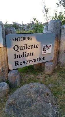
Quileute Indian Reservation, Native American reservation in La Push, Washington, United States

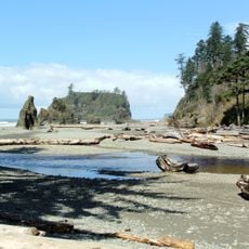
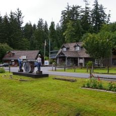
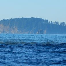
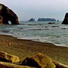
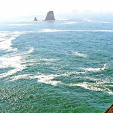
Quileute Indian Reservation is a tribal land at the mouth of the Quillayute River on Washington's Pacific coast. The settlement sits directly on the shore and includes homes, a resort facility, and spaces dedicated to fishing and community activities.

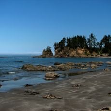
The reservation was established in 1889 through an executive order from President Cleveland, following the Quinault Treaty of 1855 that set the framework for tribal territories. In the 2010s, the community relocated its buildings inland to protect against tsunami risk.

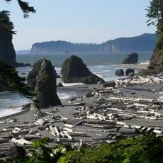
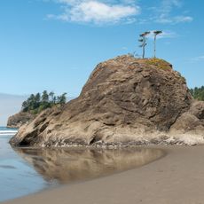
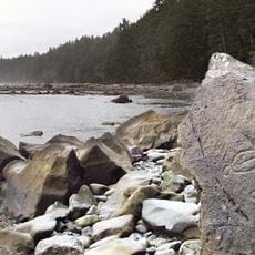
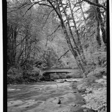
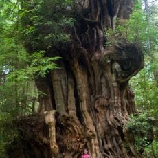
The Quileute speak a language found nowhere else, passed down through generations despite facing extinction, and the community continues basketweaving and canoe building as tangible expressions of heritage. Daily life here centers on the ocean and its cycles, shaping how residents and visitors interact with the place.

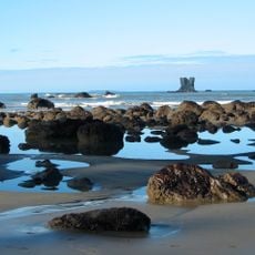
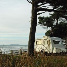
The resort provides lodging options on site, and visitors can fish, watch whales, or surf in the surrounding waters. Plan visits during calmer weather periods, and prepare for wet conditions and strong coastal winds typical of the region.

The area received additional land from Olympic National Park in 2012, allowing the community to move its structures away from the vulnerable coast. This transfer marked an important moment for tribal self-determination and safety against natural hazards.

The community of curious travelers

AroundUs brings together thousands of curated places, local tips, and hidden gems, enriched daily by 60,000 contributors worldwide.

Start exploring
Location
GPS coordinates
47.90440,-124.62324
Latest update
December 10, 2025 16:01
Around this place
Ruby Beach
United States of America

Ruby Beach

26.6 km
La Push Beach
United States of America

La Push Beach

1.3 km
Olympic Coast National Marine Sanctuary
United States of America

Olympic Coast National Marine Sanctuary

15.9 km
Destruction Island Lighthouse
United States of America

Destruction Island Lighthouse

27.6 km
Bogachiel State Park
United States of America

Bogachiel State Park

19.7 km
Quillayute Needles National Wildlife Refuge
United States of America

Quillayute Needles National Wildlife Refuge

11.6 km
Flattery Rocks National Wildlife Refuge
United States of America

Flattery Rocks National Wildlife Refuge

31.1 km
Slip Point Light
United States of America

Slip Point Light

48.7 km
Peter Roose Homestead
United States of America

Peter Roose Homestead

29.3 km
Kloshe Nanitch Lookout
United States of America

Kloshe Nanitch Lookout

45.1 km
Forks Timber Museum
United States of America

Forks Timber Museum

17.5 km
Forks Timber Museum
United States of America

Forks Timber Museum

17.5 km
Point of Arches
United States of America

Point of Arches

38.5 km
Wedding Rock Petroglyphs
United States of America

Wedding Rock Petroglyphs

28.1 km
Sunset Lanes
United States of America

Sunset Lanes

18.5 km
Pacific coastal area of Olympic National Park
United States of America

Pacific coastal area of Olympic National Park

4.1 km
Beach 1
United States of America

Beach 1

41.7 km
Hobuck Beach
United States of America

Hobuck Beach

48.4 km
Forks Loggers Memorial
United States of America

Forks Loggers Memorial

17.5 km
Sol Duc River Bridge
United States of America

Sol Duc River Bridge

31.2 km
Middle Rock
United States of America

Middle Rock

21.7 km
Kalaloch Campground
United States of America

Kalaloch Campground

37.4 km
Hoh Head
United States of America

Hoh Head

18.7 km
Hole-in-the-Wall
United States of America

Hole-in-the-Wall

4.6 km
Forks Visitor Information Center
United States of America

Forks Visitor Information Center

17.5 km
Yellow Banks
United States of America

Yellow Banks

21.8 km
Big Cedar Tree
United States of America

Big Cedar Tree

30.8 km
Father and Son
United States of America

Father and Son

36.4 km
Show the full map
Reviews
Share your experience

No review yet

Discussions
Start a discussion...

No discussion yet

« Quileute Indian Reservation - Native American reservation in La Push, Washington, United States » is provided by Around Us (aroundus.com). Images and texts are derived from Wikimedia project under a Creative Commons license. You are allowed to copy, distribute, and modify copies of this page, under the conditions set by the license, as long as this note is clearly visible.

Discover hidden gems everywhere you go!

From secret cafés to breathtaking viewpoints, skip the crowded tourist spots and find places that match your style. Our app makes it easy with voice search, smart filtering, route optimization, and insider tips from travelers worldwide. Download now for the complete mobile experience.

Around Us App Screenshot

A unique approach to discovering new places

Le Figaro

All the places worth exploring

France Info

A tailor-made excursion in just a few clicks

20 Minutes

Around Us
Travel Guide & Maps
Download

Send to your phone

QR Code
1

Open the camera app on your mobile.

2

Point at the QR code with your camera. A notification will appear.

3

Tap the notification to open the link.