Enable Location

We need your location to show you interesting places around you

Discover nearby places

Find interesting locations and hidden gems around you

Precise directions

Get accurate directions and distances to places

Your location is never shared with other users. It's only used when you tap the location button.

Quillayute Needles National Wildlife Refuge

Log in to your account

Start exploring — it's free

Trusted by 62,374 travelers worldwide

Continue with Google
Continue with Apple
or

We will send you a code to connect

By continuing, you accept our Terms and Conditions and our Privacy Policy

Check your inbox

We've sent a pincode in your inbox. Please enter the code below.

Quillayute Needles National Wildlife Refuge

Quillayute Needles National Wildlife Refuge, Marine wildlife sanctuary along Washington coast, US.

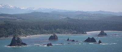
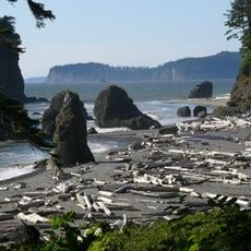
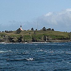
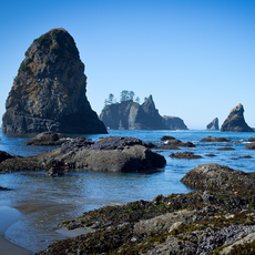
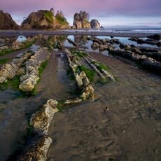
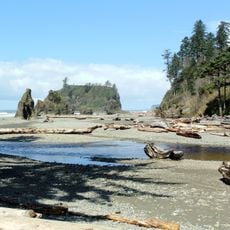
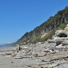
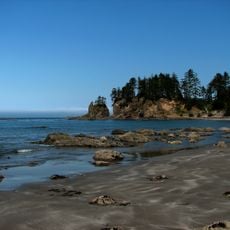
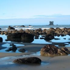
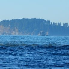
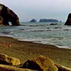
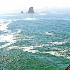
Quillayute Needles National Wildlife Refuge is a marine sanctuary along Washington's coast comprising around 800 offshore rocks, reefs, and islands spread across roughly 100 miles from Cape Flattery to Copalis Beach. The refuge protects a rugged coastal landscape where rocky formations serve as critical habitats for seabirds and marine mammals.

President Theodore Roosevelt established this refuge in 1907, making it one of the nation's earliest protections for seabird breeding grounds. This decision reflected growing recognition of the need to safeguard these critical nesting sites.

The refuge honors the territories of the Quileute and other Indigenous communities whose connection to this coastline spans generations. Local tribes continue to hold deep cultural ties to these waters and islands.

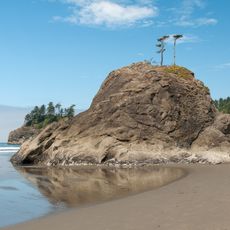
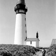
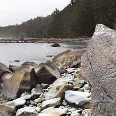
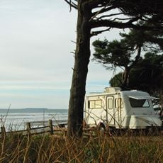
The refuge itself is closed to public access, but visitors can observe the islands and wildlife from several designated coastal viewpoints scattered along the shore. These locations offer good views of the rocks and animals without disturbing nesting areas.

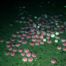
The refuge supports over 70 percent of Washington state's seabird nesting sites in a single location. Tufted puffins burrow into cliff faces while common murres perch on narrow rock ledges to lay their eggs.

The community of curious travelers

AroundUs brings together thousands of curated places, local tips, and hidden gems, enriched daily by 60,000 contributors worldwide.

Start exploring
Location
GPS coordinates
47.99705,-124.69538
Latest update
December 12, 2025 17:43
Around this place
Ruby Beach
United States of America

Ruby Beach

38.1 km
La Push Beach
United States of America

La Push Beach

10.7 km
Hall of Mosses Trail
United States of America

Hall of Mosses Trail

59.2 km
Olympic Coast National Marine Sanctuary
United States of America

Olympic Coast National Marine Sanctuary

21.2 km
Destruction Island Lighthouse
United States of America

Destruction Island Lighthouse

39.2 km
Bogachiel State Park
United States of America

Bogachiel State Park

27.3 km
Flattery Rocks National Wildlife Refuge
United States of America

Flattery Rocks National Wildlife Refuge

19.9 km
Copalis National Wildlife Refuge
United States of America

Copalis National Wildlife Refuge

71.9 km
Peter Roose Homestead
United States of America

Peter Roose Homestead

18.3 km
Kloshe Nanitch Lookout
United States of America

Kloshe Nanitch Lookout

46.8 km
Forks Timber Museum
United States of America

Forks Timber Museum

23.4 km
Forks Timber Museum
United States of America

Forks Timber Museum

23.4 km
Point of Arches
United States of America

Point of Arches

27.8 km
Wedding Rock Petroglyphs
United States of America

Wedding Rock Petroglyphs

17 km
Pacific coastal area of Olympic National Park
United States of America

Pacific coastal area of Olympic National Park

15.5 km
Hoh Rain Forest Visitor Center
United States of America

Hoh Rain Forest Visitor Center

58.7 km
Beach 1
United States of America

Beach 1

53.3 km
Forks Loggers Memorial
United States of America

Forks Loggers Memorial

23.5 km
Sol Duc River Bridge
United States of America

Sol Duc River Bridge

31.6 km
Yellow Banks
United States of America

Yellow Banks

11 km
Kalaloch Campground
United States of America

Kalaloch Campground

49 km
Forks Visitor Information Center
United States of America

Forks Visitor Information Center

23.5 km
Middle Rock
United States of America

Middle Rock

33.3 km
Hoh Head
United States of America

Hoh Head

30.2 km
Hole-in-the-Wall
United States of America

Hole-in-the-Wall

7 km
Father and Son
United States of America

Father and Son

25.5 km
Big Cedar Tree
United States of America

Big Cedar Tree

42.4 km
Hoh Campground
United States of America

Hoh Campground

58.8 km
Show the full map
« Quillayute Needles National Wildlife Refuge - Marine wildlife sanctuary along Washington coast, US » is provided by Around Us (aroundus.com). Images and texts are derived from Wikimedia project under a Creative Commons license. You are allowed to copy, distribute, and modify copies of this page, under the conditions set by the license, as long as this note is clearly visible.

Discover hidden gems everywhere you go!

From secret cafés to breathtaking viewpoints, skip the crowded tourist spots and find places that match your style. Our app makes it easy with voice search, smart filtering, route optimization, and insider tips from travelers worldwide. Download now for the complete mobile experience.

Around Us App Screenshot

A unique approach to discovering new places

Le Figaro

All the places worth exploring

France Info

A tailor-made excursion in just a few clicks

20 Minutes

Around Us
Travel Guide & Maps
Download

Send to your phone

QR Code
1

Open the camera app on your mobile.

2

Point at the QR code with your camera. A notification will appear.

3

Tap the notification to open the link.