Olympic Coast National Marine Sanctuary

Log in to your account

AroundUs is a community-driven map of interesting places, built by curious explorers like you. It grows with every review, story, and photo you share.
Connect to save your favorite spots, contribute locations, and create personalized routes.
Continue with Google
Continue with Apple
Continue with X
Continue with Facebook
Continue with email
By continuing, you accept our Terms and Conditions and our Privacy Policy
Create an account

Olympic Coast National Marine Sanctuary

Add to collection
Map
Suggest a change
Share

Olympic Coast National Marine Sanctuary, Marine sanctuary along Olympic Peninsula, Washington, US

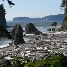
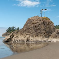
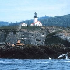
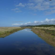
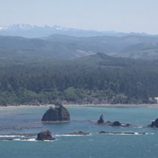
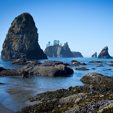
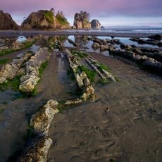
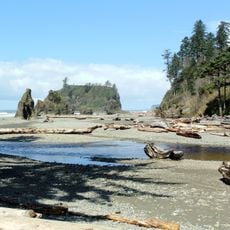
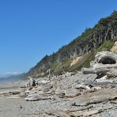
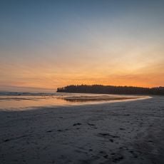
The Olympic Coast National Marine Sanctuary stretches roughly 160 miles along the Pacific Ocean and protects a vast expanse of ocean waters with underwater canyons and diverse marine habitats. The sanctuary extends far offshore from Washington's Olympic Peninsula and encompasses multiple distinct zones of ocean life.

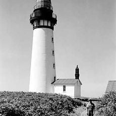
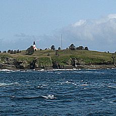
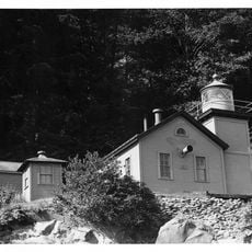
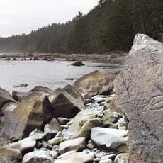
The sanctuary was established in 1994 to protect these ocean waters and recognize the maritime history along this coast, where ships have been lost over many decades. The area has long served as a major shipping route with a complicated past.

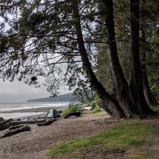
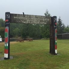
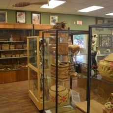
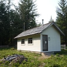
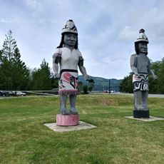
Four Native American tribes - Hoh, Makah, Quileute, and Quinault - work together with authorities to manage the waters and continue their traditional practices of fishing and harvesting. You can see evidence of these traditions in how local communities interact with the coast.

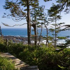
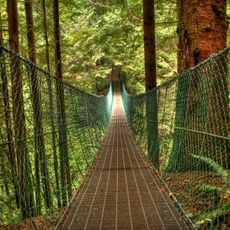
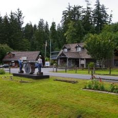
The sanctuary offers opportunities for fishing, shellfish gathering, diving, kayaking, and wildlife watching, though each activity has specific conditions to consider. Plan your visit with flexibility, as ocean conditions can change significantly with weather and seasons.

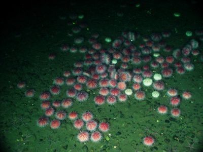
The sanctuary is home to around 30 species of marine mammals, including humpback whales, seals, and sea otters, making it one of the most diverse marine mammal habitats on the coast. These animals are regularly visible to visitors, offering frequent chances to observe large marine creatures in their natural setting.

Operator: National Oceanic and Atmospheric Administration

Website: https://olympiccoast.noaa.gov

GPS coordinates: 47.81742,-124.79134

Latest update: December 11, 2025 11:02

Photos
Around this place
Ruby Beach
United States of America

Ruby Beach

30.5 km
Juan de Fuca Marine Trail
Canada

Juan de Fuca Marine Trail

83.3 km
La Push Beach
United States of America

La Push Beach

15.2 km
Cape Flattery Light
United States of America

Cape Flattery Light

64.1 km
Juan de Fuca Provincial Park
Canada

Juan de Fuca Provincial Park

83.3 km
Sombrio Beach
Canada

Sombrio Beach

84.2 km
Destruction Island Lighthouse
United States of America

Destruction Island Lighthouse

27.8 km
Bogachiel State Park
United States of America

Bogachiel State Park

33.4 km
Pacific Beach State Park
United States of America

Pacific Beach State Park

81.2 km
Quillayute Needles National Wildlife Refuge
United States of America

Quillayute Needles National Wildlife Refuge

21.2 km
Flattery Rocks National Wildlife Refuge
United States of America

Flattery Rocks National Wildlife Refuge

40 km
Makah Museum
United States of America

Makah Museum

63 km
Chow Chow Bridge
United States of America

Chow Chow Bridge

68.5 km
Quinault Cultural Center and Museum
United States of America

Quinault Cultural Center and Museum

65.1 km
Copalis National Wildlife Refuge
United States of America

Copalis National Wildlife Refuge

57.9 km
Slip Point Light
United States of America

Slip Point Light

64 km
Peter Roose Homestead
United States of America

Peter Roose Homestead

38.8 km
Forks Timber Museum
United States of America

Forks Timber Museum

32.5 km
Forks Timber Museum
United States of America

Forks Timber Museum

32.5 km
Point of Arches
United States of America

Point of Arches

48.2 km
Makah Cultural & Research Center Museum
United States of America

Makah Cultural & Research Center Museum

63 km
Wedding Rock Petroglyphs
United States of America

Wedding Rock Petroglyphs

37.2 km
Pacific coastal area of Olympic National Park
United States of America

Pacific coastal area of Olympic National Park

17.3 km
Forks Loggers Memorial
United States of America

Forks Loggers Memorial

32.5 km
Beach 1
United States of America

Beach 1

42.1 km
Hobuck Beach
United States of America

Hobuck Beach

58.7 km
Sol Duc River Bridge
United States of America

Sol Duc River Bridge

47.1 km
Sail Rock
United States of America

Sail Rock

63 km
Show the full map
Reviews

Visited this place? Tap the stars to rate it and share your experience / photos with the community! Try now! You can cancel it anytime.

« Olympic Coast National Marine Sanctuary - Marine sanctuary along Olympic Peninsula, Washington, US » is provided by Around Us (aroundus.com). Images and texts are derived from Wikimedia project under a Creative Commons license. You are allowed to copy, distribute, and modify copies of this page, under the conditions set by the license, as long as this note is clearly visible.

Discover hidden gems everywhere you go!

From secret cafés to breathtaking viewpoints, skip the crowded tourist spots and find places that match your style. Our app makes it easy with voice search, smart filtering, route optimization, and insider tips from travelers worldwide. Download now for the complete mobile experience.

Around Us App Screenshot

A unique approach to discovering new places

Le Figaro

All the places worth exploring

France Info

A tailor-made excursion in just a few clicks

20 Minutes