Courtenay River, Brook in Courtenay, Canada
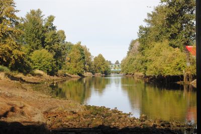
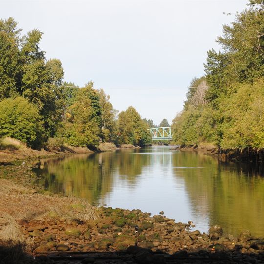
The Courtenay River is a 3 km channel on Vancouver Island, British Columbia, formed at the northern edge of the City of Courtenay where the Puntledge and Tsolum Rivers meet. It flows south-southeast into Comox Harbour, an estuary of the Strait of Georgia. British Columbia Highway 19A and 5th Street cross it, with Lewis Park and Simms Millennium Park on the left bank and Courtenay Marina Park and the city airfield on the right near the mouth.
The name Courtenay River was officially adopted in 1922, taken from an 1865 British Admiralty chart. It honours Captain George William Courtenay of HMS Constance, later a rear admiral in the Royal Navy.
The river's name was officially adopted in 1922, taken from an 1865 British Admiralty chart honouring Captain George William Courtenay of HMS Constance. Today the banks are parkland: Lewis Park and Simms Millennium Park sit on the left bank, and Courtenay Marina Park lies by the mouth.
The river runs 3 km south-southeast from the Puntledge–Tsolum confluence at Courtenay's north edge to Comox Harbour. Highway 19A and 5th Street cross it; Lewis Park and Simms Millennium Park sit on the left bank, Courtenay Marina Park and the airfield on the right of the mouth. Mean discharge is about 51.6 m³/s.
The river is only 3 km long, flowing south-southeast from the Puntledge–Tsolum confluence to Comox Harbour. Its mean discharge is about 51.6 m³/s. Highway 19A and 5th Street cross it, with Lewis Park and Simms Millennium Park on the left bank and Courtenay Marina Park and the city airfield on the right.
The community of curious travelers
AroundUs brings together thousands of curated places, local tips, and hidden gems, enriched daily by 93,772 contributors worldwide.