Enable Location

We need your location to show you interesting places around you

Discover nearby places

Find interesting locations and hidden gems around you

Precise directions

Get accurate directions and distances to places

Your location is never shared with other users. It's only used when you tap the location button.

Mount Carrie

Log in to your account

Start exploring — it's free

Trusted by 62,845 travelers worldwide

Continue with Google
Continue with Apple
or

We will send you a code to connect

By continuing, you accept our Terms and Conditions and our Privacy Policy

Check your inbox

We've sent a pincode in your inbox. Please enter the code below.

Mount Carrie

Mount Carrie, Mountain summit in Clallam County, United States

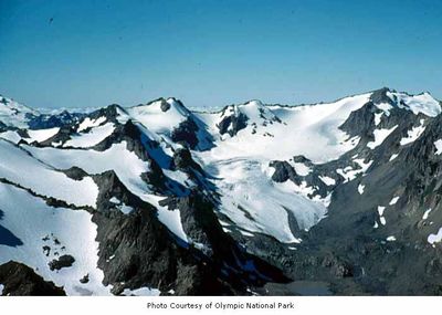
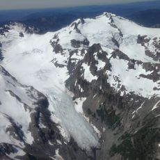
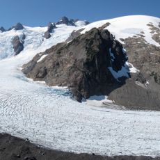
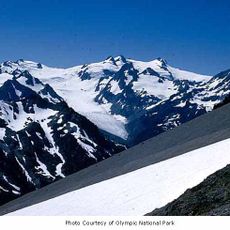
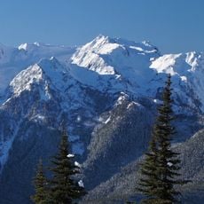
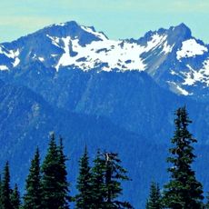
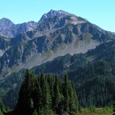
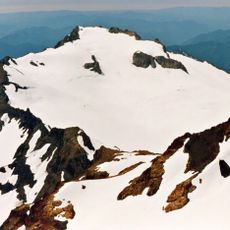
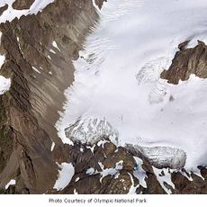
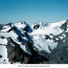
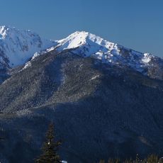
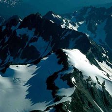
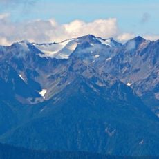
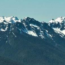
Mount Carrie is a peak in the Bailey Range within Olympic National Park that features rocky ridges and multiple glaciated slopes. The northeast and eastern faces hold permanent ice fields that remain from persistent winter snowfall throughout the year.

Surveyors explored the Olympic Range between 1898 and 1900, naming this peak in 1899 after the wife of one of the cartographers. This naming marked one of the final steps in mapping the remote backcountry of the region.

Theodore Rixon named the mountain after his wife Caroline, who taught music to children and developed artistic talents in painting and singing.

This summit requires advanced mountaineering skills and is accessible only to experienced hikers comfortable with alpine terrain. Visitors should prepare for rapidly changing weather and potential glacier crossing hazards.

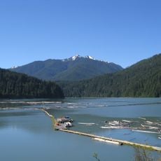
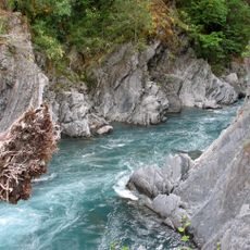
Precipitation from Mount Carrie flows into two major water systems, contributing to both the Elwha River and Hoh River tributaries.

The community of curious travelers

AroundUs brings together thousands of curated places, local tips, and hidden gems, enriched daily by 60,000 contributors worldwide.

Start exploring
Location
Elevation above the sea
2,132 m
GPS coordinates
47.89435,-123.64950
Latest update
December 14, 2025 18:08
« Mount Carrie - Mountain summit in Clallam County, United States » is provided by Around Us (aroundus.com). Images and texts are derived from Wikimedia project under a Creative Commons license. You are allowed to copy, distribute, and modify copies of this page, under the conditions set by the license, as long as this note is clearly visible.

Discover hidden gems everywhere you go!

From secret cafés to breathtaking viewpoints, skip the crowded tourist spots and find places that match your style. Our app makes it easy with voice search, smart filtering, route optimization, and insider tips from travelers worldwide. Download now for the complete mobile experience.

Around Us App Screenshot

A unique approach to discovering new places

Le Figaro

All the places worth exploring

France Info

A tailor-made excursion in just a few clicks

20 Minutes

Around Us
Travel Guide & Maps
Download

Send to your phone

QR Code
1

Open the camera app on your mobile.

2

Point at the QR code with your camera. A notification will appear.

3

Tap the notification to open the link.