Chest opened
+${chestReward.xp} XP
Explorer
NOUVEAU ×${chestReward.collectible.quantity}
tapez pour fermer
Chest locked

Open chests in the app

Around Us is built for your phone — chests unlock when you walk, explore and capture nearby places.

Enable Location

We need your location to show you interesting places around you

Discover nearby places

Find interesting locations and hidden gems around you

Precise directions

Get accurate directions and distances to places

Your location is never shared with other users. It's only used when you tap the location button.

Hurricane Ridge

Log in to your account

Start exploring — it's free

Trusted by 72,887 travelers worldwide

Continue with Google
Continue with Apple
or

We will send you a code to connect

By continuing, you accept our Terms and Conditions and our Privacy Policy

Check your inbox

We've sent a pincode in your inbox. Please enter the code below.

Hurricane Ridge
Discussion Reviews 1 Photos
28.4k Popularity

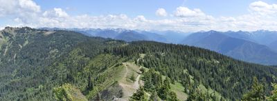
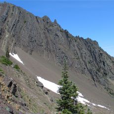
Hurricane Ridge, Mountain ridge in Olympic National Park, Washington, US

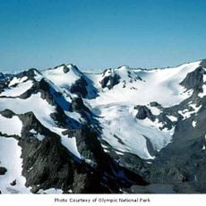
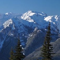
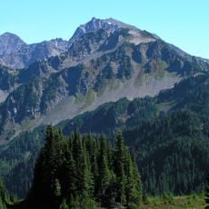
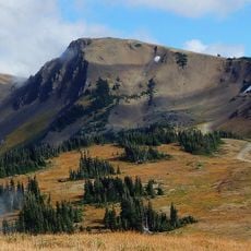
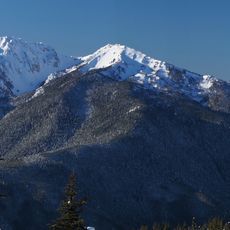
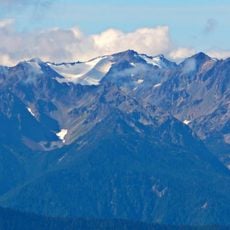
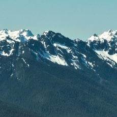
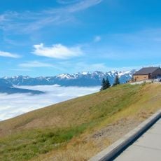
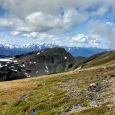
Hurricane Ridge is a mountain ridge in Olympic National Park in Washington that rises to 5,240 feet and offers sweeping views in all directions. From this vantage point, visitors see the Olympic mountain range, the Strait of Juan de Fuca, and distant peaks on clear days.

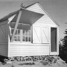
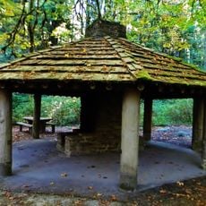
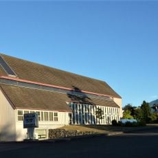
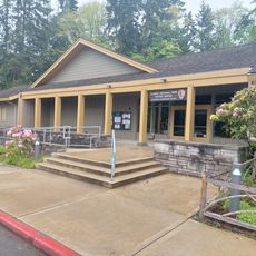
The ridge was developed as a recreational destination in the 1930s through road construction and became an important visitor hub in the park. Infrastructure grew over the decades to serve both summer and winter activities for growing numbers of guests.

The ridge's name comes from the fierce winds that sweep across it, shaping how visitors experience the landscape and how local communities have used this place for recreation over generations.

The access road is open daily during summer months but only on weekends in winter when snow is present. Visitors should prepare for wind and cool temperatures regardless of the season, as elevation affects weather conditions significantly.

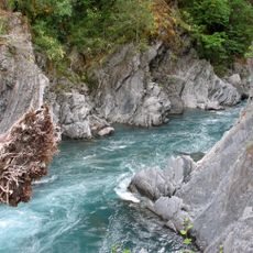
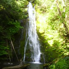
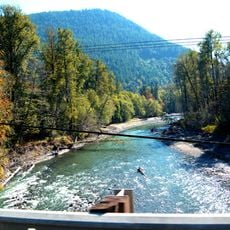
The area receives over 400 inches of annual snowfall, which feeds lush alpine meadows with rare plant species that bloom during warmer months. This mix of intense winters and abundant summer wildflowers makes the place ecologically distinctive.

The community of curious travelers

AroundUs brings together thousands of curated places, local tips, and hidden gems, enriched daily by 60,000 contributors worldwide.

Start exploring
Location
GPS coordinates
47.97700,-123.51800
Latest update
December 20, 2025 12:37
Around this place
Elwha Dam
United States of America

Elwha Dam

13.4 km
Olympic Hot Springs
United States of America

Olympic Hot Springs

12.7 km
Sol Duc Hot Springs
United States of America

Sol Duc Hot Springs

25.7 km
Glines Canyon Dam
United States of America

Glines Canyon Dam

6.7 km
Mount Angeles
United States of America

Mount Angeles

4.3 km
Lake Mills
United States of America

Lake Mills

6.7 km
Goblins Gate
United States of America

Goblins Gate

4.8 km
Madison Creek Falls
United States of America

Madison Creek Falls

8.9 km
United States of America

Hurricane Hill

1.7 km
Humes Ranch Cabin
United States of America

Humes Ranch Cabin

3.7 km
Mount Carrie
United States of America

Mount Carrie

13.4 km
Elwha River Bridge
United States of America

Elwha River Bridge

15.5 km
Mount Fairchild
United States of America

Mount Fairchild

12.1 km
Dodger Point Fire Lookout
United States of America

Dodger Point Fire Lookout

11.5 km
Cat Peak
United States of America

Cat Peak

14.8 km
Altair Campground Community Kitchen
United States of America

Altair Campground Community Kitchen

6.8 km
Obstruction Peak
United States of America

Obstruction Peak

11.9 km
Carrie Glacier
United States of America

Carrie Glacier

12.9 km
Elwha Ranger Station
United States of America

Elwha Ranger Station

7 km
Olympic National Park Headquarters Historic District
United States of America

Olympic National Park Headquarters Historic District

15.2 km
Mount Fitzhenry
United States of America

Mount Fitzhenry

10.3 km
Elwha Campground Community Kitchen
United States of America

Elwha Campground Community Kitchen

7.6 km
Fairchild Glacier
United States of America

Fairchild Glacier

11.4 km
Ludden Peak
United States of America

Ludden Peak

13.6 km
Holy Trinity Lutheran Church
United States of America

Holy Trinity Lutheran Church

15.4 km
Hurricane Ridge Visitor Center
United States of America

Hurricane Ridge Visitor Center

1.7 km
Olympic National Park Visitor Center
United States of America

Olympic National Park Visitor Center

15.3 km
Obstruction Point-Deer Park Trail
United States of America

Obstruction Point-Deer Park Trail

12 km
Show the full map
Reviews
Share your experience

No review yet

Discussions
Start a discussion...

No discussion yet

« Hurricane Ridge - Mountain ridge in Olympic National Park, Washington, US » is provided by Around Us (aroundus.com). Images and texts are derived from Wikimedia project under a Creative Commons license. You are allowed to copy, distribute, and modify copies of this page, under the conditions set by the license, as long as this note is clearly visible.

Discover hidden gems everywhere you go!

From secret cafés to breathtaking viewpoints, skip the crowded tourist spots and find places that match your style. Our app makes it easy with voice search, smart filtering, route optimization, and insider tips from travelers worldwide. Download now for the complete mobile experience.

Around Us App Screenshot

A unique approach to discovering new places

Le Figaro

All the places worth exploring

France Info

A tailor-made excursion in just a few clicks

20 Minutes

Around Us
Travel Guide & Maps
Download

Send to your phone

QR Code
1

Open the camera app on your mobile.

2

Point at the QR code with your camera. A notification will appear.

3

Tap the notification to open the link.