Enable Location

We need your location to show you interesting places around you

Discover nearby places

Find interesting locations and hidden gems around you

Precise directions

Get accurate directions and distances to places

Your location is never shared with other users. It's only used when you tap the location button.

Penrose Point State Park

Log in to your account

Start exploring — it's free

Trusted by 61,996 travelers worldwide

Continue with Google
Continue with Apple
or

We will send you a code to connect

By continuing, you accept our Terms and Conditions and our Privacy Policy

Check your inbox

We've sent a pincode in your inbox. Please enter the code below.

Penrose Point State Park

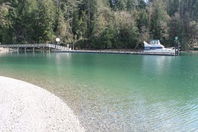
Penrose Point State Park, State park near Mayo Cove, Pierce County, US.

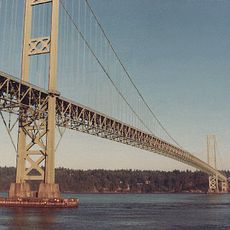
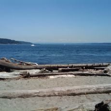
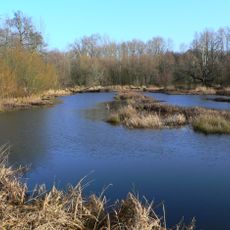
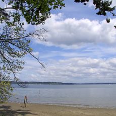
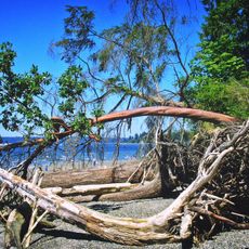
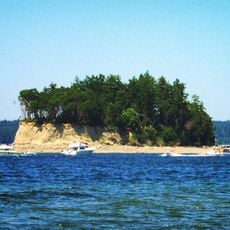
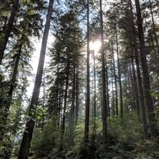
Penrose Point State Park is a forested park with over 2 kilometers of shoreline along Puget Sound in Pierce County. The park offers several trails that wind through dense woods and along the rocky coastal sections.

The park takes its name from Stephen Penrose, who served as president of Whitman College in Walla Walla from 1884 to 1934. His connection to the region led to this coastal area being named after him.

Local people use the coves and shallow waters regularly to harvest clams and crabs, continuing a tradition that goes back generations in this region. These practices show how deeply the community connects with the marine environment.

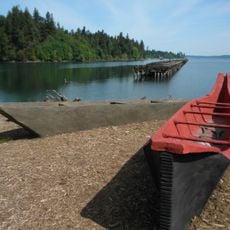
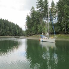
The park has 82 campsites and boat moorage with space for eight additional buoys distributed along the shore. The trails are well-marked, making navigation and access to different coves straightforward.

A trail in the park was built by an Eagle Scout as an interpretive project and guides visitors through the ecosystems of the Pacific Northwest. This hand-built path showcases details of local plants and wildlife in an informative way.

The community of curious travelers

AroundUs brings together thousands of curated places, local tips, and hidden gems, enriched daily by 60,000 contributors worldwide.

Start exploring
Location
GPS coordinates
47.25870,-122.74400
Latest update
December 11, 2025 11:09
Around this place
Tacoma Narrows Bridge
United States of America

Tacoma Narrows Bridge

14.7 km
Chambers Bay Golf Course
United States of America

Chambers Bay Golf Course

14.7 km
McNeil Island Corrections Center
United States of America

McNeil Island Corrections Center

6.4 km
Tacoma Narrows Bridge
United States of America

Tacoma Narrows Bridge

14.6 km
Point Defiance Park
United States of America

Point Defiance Park

17.1 km
Point Defiance Zoo & Aquarium
United States of America

Point Defiance Zoo & Aquarium

17.6 km
Fort Nisqually
United States of America

Fort Nisqually

16.7 km
Thornewood
United States of America

Thornewood

20.4 km
Billy Frank Jr. Nisqually National Wildlife Refuge
United States of America

Billy Frank Jr. Nisqually National Wildlife Refuge

18.7 km
Fort Steilacoom
United States of America

Fort Steilacoom

16.2 km
Tolmie State Park
United States of America

Tolmie State Park

15.9 km
Kopachuck State Park
United States of America

Kopachuck State Park

8.1 km
Cutts Island State Park
United States of America

Cutts Island State Park

8.1 km
Woodard Bay Natural Resources Conservation Area
United States of America

Woodard Bay Natural Resources Conservation Area

15.6 km
Joemma Beach State Park
United States of America

Joemma Beach State Park

6.1 km
Jarrell Cove State Park
United States of America

Jarrell Cove State Park

10.8 km
Rhodesleigh
United States of America

Rhodesleigh

19.3 km
Fireboat No. 1
United States of America

Fireboat No. 1

20.1 km
Camp 6 Logging Museum
United States of America

Camp 6 Logging Museum

17.1 km
DuPont Museum
United States of America

DuPont Museum

20.2 km
Harbor History Museum
United States of America

Harbor History Museum

14.4 km
Dofflemyer Point Light
United States of America

Dofflemyer Point Light

18 km
Purdy Bridge
United States of America

Purdy Bridge

16.5 km
North 23rd Street Bridge
United States of America

North 23rd Street Bridge

20.6 km
Winnifred Street Bridge
United States of America

Winnifred Street Bridge

18.1 km
Fox Island School
United States of America

Fox Island School

9.3 km
Blue Mouse Theatre, North End
United States of America

Blue Mouse Theatre, North End

19.3 km
DuPont Library
United States of America

DuPont Library

20.1 km
Show the full map
« Penrose Point State Park - State park near Mayo Cove, Pierce County, US » is provided by Around Us (aroundus.com). Images and texts are derived from Wikimedia project under a Creative Commons license. You are allowed to copy, distribute, and modify copies of this page, under the conditions set by the license, as long as this note is clearly visible.

Discover hidden gems everywhere you go!

From secret cafés to breathtaking viewpoints, skip the crowded tourist spots and find places that match your style. Our app makes it easy with voice search, smart filtering, route optimization, and insider tips from travelers worldwide. Download now for the complete mobile experience.

Around Us App Screenshot

A unique approach to discovering new places

Le Figaro

All the places worth exploring

France Info

A tailor-made excursion in just a few clicks

20 Minutes

Around Us
Travel Guide & Maps
Download

Send to your phone

QR Code
1

Open the camera app on your mobile.

2

Point at the QR code with your camera. A notification will appear.

3

Tap the notification to open the link.