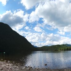
Hayward Lake, lake in Fraser Valley Regional District, British Columbia, Canada
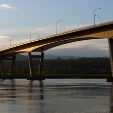
Hayward Lake is an artificial water body in British Columbia created by a dam on the Stave River. The reservoir is surrounded by dense forest and offers calm water used for fishing, swimming, and recreation.
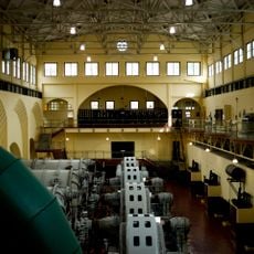
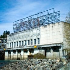
The lake was created by construction of Ruskin Dam, which generates electricity for local communities. This hydroelectric facility played a key role in the region's development and is now operated by BC Hydro.
The lake's name connects to the region's history and its relationship with hydroelectric power. Today, visitors experience it as a quiet refuge where people come to step away from daily life and reconnect with natural surroundings in a simple, uncluttered way.
Bring comfortable shoes for hiking and appropriate clothing for the weather. The area is accessible year-round but is most popular in summer, with parking and restrooms located near the main recreation area.
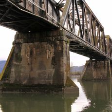
The Railway Trail follows a historic railway route that once connected the lake to the town of Mission and is about 12 kilometers long. Along the way, visitors pass old wooden pillars from a former bridge, revealing the area's industrial past in the landscape.
The community of curious travelers
AroundUs brings together thousands of curated places, local tips, and hidden gems, enriched daily by 60,000 contributors worldwide.