Chest opened
+${chestReward.xp} XP
Explorer
NOUVEAU ×${chestReward.collectible.quantity}
tapez pour fermer
Chest locked

Open chests in the app

Around Us is built for your phone — chests unlock when you walk, explore and capture nearby places.

Enable Location

We need your location to show you interesting places around you

Discover nearby places

Find interesting locations and hidden gems around you

Precise directions

Get accurate directions and distances to places

Your location is never shared with other users. It's only used when you tap the location button.

Methow River

Log in to your account

Start exploring — it's free

Trusted by 72,889 travelers worldwide

Continue with Google
Continue with Apple
or

We will send you a code to connect

By continuing, you accept our Terms and Conditions and our Privacy Policy

Check your inbox

We've sent a pincode in your inbox. Please enter the code below.

Methow River
Discussion Reviews 1 Photos
11k Popularity

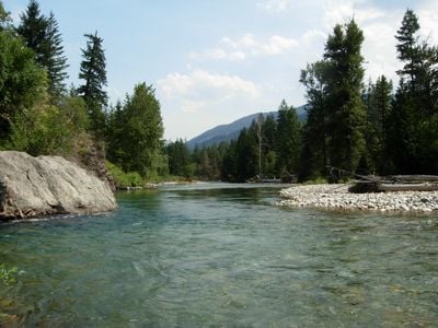
Methow River, Mountain river in North Cascades, Washington, United States.

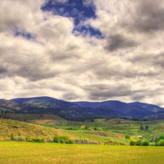
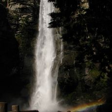
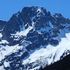
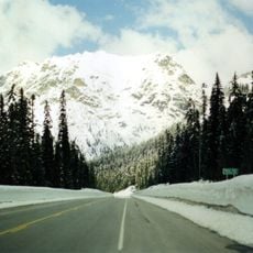
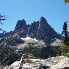
The Methow River is a mountain river flowing through northern Washington's Cascades, carving through forests and ridges before meeting the Columbia River near Pateros. Its waters pass through varied terrain, from forested valleys to more open slopes with rocky features.

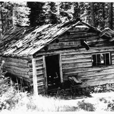
The river takes its name from the Methow people, native inhabitants of the region, with the word meaning sunflower seeds in their language. This waterway held significance for these communities long before modern settlement arrived.

Salmon runs have shaped life in this river valley for generations, drawing people who depend on the fish and the ecosystem it supports. The connection between the water and local communities remains visible in how people use and protect the river today.

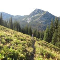
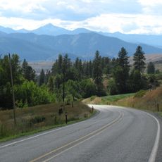
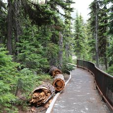
Access to the river is easiest from State Route 20, which runs alongside it with several pull-off points for fishing and exploring. Planning your visit around daylight hours and checking local conditions will help you get the most from the landscape.

Beavers have been reintroduced to this river through a restoration project aimed at rebuilding natural water systems and slowing erosion. These returning beavers are transforming the landscape by creating wetlands that support a wider range of wildlife.

The community of curious travelers

AroundUs brings together thousands of curated places, local tips, and hidden gems, enriched daily by 60,000 contributors worldwide.

Start exploring
GPS coordinates
48.55543,-120.33985
Latest update
December 8, 2025 13:43
Around this place
Washington pass
United States of America

Washington pass

23.5 km
Pasayten Wilderness
United States of America

Pasayten Wilderness

34.1 km
Lake Chelan National Recreation Area
United States of America

Lake Chelan National Recreation Area

34.6 km
Pearrygin Lake State Park
United States of America

Pearrygin Lake State Park

16.2 km
Lake Chelan-Sawtooth Wilderness
United States of America

Lake Chelan-Sawtooth Wilderness

26.7 km
Early Winters Spires
United States of America

Early Winters Spires

23.9 km
Cutthroat Peak
Canada

Cutthroat Peak

27 km
Rainbow Falls
United States of America

Rainbow Falls

35.5 km
Buckner Homestead Historic District
United States of America

Buckner Homestead Historic District

36.2 km
Purple Point-Stehekin Ranger Station House
United States of America

Purple Point-Stehekin Ranger Station House

36.1 km
Loup Loup Pass
United States of America

Loup Loup Pass

38.1 km
Stehekin School
United States of America

Stehekin School

35.6 km
Castle Rock
United States of America

Castle Rock

42.1 km
Golden West Visitor Center
United States of America

Golden West Visitor Center

36.1 km
United States of America

Ashnola Mountain

41 km
Golden West Lodge Historic District
United States of America

Golden West Lodge Historic District

36 km
United States of America

Hock Mountain

26.8 km
Bridge Creek Shelter
United States of America

Bridge Creek Shelter

41.1 km
Sandalee Glacier
United States of America

Sandalee Glacier

36.9 km
Buckner Cabin
United States of America

Buckner Cabin

36.1 km
Early Winters Ranger Station Work Center
United States of America

Early Winters Ranger Station Work Center

8 km
Repulse Peak
United States of America

Repulse Peak

35.3 km
George Miller House
United States of America

George Miller House

35.6 km
Sulphide–Frisco Cabin
United States of America

Sulphide–Frisco Cabin

28.6 km
Rainy Pass
United States of America

Rainy Pass

29.4 km
Washington Pass Overlook Trail
United States of America

Washington Pass Overlook Trail

23 km
High Bridge Shelter
United States of America

High Bridge Shelter

41.7 km
Washington Pass Overlook
United States of America

Washington Pass Overlook

22.9 km
Show the full map
Reviews
Share your experience

No review yet

Discussions
Start a discussion...

No discussion yet

« Methow River - Mountain river in North Cascades, Washington, United States » is provided by Around Us (aroundus.com). Images and texts are derived from Wikimedia project under a Creative Commons license. You are allowed to copy, distribute, and modify copies of this page, under the conditions set by the license, as long as this note is clearly visible.

Discover hidden gems everywhere you go!

From secret cafés to breathtaking viewpoints, skip the crowded tourist spots and find places that match your style. Our app makes it easy with voice search, smart filtering, route optimization, and insider tips from travelers worldwide. Download now for the complete mobile experience.

Around Us App Screenshot

A unique approach to discovering new places

Le Figaro

All the places worth exploring

France Info

A tailor-made excursion in just a few clicks

20 Minutes

Around Us
Travel Guide & Maps
Download

Send to your phone

QR Code
1

Open the camera app on your mobile.

2

Point at the QR code with your camera. A notification will appear.

3

Tap the notification to open the link.