Chest opened
+${chestReward.xp} XP
Explorer
NOUVEAU ×${chestReward.collectible.quantity}
tapez pour fermer
Chest locked

Open chests in the app

Around Us is built for your phone — chests unlock when you walk, explore and capture nearby places.

Enable Location

We need your location to show you interesting places around you

Discover nearby places

Find interesting locations and hidden gems around you

Precise directions

Get accurate directions and distances to places

Your location is never shared with other users. It's only used when you tap the location button.

Camp Verde

Log in to your account

Start exploring — it's free

Trusted by 72,876 travelers worldwide

Continue with Google
Continue with Apple
or

We will send you a code to connect

By continuing, you accept our Terms and Conditions and our Privacy Policy

Check your inbox

We've sent a pincode in your inbox. Please enter the code below.

Discussion Reviews 2 Photos
37.3k Popularity

Camp Verde, International Dark Sky Community in Yavapai County, Arizona

Camp Verde is a town in Yavapai County, Arizona, situated along the Verde River in desert terrain. The area is characterized by low artificial light at night and sits at an elevation of around 1000 feet (300 meters).

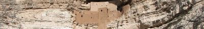
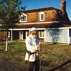
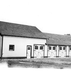
Fort Verde was established in 1865 as a military outpost to manage conflicts between settlers and Native peoples in the region. The fort shaped the early settlement and development of the area.

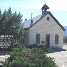
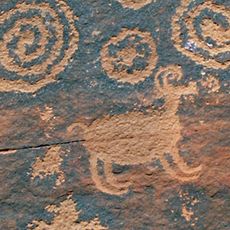
The Yavapai-Apache Nation remains deeply connected to Camp Verde through year-round traditional ceremonies and gatherings that shape community life. Visitors can witness these cultural expressions at local events and in spaces that hold meaning for the people who call this place home.

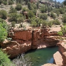
The flat terrain around Camp Verde makes exploring on foot relatively straightforward, particularly during cooler morning and evening hours in warmer months. Visitors should prepare for dry conditions and strong sun, bringing plenty of water since the region is quite arid.

The place holds International Dark Sky Community status, making it possible to see the Milky Way and star clusters without optical aid on clear nights. This designation means the community has actively worked to preserve nighttime darkness and reduce light pollution.

The community of curious travelers

AroundUs brings together thousands of curated places, local tips, and hidden gems, enriched daily by 60,000 contributors worldwide.

Start exploring
Location
Elevation above the sea
959 m
GPS coordinates
34.56361,-111.85444
Latest update
December 17, 2025 10:23
Around this place
Out of Africa Wildlife Park
United States of America

Out of Africa Wildlife Park

8.3 km
Fort Verde State Historic Park
United States of America

Fort Verde State Historic Park

257 m
United States of America

West Clear Creek Wilderness

10 km
V-Bar-V Heritage Site
United States of America

V-Bar-V Heritage Site

16.5 km
United States of America

House Mountain

23.1 km
Beaver Creek Ranger Station
United States of America

Beaver Creek Ranger Station

17.9 km
Clear Creek Church
United States of America

Clear Creek Church

4.9 km
United States of America

Cedar Bench Wilderness

15.2 km
United States of America

Thompson Ranch

21.6 km
Master Mechanic's House
United States of America

Master Mechanic's House

24.6 km
Bell Trail
United States of America

Bell Trail

17.9 km
United States of America

Montezuma Castle Visitor Center

5.5 km
Verde Valley Archaeology Center and Museum
United States of America

Verde Valley Archaeology Center and Museum

779 m
United States of America

Beaver Creek Biosphere Reserve

21.3 km
United States of America

Aleutian Islands Biosphere Reserve

21.3 km
United States of America

Deadwood Point

18.6 km
United States of America

Beaverhead

22.4 km
United States of America

Cienega Tank

11.3 km
United States of America

Bull Run Rapid

16.5 km
United States of America

Bushman Rapid

18.5 km
United States of America

Verde Santa Fe Golf Course

20.6 km
United States of America

Scenic viewpoint

23.1 km
United States of America

Scenic viewpoint

5.5 km
United States of America

Scenic viewpoint

10.8 km
United States of America

Scenic viewpoint

10.8 km
United States of America

Scenic viewpoint

10.5 km
United States of America

Scenic viewpoint

21.8 km
United States of America

Scenic viewpoint

21.8 km
Show the full map
Reviews
Share your experience

No review yet

Discussions
Start a discussion...

No discussion yet

« Camp Verde - International Dark Sky Community in Yavapai County, Arizona » is provided by Around Us (aroundus.com). Images and texts are derived from Wikimedia project under a Creative Commons license. You are allowed to copy, distribute, and modify copies of this page, under the conditions set by the license, as long as this note is clearly visible.

Discover hidden gems everywhere you go!

From secret cafés to breathtaking viewpoints, skip the crowded tourist spots and find places that match your style. Our app makes it easy with voice search, smart filtering, route optimization, and insider tips from travelers worldwide. Download now for the complete mobile experience.

Around Us App Screenshot

A unique approach to discovering new places

Le Figaro

All the places worth exploring

France Info

A tailor-made excursion in just a few clicks

20 Minutes

Around Us
Travel Guide & Maps
Download

Send to your phone

QR Code
1

Open the camera app on your mobile.

2

Point at the QR code with your camera. A notification will appear.

3

Tap the notification to open the link.