Enable Location

We need your location to show you interesting places around you

Discover nearby places

Find interesting locations and hidden gems around you

Precise directions

Get accurate directions and distances to places

Your location is never shared with other users. It's only used when you tap the location button.

Log in to your account

Start exploring — it's free

Trusted by 63,520 travelers worldwide

Continue with Google
Continue with Apple
or

We will send you a code to connect

By continuing, you accept our Terms and Conditions and our Privacy Policy

Check your inbox

We've sent a pincode in your inbox. Please enter the code below.

Dogtown Reservoir
Discussion Reviews Photo
1.5k Popularity

Dogtown Reservoir, water body in Coconino County, Arizona

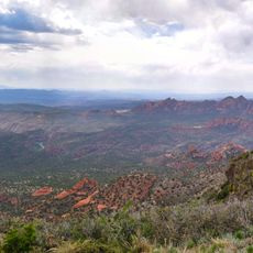
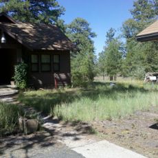
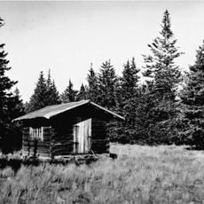
Dogtown Reservoir is a body of water in Coconino County, Arizona, situated in a dry, mountainous region surrounded by forest and natural landscape. The calm surface stretches beneath open sky and serves as a spot for fishing, walking, and picnicking along the shoreline.

This reservoir was built decades ago to hold water for local communities and regional needs. Over time it shifted from serving a purely practical purpose to becoming a favored spot for outdoor recreation and nature enjoyment.

The area is accessible by simple roads with parking available near the water for easy access. Visit during fair weather since some roads are unpaved and can become difficult after rain.

The changing light throughout the day creates shifting reflections on the water surface, offering visitors a naturally changing visual experience. These subtle transformations make each visit feel different and encourage quiet observation.

The community of curious travelers

AroundUs brings together thousands of curated places, local tips, and hidden gems, enriched daily by 60,000 contributors worldwide.

Start exploring
Location
GPS coordinates
35.21092,-112.13070
Latest update
February 9, 2026 08:19
Around this place
Lowell Observatory
United States of America

Lowell Observatory

42.4 km
Lava River Cave
United States of America

Lava River Cave

30.5 km
Red Rock-Secret Mountain Wilderness
United States of America

Red Rock-Secret Mountain Wilderness

37 km
Riordan Mansion State Historic Park
United States of America

Riordan Mansion State Historic Park

43.1 km
Museum of Northern Arizona
United States of America

Museum of Northern Arizona

42.4 km
Agassiz Peak
United States of America

Agassiz Peak

43.1 km
Kendrick Peak
United States of America

Kendrick Peak

33.6 km
Sycamore Canyon Wilderness
United States of America

Sycamore Canyon Wilderness

28 km
The Arboretum at Flagstaff
United States of America

The Arboretum at Flagstaff

36.8 km
Urban Route 66, Williams
United States of America

Urban Route 66, Williams

7 km
Barney Flat Historic Railroad Logging Landscape
United States of America

Barney Flat Historic Railroad Logging Landscape

6.2 km
Perkinsville Bridge
United States of America

Perkinsville Bridge

35.8 km
Camp Clover Ranger Station
United States of America

Camp Clover Ranger Station

8.5 km
First Methodist Episcopal Church and Parsonage
United States of America

First Methodist Episcopal Church and Parsonage

14.2 km
Riordan Mansion
United States of America

Riordan Mansion

42.9 km
Williams Residential Historic District
United States of America

Williams Residential Historic District

6.4 km
Route 66 Museum And Gift Shop
United States of America

Route 66 Museum And Gift Shop

7.2 km
Flagstaff Armory
United States of America

Flagstaff Armory

43.2 km
Pioneer Museum--Arizona Historical Society
United States of America

Pioneer Museum--Arizona Historical Society

43.3 km
Woody Mountain Lookout Tower
United States of America

Woody Mountain Lookout Tower

35.3 km
Volunteer Lookout Cabin
United States of America

Volunteer Lookout Cabin

21.4 km
Kendrick Mountain Fire Lookout Cabin
United States of America

Kendrick Mountain Fire Lookout Cabin

33.9 km
Flagstaff Federated Community Church
United States of America

Flagstaff Federated Community Church

43.4 km
Bill Williams Lookout Tower
United States of America

Bill Williams Lookout Tower

6.9 km
Volunteer Lookout Tower
United States of America

Volunteer Lookout Tower

21.4 km
Big Hell Canyon Railroad Bridge
United States of America

Big Hell Canyon Railroad Bridge

34.5 km
Little Hell Canyon Bridge
United States of America

Little Hell Canyon Bridge

29 km
Pumphouse Wash Bridge
United States of America

Pumphouse Wash Bridge

41.5 km
Show the full map
Reviews
Share your experience

No review yet

Discussions
Start a discussion...

No discussion yet

« Dogtown Reservoir - water body in Coconino County, Arizona » is provided by Around Us (aroundus.com). Images and texts are derived from Wikimedia project under a Creative Commons license. You are allowed to copy, distribute, and modify copies of this page, under the conditions set by the license, as long as this note is clearly visible.

Discover hidden gems everywhere you go!

From secret cafés to breathtaking viewpoints, skip the crowded tourist spots and find places that match your style. Our app makes it easy with voice search, smart filtering, route optimization, and insider tips from travelers worldwide. Download now for the complete mobile experience.

Around Us App Screenshot

A unique approach to discovering new places

Le Figaro

All the places worth exploring

France Info

A tailor-made excursion in just a few clicks

20 Minutes

Around Us
Travel Guide & Maps
Download

Send to your phone

QR Code
1

Open the camera app on your mobile.

2

Point at the QR code with your camera. A notification will appear.

3

Tap the notification to open the link.