Enable Location

We need your location to show you interesting places around you

Discover nearby places

Find interesting locations and hidden gems around you

Precise directions

Get accurate directions and distances to places

Your location is never shared with other users. It's only used when you tap the location button.

Red Rock-Secret Mountain Wilderness

Log in to your account

Start exploring — it's free

Trusted by 62,474 travelers worldwide

Continue with Google
Continue with Apple
or

We will send you a code to connect

By continuing, you accept our Terms and Conditions and our Privacy Policy

Check your inbox

We've sent a pincode in your inbox. Please enter the code below.

Red Rock-Secret Mountain Wilderness, National Wilderness Area in Coconino National Forest, Arizona.

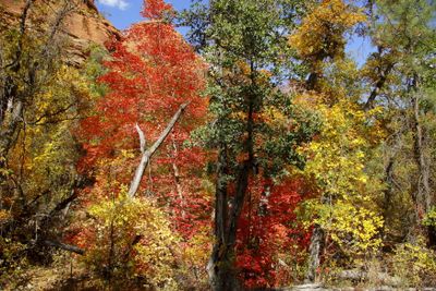
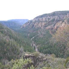
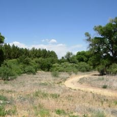
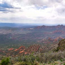
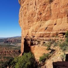
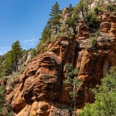
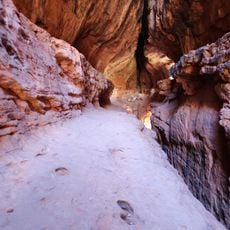
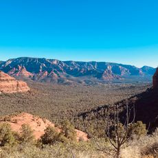
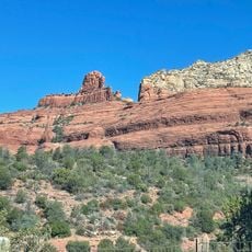
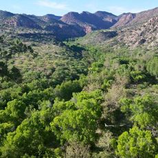
Red Rock-Secret Mountain Wilderness is a protected landscape in Arizona marked by red sandstone formations, natural arches, and deep canyons carved by water. The terrain rises steeply with dramatic cliffs, while creeks flow downward toward Oak Creek.

The area became officially protected in 1984 when designated as part of the National Wilderness Preservation System. This decision safeguarded the land's natural resources and prevented further development in the region.

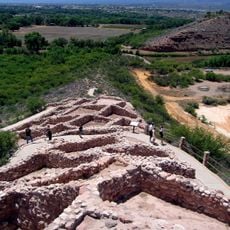
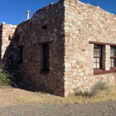
The area carries names from Navajo and Apache peoples who have inhabited these canyons for centuries. Petroglyphs and abandoned dwellings on the canyon walls show how deeply indigenous communities were connected to this land.

Bring detailed maps and plenty of water, as remote sections lack reliable cell service. Proper gear and planning are essential before heading into these backcountry areas.

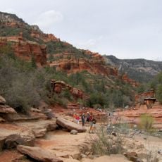
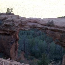
A natural red sandstone bridge arches across a canyon along the Devil's Bridge Trail, one of the most visited paths in the area. This geological feature draws hikers seeking uncommon rock formations.

The community of curious travelers

AroundUs brings together thousands of curated places, local tips, and hidden gems, enriched daily by 60,000 contributors worldwide.

Start exploring
Location
Operator
United States Forest Service
GPS coordinates
34.96560,-111.85700
Latest update
December 8, 2025 19:57
Around this place
Oak Creek Canyon
United States of America

Oak Creek Canyon

13.3 km
Cathedral Rock
United States of America

Cathedral Rock

17.2 km
Slide Rock State Park
United States of America

Slide Rock State Park

12.8 km
Red Rock State Park
United States of America

Red Rock State Park

17 km
Tuzigoot National Monument
United States of America

Tuzigoot National Monument

26.6 km
Bell Rock
United States of America

Bell Rock

20.2 km
Dead Horse Ranch State Park
United States of America

Dead Horse Ranch State Park

27.7 km
Courthouse Butte
United States of America

Courthouse Butte

20.5 km
Sycamore Canyon Wilderness
United States of America

Sycamore Canyon Wilderness

12.2 km
Cathedral Rock Trailhead
United States of America

Cathedral Rock Trailhead

16.8 km
The Arboretum at Flagstaff
United States of America

The Arboretum at Flagstaff

24.5 km
West Fork Trailhead
United States of America

West Fork Trailhead

10.8 km
Soldier Pass Trailhead (Southernmost)
United States of America

Soldier Pass Trailhead (Southernmost)

11.3 km
Sedona Ranger Station
United States of America

Sedona Ranger Station

14.2 km
Clarkdale Historic District
United States of America

Clarkdale Historic District

28.2 km
Sedona Heritage Museum
United States of America

Sedona Heritage Museum

13 km
Sycamore Falls
United States of America

Sycamore Falls

24.7 km
Tuzigoot Museum
United States of America

Tuzigoot Museum

26.7 km
Woody Mountain Lookout Tower
United States of America

Woody Mountain Lookout Tower

21.9 km
Devil's Bridge, Sedona
United States of America

Devil's Bridge, Sedona

8.7 km
Brins Mesa Trailhead
United States of America

Brins Mesa Trailhead

11.8 km
Wilson Mountain Trailhead
United States of America

Wilson Mountain Trailhead

13.7 km
Clark Memorial Clubhouse
United States of America

Clark Memorial Clubhouse

28.2 km
Volunteer Lookout Tower
United States of America

Volunteer Lookout Tower

28.3 km
Midgley Bridge
United States of America

Midgley Bridge

13.8 km
Sycamore Canyon
United States of America

Sycamore Canyon

22.6 km
Broadway Street Bridge
United States of America

Broadway Street Bridge

28 km
Pumphouse Wash Bridge
United States of America

Pumphouse Wash Bridge

12.9 km
Show the full map
« Red Rock-Secret Mountain Wilderness - National Wilderness Area in Coconino National Forest, Arizona » is provided by Around Us (aroundus.com). Images and texts are derived from Wikimedia project under a Creative Commons license. You are allowed to copy, distribute, and modify copies of this page, under the conditions set by the license, as long as this note is clearly visible.

Discover hidden gems everywhere you go!

From secret cafés to breathtaking viewpoints, skip the crowded tourist spots and find places that match your style. Our app makes it easy with voice search, smart filtering, route optimization, and insider tips from travelers worldwide. Download now for the complete mobile experience.

Around Us App Screenshot

A unique approach to discovering new places

Le Figaro

All the places worth exploring

France Info

A tailor-made excursion in just a few clicks

20 Minutes

Around Us
Travel Guide & Maps
Download

Send to your phone

QR Code
1

Open the camera app on your mobile.

2

Point at the QR code with your camera. A notification will appear.

3

Tap the notification to open the link.