Soldier Pass Trailhead

Log in to your account

AroundUs is a community-driven map of interesting places, built by curious explorers like you. It grows with every review, story, and photo you share.
Connect to save your favorite spots, contribute locations, and create personalized routes.
Continue with Google
Continue with Apple
Continue with X
Continue with Facebook
Continue with email
By continuing, you accept our Terms and Conditions and our Privacy Policy
Create an account

Soldier Pass Trailhead

Add to collection
Map
Suggest a change
Share

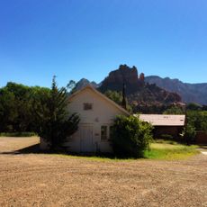
Soldier Pass Trailhead, Trail access point in Sedona, United States.

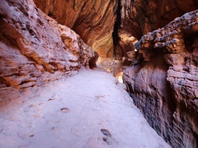
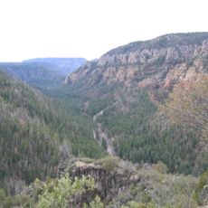
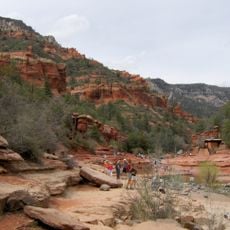
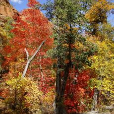
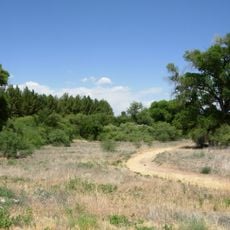
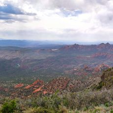
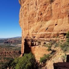
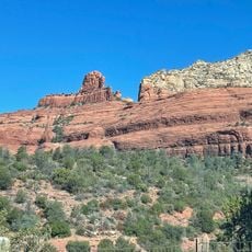
Soldier Pass Trailhead is a hiking access point at the southern end of a trail that winds through red sandstone formations in the Coconino National Forest. The route connects to multiple paths that lead toward different natural features across the landscape.

The trail takes its name from military personnel stationed at Fort Verde who traveled this route during the late 1800s. This historical connection to military transport routes shaped the naming and development of the path.

Petroglyphs left by Native Americans can be spotted along the connecting paths, marking their presence in this landscape. These rock carvings tell stories of ancient communities who used these lands long before modern trails were established.

The trailhead has a parking area that tends to fill up during morning hours, so arriving early helps ensure a spot. Visiting during late afternoon or weekday mornings can make parking easier to find.

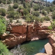
The Devil's Kitchen sinkhole can be reached from the connecting paths and offers a striking geological formation that most visitors seek out. Additionally, a series of seven natural water-collecting pools form in the rock, creating small reservoirs that hold water seasonally.

Location: Sedona

Address: Forest Service 9904 Rd, Sedona, AZ 86336, USA

Opening Hours: Monday-Sunday 08:00-18:00

Phone: +19282032900

Website: https://fs.usda.gov/recarea/coconino/recarea/?recid=55392

GPS coordinates: 34.88435,-111.78367

Latest update: December 14, 2025 17:03

Photos
Around this place
Oak Creek Canyon
United States of America

Oak Creek Canyon

6 km
Cathedral Rock
United States of America

Cathedral Rock

7.2 km
Slide Rock State Park
United States of America

Slide Rock State Park

5.9 km
Red Rock State Park
United States of America

Red Rock State Park

8.7 km
Tuzigoot National Monument
United States of America

Tuzigoot National Monument

25.5 km
Bell Rock
United States of America

Bell Rock

9.5 km
Red Rock-Secret Mountain Wilderness
United States of America

Red Rock-Secret Mountain Wilderness

11.3 km
Dead Horse Ranch State Park
United States of America

Dead Horse Ranch State Park

25.5 km
Courthouse Butte
United States of America

Courthouse Butte

9.6 km
V-Bar-V Heritage Site
United States of America

V-Bar-V Heritage Site

25.6 km
Sycamore Canyon Wilderness
United States of America

Sycamore Canyon Wilderness

21.9 km
Cathedral Rock Trailhead
United States of America

Cathedral Rock Trailhead

6.6 km
Beaver Creek Ranger Station
United States of America

Beaver Creek Ranger Station

24.5 km
Sedona Ranger Station
United States of America

Sedona Ranger Station

2.9 km
Clarkdale Historic District
United States of America

Clarkdale Historic District

28 km
Master Mechanic's House
United States of America

Master Mechanic's House

27.8 km
Willard House
United States of America

Willard House

26.9 km
Sedona Heritage Museum
United States of America

Sedona Heritage Museum

2 km
Bell Trail
United States of America

Bell Trail

24.2 km
Tuzigoot Museum
United States of America

Tuzigoot Museum

25.6 km
Woody Mountain Lookout Tower
United States of America

Woody Mountain Lookout Tower

28.9 km
Devil's Bridge, Sedona
United States of America

Devil's Bridge, Sedona

2.8 km
Wilson Mountain Trailhead
United States of America

Wilson Mountain Trailhead

3.8 km
Clark Memorial Clubhouse
United States of America

Clark Memorial Clubhouse

27.9 km
Midgley Bridge
United States of America

Midgley Bridge

3.8 km
Apache Maid Lookout
United States of America

Apache Maid Lookout

27.7 km
Sycamore Canyon
United States of America

Sycamore Canyon

26.4 km
Broadway Street Bridge
United States of America

Broadway Street Bridge

27.7 km
Show the full map
Reviews

Visited this place? Tap the stars to rate it and share your experience / photos with the community! Try now! You can cancel it anytime.

« Soldier Pass Trailhead - Trail access point in Sedona, United States » is provided by Around Us (aroundus.com). Images and texts are derived from Wikimedia project under a Creative Commons license. You are allowed to copy, distribute, and modify copies of this page, under the conditions set by the license, as long as this note is clearly visible.

Discover hidden gems everywhere you go!

From secret cafés to breathtaking viewpoints, skip the crowded tourist spots and find places that match your style. Our app makes it easy with voice search, smart filtering, route optimization, and insider tips from travelers worldwide. Download now for the complete mobile experience.

Around Us App Screenshot

A unique approach to discovering new places

Le Figaro

All the places worth exploring

France Info

A tailor-made excursion in just a few clicks

20 Minutes