Chest opened
+${chestReward.xp} XP
Explorer
NOUVEAU ×${chestReward.collectible.quantity}
tapez pour fermer

See the monuments around you in AR Open chests in the app

Around Us is built for your phone — point your camera at the streets and discover the monuments and places around you in augmented reality. Around Us is built for your phone — chests unlock when you walk, explore and capture nearby places.

•

Enable Location

We need your location to show you interesting places around you

Discover nearby places

Find interesting locations and hidden gems around you

Precise directions

Get accurate directions and distances to places

Your location is never shared with other users. It's only used when you tap the location button.

Mill Creek Canyon

Log in to your account

Start exploring — it's free

Trusted by 93,787 travelers worldwide

Continue with Google
Continue with Apple
or

We will send you a code to connect

By continuing, you accept our Terms and Conditions and our Privacy Policy

Check your inbox

We've sent a pincode in your inbox. Please enter the code below.

Mill Creek Canyon

Mill Creek Canyon, Canyon in Salt Lake County, United States

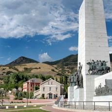
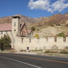
Mill Creek Canyon is a canyon in the Wasatch Mountains on the east side of the Salt Lake Valley, bordered by Parley's Canyon to the north and Big Cottonwood Canyon to the south. Its forested slopes hold trails such as the Pipeline Trail, a 6.7-mile route with 800 feet of elevation gain, and the Desolation Trail to Salt Lake Overlook. The canyon also has two restaurants and six Boy Scout day camps.

Brigham Young named the canyon on August 22, 1847, before the mills that gave it its name were built in and below the densely forested gorge. The Shoshoni name Tempin-Tekkoappah means "rock trap." On February 6, 2021, an avalanche in the Wilson Glade area killed four skiers and injured four others, closing the canyon to recreation until further notice.

The canyon's Shoshoni name, Tempin-Tekkoappah, means "rock trap". Brigham Young named it on August 22, 1847, before the mills that gave it its English name were built in and below the canyon. Six Boy Scout day camps operate within it, and two restaurants serve visitors.

The upper half of the canyon closes to vehicle traffic from November 1 to July 1, so winter access is on foot, ski or snowshoe from the winter gate at the Maple Grove picnic area. A $5 fee per vehicle is paid on the way out; annual passes cost $50, seniors $3 per day or $30 per year, and National Park Service interagency passes are not accepted. Bikes and off-leash dogs on upper trails follow odd/even day rules.

The canyon's Shoshoni name, Tempin-Tekkoappah, means "rock trap", a reference predating Brigham Young's naming of the canyon on August 22, 1847. The upper canyon road closes to vehicles from November 1 to July 1, and when the snow along it is groomed it is treated as a ski trail, where dogs may run off leash on odd-numbered days.

The community of curious travelers

AroundUs brings together thousands of curated places, local tips, and hidden gems, enriched daily by 93,787 contributors worldwide.

Start exploring
Location
Elevation above the sea
2,186 m
GPS coordinates
40.68920,-111.78500
Latest update
October 29, 2026 08:23
Around this place
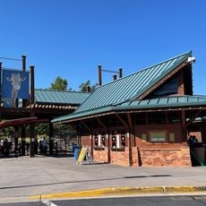
Hogle Zoo
United States of America

Hogle Zoo

4.5 mi
This Is the Place Heritage Park
United States of America

This Is the Place Heritage Park

4.7 mi
Mount Olympus
United States of America

Mount Olympus

2.4 mi
Cottonwood Paper Mill
United States of America

Cottonwood Paper Mill

4.4 mi
This is the Place Monument
United States of America

This is the Place Monument

4.6 mi
This Is The Place Heritage Park
United States of America

This Is The Place Heritage Park

4.7 mi
Henry J. Wheeler Farm
United States of America

Henry J. Wheeler Farm

5.5 mi
Granite Stake Tabernacle
United States of America

Granite Stake Tabernacle

4.9 mi
Mountain Dell Dam
United States of America

Mountain Dell Dam

5.4 mi
Murray City Park
United States of America

Murray City Park

5.5 mi
Stairs Station Hydroelectric Power Plant Historic District
United States of America

Stairs Station Hydroelectric Power Plant Historic District

4.9 mi
Kearns-St. Ann's Orphanage
United States of America

Kearns-St. Ann's Orphanage

5.5 mi
Sugar House Monument
United States of America

Sugar House Monument

4.7 mi
George M. Cannon House
United States of America

George M. Cannon House

4.9 mi
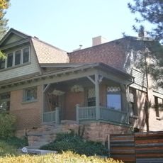
Amanda Conk Best House
United States of America

Amanda Conk Best House

3.9 mi
Granite Hydroelectric Power Plant Historic District
United States of America

Granite Hydroelectric Power Plant Historic District

4.8 mi
Converse Hall
United States of America

Converse Hall

4.7 mi
Emery County Cabin
United States of America

Emery County Cabin

4.8 mi
Third Presbyterian Church Parsonage
United States of America

Third Presbyterian Church Parsonage

4.9 mi
Anders Hintze House
United States of America

Anders Hintze House

2.1 mi
Harold W. and Evelyn Burton House
United States of America

Harold W. and Evelyn Burton House

3.4 mi
George Arbuckle House
United States of America

George Arbuckle House

5.4 mi
Ray F. and Ethel Smith House
United States of America

Ray F. and Ethel Smith House

4.5 mi
J. Leo Fairbanks House
United States of America

J. Leo Fairbanks House

4.9 mi
Sugarbeets
United States of America

Sugarbeets

4.6 mi
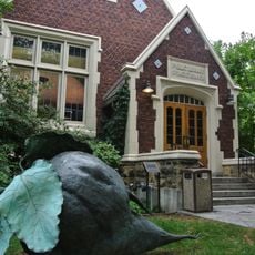
Sprague Branch of the Salt Lake City Public Library
United States of America

Sprague Branch of the Salt Lake City Public Library

4.6 mi
Living Room Trail
United States of America

Living Room Trail

5.3 mi
Evergreen Avenue Historic District
United States of America

Evergreen Avenue Historic District

1.9 mi
Show the full map
Reviews
Share your experience

No review yet

Discussions
Start a discussion...

No discussion yet

« Mill Creek Canyon - Canyon in Salt Lake County, United States » is provided by Around Us (aroundus.com). Images and texts are derived from Wikimedia project under a Creative Commons license. You are allowed to copy, distribute, and modify copies of this page, under the conditions set by the license, as long as this note is clearly visible.

Discover hidden gems everywhere you go!

From secret cafés to breathtaking viewpoints, skip the crowded tourist spots and find places that match your style. Our app makes it easy with voice search, smart filtering, route optimization, and insider tips from travelers worldwide. Download now for the complete mobile experience.
Around Us App Screenshot
❝

A unique approach to discovering new places❞

— Le Figaro

❝

All the places worth exploring❞

— France Info

❝

A tailor-made excursion in just a few clicks❞

— 20 Minutes

Around Us
Travel Guide & Maps
Download

Send to your phone

QR Code
1

Open the camera app on your mobile.

2

Point at the QR code with your camera. A notification will appear.

3

Tap the notification to open the link.