Chest opened
+${chestReward.xp} XP
Explorer
NOUVEAU ×${chestReward.collectible.quantity}
tapez pour fermer
Chest locked

Open chests in the app

Around Us is built for your phone — chests unlock when you walk, explore and capture nearby places.

Enable Location

We need your location to show you interesting places around you

Discover nearby places

Find interesting locations and hidden gems around you

Precise directions

Get accurate directions and distances to places

Your location is never shared with other users. It's only used when you tap the location button.

American Falls

Log in to your account

Start exploring — it's free

Trusted by 72,930 travelers worldwide

Continue with Google
Continue with Apple
or

We will send you a code to connect

By continuing, you accept our Terms and Conditions and our Privacy Policy

Check your inbox

We've sent a pincode in your inbox. Please enter the code below.

Discussion Reviews 1 Photos
17k Popularity

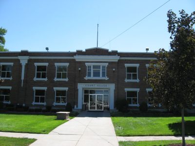
American Falls, city in and county seat of Power County, Idaho, United States

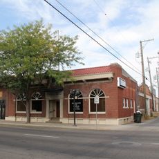
American Falls is a small city in Power County in southeastern Idaho located next to the Snake River and American Falls Reservoir. It serves as the county seat and offers basic services including government facilities, local businesses, and family-owned restaurants.

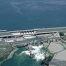
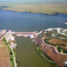
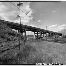
Explorers like Wilson Price Hunt and John C. Fremont visited the falls in the area during their expeditions westward. The original town relocated in 1925 to allow construction of a dam that provided electricity to the region.

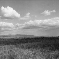
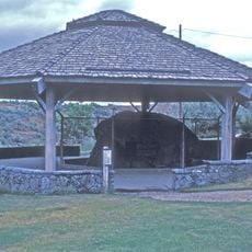
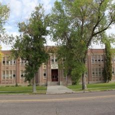
American Falls serves as the administrative center of Power County and shapes local community life. The town reflects daily rural living where farming and river traditions remain central to how people gather and share values.

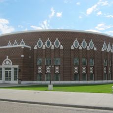
The city is easily accessible by state roads and sits along travel routes through Idaho. Visitors will find parking and access to local services including police and fire stations plus basic utilities.

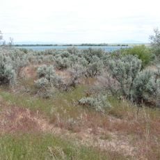
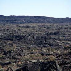
The city takes its name from American trappers who went over the falls in their boat. This event from the past remains part of the town's identity and gives the waterfall and settlement their distinctive name.

The community of curious travelers

AroundUs brings together thousands of curated places, local tips, and hidden gems, enriched daily by 60,000 contributors worldwide.

Start exploring
Location
Elevation above the sea
1,343 m
Shares border with
Snowville
GPS coordinates
42.78111,-112.85556
Latest update
February 17, 2026 01:20
Around this place
Fort Hall
United States of America

Fort Hall

32.1 km
Massacre Rocks State Park
United States of America

Massacre Rocks State Park

8.8 km
Holt Arena
United States of America

Holt Arena

36.3 km
American Falls Dam
United States of America

American Falls Dam

1.5 km
Pocatello Idaho Temple
United States of America

Pocatello Idaho Temple

39.5 km
Register Rock
United States of America

Register Rock

19.4 km
Lake Walcott State Park
United States of America

Lake Walcott State Park

52.2 km
Lake Walcott
United States of America

Lake Walcott

42.9 km
Idaho Museum of Natural History
United States of America

Idaho Museum of Natural History

35.8 km
Minidoka National Wildlife Refuge
United States of America

Minidoka National Wildlife Refuge

45.3 km
Blackfoot LDS Tabernacle
United States of America

Blackfoot LDS Tabernacle

61.5 km
St. Joseph's Catholic Church
United States of America

St. Joseph's Catholic Church

33.9 km
Standrod House
United States of America

Standrod House

33.8 km
Idaho State Arboretum
United States of America

Idaho State Arboretum

35.6 km
Church of the Assumption
United States of America

Church of the Assumption

34.9 km
Idaho State University Administration Building
United States of America

Idaho State University Administration Building

35.7 km
Power County Courthouse
United States of America

Power County Courthouse

580 m
A.F.R. Building
United States of America

A.F.R. Building

34.1 km
Walter Sparks House
United States of America

Walter Sparks House

508 m
Pocatello Carnegie Library
United States of America

Pocatello Carnegie Library

34.1 km
Sullivan-Kinney House
United States of America

Sullivan-Kinney House

34.3 km
John Hood House
United States of America

John Hood House

35.4 km
United States of America

Oneida Milling and Elevator Company Grain Elevator

1.1 km
Idaho Republican Building
United States of America

Idaho Republican Building

61.6 km
Shilling Avenue Historic District
United States of America

Shilling Avenue Historic District

61.6 km
Idaho Museum of Natural History
United States of America

Idaho Museum of Natural History

35.5 km
Wapi Lava Field
United States of America

Wapi Lava Field

31.7 km
McCammon Overhead and River Crossing Bridge
United States of America

McCammon Overhead and River Crossing Bridge

55.7 km
Show the full map
Reviews
Share your experience

No review yet

Discussions
Start a discussion...

No discussion yet

« American Falls - city in and county seat of Power County, Idaho, United States » is provided by Around Us (aroundus.com). Images and texts are derived from Wikimedia project under a Creative Commons license. You are allowed to copy, distribute, and modify copies of this page, under the conditions set by the license, as long as this note is clearly visible.

Discover hidden gems everywhere you go!

From secret cafés to breathtaking viewpoints, skip the crowded tourist spots and find places that match your style. Our app makes it easy with voice search, smart filtering, route optimization, and insider tips from travelers worldwide. Download now for the complete mobile experience.

Around Us App Screenshot

A unique approach to discovering new places

Le Figaro

All the places worth exploring

France Info

A tailor-made excursion in just a few clicks

20 Minutes

Around Us
Travel Guide & Maps
Download

Send to your phone

QR Code
1

Open the camera app on your mobile.

2

Point at the QR code with your camera. A notification will appear.

3

Tap the notification to open the link.