Chest opened
+${chestReward.xp} XP
Explorer
NOUVEAU ×${chestReward.collectible.quantity}
tapez pour fermer
Chest locked

Open chests in the app

Around Us is built for your phone — chests unlock when you walk, explore and capture nearby places.

Enable Location

We need your location to show you interesting places around you

Discover nearby places

Find interesting locations and hidden gems around you

Precise directions

Get accurate directions and distances to places

Your location is never shared with other users. It's only used when you tap the location button.

Munds Park

Log in to your account

Start exploring — it's free

Trusted by 72,922 travelers worldwide

Continue with Google
Continue with Apple
or

We will send you a code to connect

By continuing, you accept our Terms and Conditions and our Privacy Policy

Check your inbox

We've sent a pincode in your inbox. Please enter the code below.

Discussion Reviews 1 Photos
13.8k Popularity

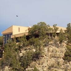
Munds Park, Mountain residential area in Coconino County, Arizona

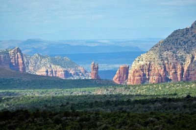
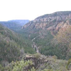
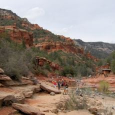
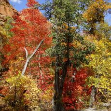
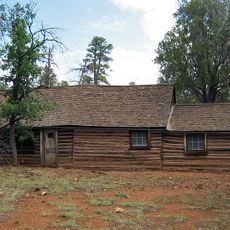
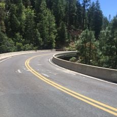
Munds Park is a mountain residential community in Arizona nestled within the Coconino National Forest, characterized by pine forests and high-elevation terrain. The area features networks of trails and natural pathways that wind through the woodland landscape.

The area developed as a residential community in the latter half of the 20th century and has grown steadily over the decades. Modern settlement patterns have been designed to work with the existing forest landscape rather than against it.

The Pinewood Country Club maintains an 18-hole championship golf course that operates seasonally from Memorial Day through October each year.

Visitors can enjoy hiking and outdoor activities year-round, though winter conditions may affect access to certain areas. It is wise to check on current trail conditions and road accessibility before planning a trip to the community.

The community is home to Pinewood Country Club, featuring an 18-hole golf course that operates during the warmer months. Nearby, Lake O'Dell formed by an earthen dam on Munds Creek offers kayaking opportunities and serves as a habitat for various bird species.

The community of curious travelers

AroundUs brings together thousands of curated places, local tips, and hidden gems, enriched daily by 60,000 contributors worldwide.

Start exploring
Location
Elevation above the sea
2,009 m
GPS coordinates
34.94556,-111.63944
Latest update
December 7, 2025 20:24
Around this place
Oak Creek Canyon
United States of America

Oak Creek Canyon

8.8 km
Cathedral Rock
United States of America

Cathedral Rock

19.8 km
Slide Rock State Park
United States of America

Slide Rock State Park

9 km
Red Rock State Park
United States of America

Red Rock State Park

22.6 km
Bell Rock
United States of America

Bell Rock

19.8 km
Red Rock-Secret Mountain Wilderness
United States of America

Red Rock-Secret Mountain Wilderness

20 km
Riordan Mansion State Historic Park
United States of America

Riordan Mansion State Historic Park

27.1 km
Courthouse Butte
United States of America

Courthouse Butte

19.2 km
Orpheum Theater
United States of America

Orpheum Theater

28.2 km
The Arboretum at Flagstaff
United States of America

The Arboretum at Flagstaff

25.3 km
Railroad Addition Historic District
United States of America

Railroad Addition Historic District

28.1 km
Our Lady of Guadaloupe Church
United States of America

Our Lady of Guadaloupe Church

27.9 km
Sedona Ranger Station
United States of America

Sedona Ranger Station

14.8 km
Presbyterian Church Parsonage
United States of America

Presbyterian Church Parsonage

28.3 km
Brannen-Devine House
United States of America

Brannen-Devine House

27.7 km
Cliffs Ranger Station
United States of America

Cliffs Ranger Station

27.8 km
Riordan Mansion
United States of America

Riordan Mansion

27 km
Sedona Heritage Museum
United States of America

Sedona Heritage Museum

13.5 km
Flagstaff Armory
United States of America

Flagstaff Armory

27.9 km
Flagstaff Southside Historic District
United States of America

Flagstaff Southside Historic District

27.7 km
Woody Mountain Lookout Tower
United States of America

Woody Mountain Lookout Tower

24.2 km
Walnut Canyon Visitor Center
United States of America

Walnut Canyon Visitor Center

27.8 km
Devil's Bridge, Sedona
United States of America

Devil's Bridge, Sedona

16.4 km
Midgley Bridge
United States of America

Midgley Bridge

11.5 km
Apache Maid Lookout
United States of America

Apache Maid Lookout

25.8 km
Flagstaff City-coconino County Public Library
United States of America

Flagstaff City-coconino County Public Library

28.3 km
Northern Arizona Normal School Historic District
United States of America

Northern Arizona Normal School Historic District

27.6 km
Pumphouse Wash Bridge
United States of America

Pumphouse Wash Bridge

12.5 km
Show the full map
Reviews
Share your experience

No review yet

Discussions
Start a discussion...

No discussion yet

« Munds Park - Mountain residential area in Coconino County, Arizona » is provided by Around Us (aroundus.com). Images and texts are derived from Wikimedia project under a Creative Commons license. You are allowed to copy, distribute, and modify copies of this page, under the conditions set by the license, as long as this note is clearly visible.

Discover hidden gems everywhere you go!

From secret cafés to breathtaking viewpoints, skip the crowded tourist spots and find places that match your style. Our app makes it easy with voice search, smart filtering, route optimization, and insider tips from travelers worldwide. Download now for the complete mobile experience.

Around Us App Screenshot

A unique approach to discovering new places

Le Figaro

All the places worth exploring

France Info

A tailor-made excursion in just a few clicks

20 Minutes

Around Us
Travel Guide & Maps
Download

Send to your phone

QR Code
1

Open the camera app on your mobile.

2

Point at the QR code with your camera. A notification will appear.

3

Tap the notification to open the link.