Chest opened
+${chestReward.xp} XP
Explorer
NOUVEAU ×${chestReward.collectible.quantity}
tapez pour fermer
Chest locked

Open chests in the app

Around Us is built for your phone — chests unlock when you walk, explore and capture nearby places.

Enable Location

We need your location to show you interesting places around you

Discover nearby places

Find interesting locations and hidden gems around you

Precise directions

Get accurate directions and distances to places

Your location is never shared with other users. It's only used when you tap the location button.

Village of Cochiti

Log in to your account

Start exploring — it's free

Trusted by 72,881 travelers worldwide

Continue with Google
Continue with Apple
or

We will send you a code to connect

By continuing, you accept our Terms and Conditions and our Privacy Policy

Check your inbox

We've sent a pincode in your inbox. Please enter the code below.

Discussion Reviews 1 Photos
11.8k Popularity

Village of Cochiti, Native American settlement in Sandoval County, United States.

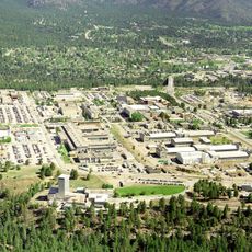
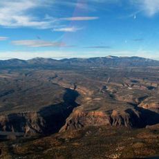
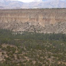
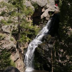
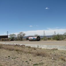
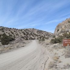
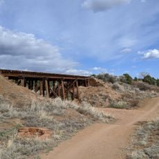
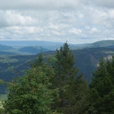
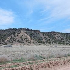
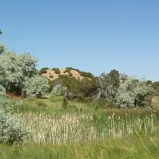
The village of Cochiti sits in the mountains southwest of Santa Fe, New Mexico, occupying a modest area in a high-elevation setting. The settlement borders Cochiti Lake and sits within a landscape of steep canyon walls and forested terrain.

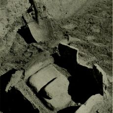
The settlement traces its roots back to Ancestral Puebloan communities that occupied these lands centuries before European contact. In the late 1600s, the people rose up against Spanish colonial rule and successfully defended their sovereignty and way of life.

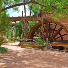
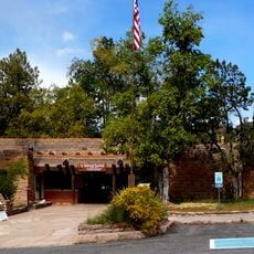
The Cochiti people speak their own language and create traditional pottery that reflects their values and identity. These crafts remain woven into everyday life, connecting people to their heritage.

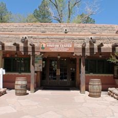
The settlement is accessible by road from nearby Santa Fe, and the area around it is relatively straightforward to navigate. Be prepared for higher elevation and terrain that slopes steeply in places, which affects how you move through the landscape.

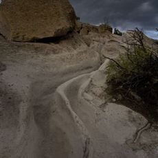
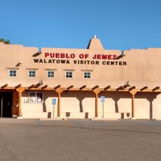
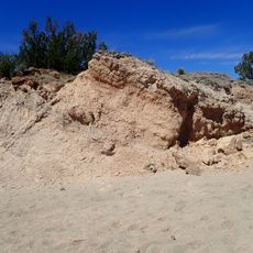
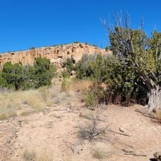
The community oversees extensive reservation lands and partners in managing a nearby national monument known for striking rock formations shaped like tents. This collaboration allows the people to protect their cultural landscapes and natural heritage.

The community of curious travelers

AroundUs brings together thousands of curated places, local tips, and hidden gems, enriched daily by 60,000 contributors worldwide.

Start exploring
Location
Elevation above the sea
1,608 m
GPS coordinates
35.60888,-106.35023
Latest update
December 7, 2025 20:48
Around this place
Los Alamos National Laboratory
United States of America

Los Alamos National Laboratory

29.8 km
Meow Wolf
United States of America

Meow Wolf

32.4 km
Valles Caldera
United States of America

Valles Caldera

34.7 km
Pajarito Plateau
United States of America

Pajarito Plateau

27.2 km
Tsankawi
United States of America

Tsankawi

30.7 km
Bradbury Science Museum
United States of America

Bradbury Science Museum

30.7 km
El Rancho de las Golondrinas
United States of America

El Rancho de las Golondrinas

21.9 km
Bandelier Tuff
United States of America

Bandelier Tuff

17.4 km
Jemez Falls
United States of America

Jemez Falls

31.8 km
Los Alamos Historical Museum
United States of America

Los Alamos Historical Museum

30.8 km
Budaghers
United States of America

Budaghers

16.8 km
Cerrillos Hills State Park
United States of America

Cerrillos Hills State Park

24.1 km
Mesa Public Library
United States of America

Mesa Public Library

30.8 km
Santa Fe Rail Trail
United States of America

Santa Fe Rail Trail

31.6 km
Cerro Grande
United States of America

Cerro Grande

29.6 km
Tonque Pueblo
United States of America

Tonque Pueblo

27.5 km
Ancha Formation
United States of America

Ancha Formation

29.8 km
Bandelier CCC Historic District
United States of America

Bandelier CCC Historic District

20.3 km
The Santa Fe Reptile and Bug Museum
United States of America

The Santa Fe Reptile and Bug Museum

28.9 km
Walatowa Visitor Center
United States of America

Walatowa Visitor Center

34.3 km
Tanos Formation
United States of America

Tanos Formation

22 km
Jardín botánico de Santa Fe
United States of America

Jardín botánico de Santa Fe

21.9 km
Leonora Curtin Wetland Preserve
United States of America

Leonora Curtin Wetland Preserve

21.9 km
Tsankawi Prehistoric Sites
United States of America

Tsankawi Prehistoric Sites

30.2 km
Frijoles Canyon Visitor Center
United States of America

Frijoles Canyon Visitor Center

20.3 km
Los Alamos VLBA station
United States of America

Los Alamos VLBA station

20.8 km
Becoming Human
United States of America

Becoming Human

32.4 km
Piñon Park Splash Pad
United States of America

Piñon Park Splash Pad

27.1 km
Show the full map
Reviews
Share your experience

No review yet

Discussions
Start a discussion...

No discussion yet

« Village of Cochiti - Native American settlement in Sandoval County, United States » is provided by Around Us (aroundus.com). Images and texts are derived from Wikimedia project under a Creative Commons license. You are allowed to copy, distribute, and modify copies of this page, under the conditions set by the license, as long as this note is clearly visible.

Discover hidden gems everywhere you go!

From secret cafés to breathtaking viewpoints, skip the crowded tourist spots and find places that match your style. Our app makes it easy with voice search, smart filtering, route optimization, and insider tips from travelers worldwide. Download now for the complete mobile experience.

Around Us App Screenshot

A unique approach to discovering new places

Le Figaro

All the places worth exploring

France Info

A tailor-made excursion in just a few clicks

20 Minutes

Around Us
Travel Guide & Maps
Download

Send to your phone

QR Code
1

Open the camera app on your mobile.

2

Point at the QR code with your camera. A notification will appear.

3

Tap the notification to open the link.