Chest opened
+${chestReward.xp} XP
Explorer
NOUVEAU ×${chestReward.collectible.quantity}
tapez pour fermer
Chest locked

Open chests in the app

Around Us is built for your phone — chests unlock when you walk, explore and capture nearby places.

Enable Location

We need your location to show you interesting places around you

Discover nearby places

Find interesting locations and hidden gems around you

Precise directions

Get accurate directions and distances to places

Your location is never shared with other users. It's only used when you tap the location button.

Log in to your account

Start exploring — it's free

Trusted by 73,002 travelers worldwide

Continue with Google
Continue with Apple
or

We will send you a code to connect

By continuing, you accept our Terms and Conditions and our Privacy Policy

Check your inbox

We've sent a pincode in your inbox. Please enter the code below.

Rochester Rock Art Panel
Discussion Reviews Photo
4.3k Popularity

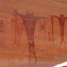
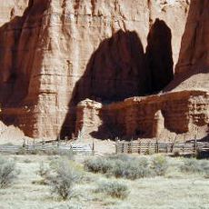
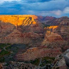
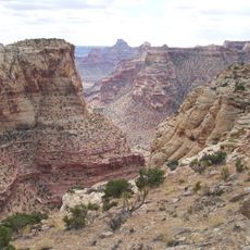
Rochester Rock Art Panel, Archaeological site in Emery County, Utah, United States.

The Rochester Rock Art Panel displays hundreds of petroglyphs carved into dark desert varnish on sandstone surfaces throughout the canyon walls. The carvings span multiple heights and show a wide range of symbols and motifs created over centuries.

The Fremont culture created the petroglyphs at this site between 600 and 1300. The carvings reflect artistic traditions that evolved over multiple generations of inhabitants.

The petroglyphs show artistic and spiritual practices of earlier inhabitants through symbols including anthropomorphic figures and animal representations. These carvings reveal how people expressed their connection to the natural world and their beliefs in stone.

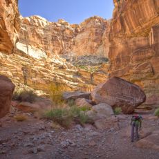
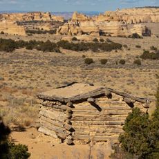
A short hiking path leads from the parking area to the panel and takes about 15 minutes with minimal elevation gain. The terrain is relatively flat and easy to walk, making it accessible for most visitors.

Alongside the ancient carvings are modern horse engravings that were added later. These overlapping marks show how people returned to the same rocks over centuries, each generation leaving its own imprint.

The community of curious travelers

AroundUs brings together thousands of curated places, local tips, and hidden gems, enriched daily by 60,000 contributors worldwide.

Start exploring
Location
GPS coordinates
38.90310,-111.19800
Latest update
December 11, 2025 11:03
Around this place
Cedar Mountain Formation
United States of America

Cedar Mountain Formation

50.7 km
Huntington State Park
United States of America

Huntington State Park

53.1 km
Buckhorn Draw Pictograph Panel
United States of America

Buckhorn Draw Pictograph Panel

50 km
Bottleneck Peak and Moon
United States of America

Bottleneck Peak and Moon

47.5 km
Emery LDS Church
United States of America

Emery LDS Church

4.8 km
San Rafael Bridge
United States of America

San Rafael Bridge

50 km
Cathedral Valley Corral
United States of America

Cathedral Valley Corral

48.4 km
Manti Presbyterian Church
United States of America

Manti Presbyterian Church

55 km
Samuel Singleton House
United States of America

Samuel Singleton House

20.9 km
Lesley Morrell Line Cabin and Corral
United States of America

Lesley Morrell Line Cabin and Corral

48.9 km
Ferron Presbyterian Church and Cottage
United States of America

Ferron Presbyterian Church and Cottage

21.7 km
Francis Marion Jolley House
United States of America

Francis Marion Jolley House

54.9 km
Castle Dale School
United States of America

Castle Dale School

38 km
Hans Ottesen House
United States of America

Hans Ottesen House

55.3 km
Peter Hansen House
United States of America

Peter Hansen House

54.8 km
Paul C. Christensen House
United States of America

Paul C. Christensen House

37.8 km
Leander Lemmon House
United States of America

Leander Lemmon House

51.2 km
Manti Carnegie Library
United States of America

Manti Carnegie Library

55.1 km
Lewis and Clara Anderson House
United States of America

Lewis and Clara Anderson House

54.8 km
Poulsen-Hall House
United States of America

Poulsen-Hall House

55.2 km
Wedge Overlook
United States of America

Wedge Overlook

44.4 km
Little Grand Canyon
United States of America

Little Grand Canyon

46 km
Little Wild Horse Canyon
United States of America

Little Wild Horse Canyon

54 km
Bell Canyon
United States of America

Bell Canyon

48.8 km
Huntington Lake
United States of America

Huntington Lake

53.9 km
Swasey's Cabin
United States of America

Swasey's Cabin

34.7 km
Eagle Canyon Arch
United States of America

Eagle Canyon Arch

32.2 km
Eagle Canyon
United States of America

Eagle Canyon

22.5 km
Show the full map
Reviews
Share your experience

No review yet

Discussions
Start a discussion...

No discussion yet

« Rochester Rock Art Panel - Archaeological site in Emery County, Utah, United States » is provided by Around Us (aroundus.com). Images and texts are derived from Wikimedia project under a Creative Commons license. You are allowed to copy, distribute, and modify copies of this page, under the conditions set by the license, as long as this note is clearly visible.

Discover hidden gems everywhere you go!

From secret cafés to breathtaking viewpoints, skip the crowded tourist spots and find places that match your style. Our app makes it easy with voice search, smart filtering, route optimization, and insider tips from travelers worldwide. Download now for the complete mobile experience.

Around Us App Screenshot

A unique approach to discovering new places

Le Figaro

All the places worth exploring

France Info

A tailor-made excursion in just a few clicks

20 Minutes

Around Us
Travel Guide & Maps
Download

Send to your phone

QR Code
1

Open the camera app on your mobile.

2

Point at the QR code with your camera. A notification will appear.

3

Tap the notification to open the link.