Wedge Overlook

Log in to your account

AroundUs is a community-driven map of interesting places, built by curious explorers like you. It grows with every review, story, and photo you share.
Connect to save your favorite spots, contribute locations, and create personalized routes.
Continue with Google
Continue with Apple
Continue with X
Continue with Facebook
Continue with email
By continuing, you accept our Terms and Conditions and our Privacy Policy
Create an account
Add to collection
Map
Suggest a change
Share

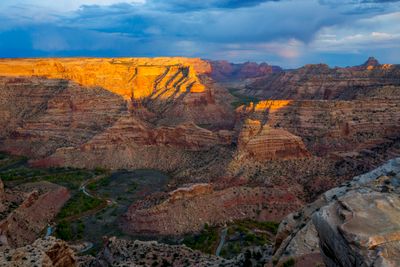
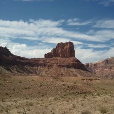
Wedge Overlook, Scenic viewpoint in Emery County, United States.

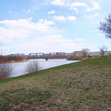
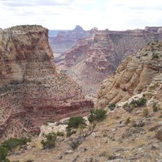
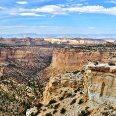
Wedge Overlook is a scenic viewpoint perched on a cliff about 1,200 feet (370 meters) high, overlooking the San Rafael River as it winds through red sandstone canyons below. From this vantage point, you can see an extensive landscape of deep ravines, rock towers, and natural formations carved into the desert plateau.

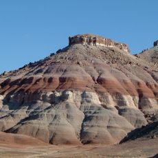
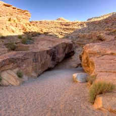
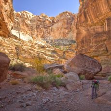
The San Rafael River carved through multiple layers of sedimentary rock over millions of years, gradually deepening its path through the plateau. The exposed rock layers visible today reveal the area's ancient geological timeline.

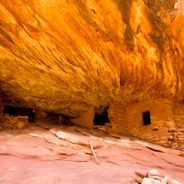
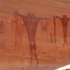
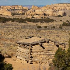
The surrounding San Rafael Swell contains Native American rock art panels and three-toed dinosaur footprints, marking the area's long human presence.

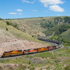
You can reach the overlook via dirt roads from Castle Dale or the I-70 exit 131, though these roads can be rough depending on weather. Bring plenty of water and supplies, as services are limited in this remote area.

The viewpoint reveals a hidden landscape often called Utah's Little Grand Canyon, where the river winds through towering spires and multicolored cliffs. This lesser-visited location offers a raw, uncrowded perspective on dramatic canyon geology without the masses.

Location: Emery County

GPS coordinates: 39.09546,-110.74907

Latest update: December 6, 2025 19:05

Photos
Natural monuments in Utah: archaeological sites, rock formations, thermal springs

Utah preserves thousands of years of human history alongside some of North America's most varied geological landscapes. The region contains extensive rock art panels and Ancestral Pueblo ruins, including the 13th-century stone structures at Bears Ears National Monument and the 650-plus petroglyphs...

Around this place
Goblin Valley State Park
United States of America

Goblin Valley State Park

59 km
Cedar Mountain Formation
United States of America

Cedar Mountain Formation

18.2 km
Crystal Geyser
United States of America

Crystal Geyser

55.9 km
Green River State Park
United States of America

Green River State Park

52.7 km
Huntington State Park
United States of America

Huntington State Park

32.1 km
Buckhorn Draw Pictograph Panel
United States of America

Buckhorn Draw Pictograph Panel

5.7 km
USU Eastern Prehistoric Museum
United States of America

USU Eastern Prehistoric Museum

56.3 km
Bottleneck Peak and Moon
United States of America

Bottleneck Peak and Moon

6.6 km
Emery LDS Church
United States of America

Emery LDS Church

47.1 km
San Rafael Bridge
United States of America

San Rafael Bridge

7.2 km
Helper Commercial District
United States of America

Helper Commercial District

66.2 km
Samuel Singleton House
United States of America

Samuel Singleton House

33.2 km
Ferron Presbyterian Church and Cottage
United States of America

Ferron Presbyterian Church and Cottage

33.9 km
Castle Dale School
United States of America

Castle Dale School

26.7 km
Lars Peter Larson House
United States of America

Lars Peter Larson House

29.2 km
Paul C. Christensen House
United States of America

Paul C. Christensen House

26.8 km
Leander Lemmon House
United States of America

Leander Lemmon House

31.7 km
Cleveland-Lloyd Dinosaur Quarry
United States of America

Cleveland-Lloyd Dinosaur Quarry

25.9 km
The Helper Museum
United States of America

The Helper Museum

66 km
Little Grand Canyon
United States of America

Little Grand Canyon

1.7 km
Little Wild Horse Canyon
United States of America

Little Wild Horse Canyon

66.4 km
Huntington Lake
United States of America

Huntington Lake

32.8 km
Bell Canyon
United States of America

Bell Canyon

56.6 km
Swasey's Cabin
United States of America

Swasey's Cabin

29.4 km
Price Canyon
United States of America

Price Canyon

69 km
Eagle Canyon
United States of America

Eagle Canyon

22.1 km
Eagle Canyon Bridge
United States of America

Eagle Canyon Bridge

28.1 km
Dutchman Arch
United States of America

Dutchman Arch

25 km
Show the full map
Reviews

Visited this place? Tap the stars to rate it and share your experience / photos with the community! Try now! You can cancel it anytime.

« Wedge Overlook - Scenic viewpoint in Emery County, United States » is provided by Around Us (aroundus.com). Images and texts are derived from Wikimedia project under a Creative Commons license. You are allowed to copy, distribute, and modify copies of this page, under the conditions set by the license, as long as this note is clearly visible.

Discover hidden gems everywhere you go!

From secret cafés to breathtaking viewpoints, skip the crowded tourist spots and find places that match your style. Our app makes it easy with voice search, smart filtering, route optimization, and insider tips from travelers worldwide. Download now for the complete mobile experience.

Around Us App Screenshot

A unique approach to discovering new places

Le Figaro

All the places worth exploring

France Info

A tailor-made excursion in just a few clicks

20 Minutes