Dominguez-Escalante National Conservation Area

Log in to your account

AroundUs is a community-driven map of interesting places, built by curious explorers like you. It grows with every review, story, and photo you share.
Connect to save your favorite spots, contribute locations, and create personalized routes.
Continue with Google
Continue with Apple
Continue with X
Continue with Facebook
Continue with email
By continuing, you accept our Terms and Conditions and our Privacy Policy
Create an account

Dominguez-Escalante National Conservation Area

Add to collection
Map
Suggest a change
Share

Dominguez-Escalante National Conservation Area, Nature reserve in Montrose County, United States.

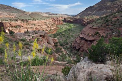
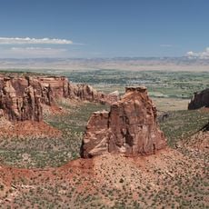
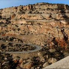
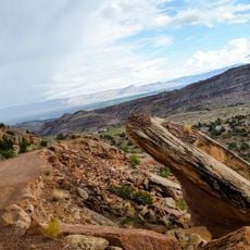
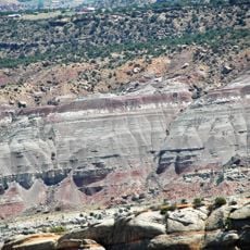
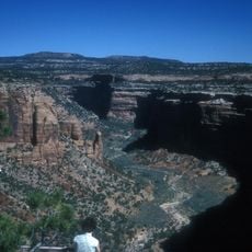
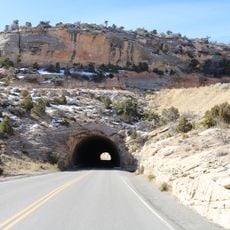
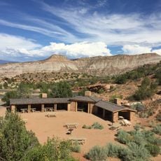
Dominguez-Escalante National Conservation Area is a nature reserve covering a large area of public land with red-rock canyons, sandstone bluffs, and multiple creek systems winding through the landscape. The terrain varies significantly, with elevation changing across the reserve and creating distinct zones of vegetation and geology.

An old trading route used by merchants crossing between New Mexico and California passed through the eastern section during the 1800s. This historic pathway marks one of the region's important connections to early commerce and travel.

The land holds deep meaning for Ute Tribes as a connection to their ancestral home and heritage. You can see evidence of this significance throughout the area in the form of archaeological remains.

The east side is accessible via Bridgeport Bridge from US-50, while the north side requires travel on Highway 141 from Whitewater toward Tabeguache Trail. Different entry points serve different areas, so plan your route based on which section you want to explore.

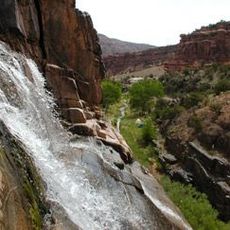
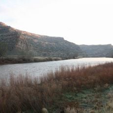
The reserve is crisscrossed by streams that create lifelines through the arid landscape, supporting a diverse array of species that depend on flowing water year-round. These waterways are crucial for the survival of creatures that would otherwise struggle to thrive in such a dry environment.

Location: Montrose County

Operator: Bureau of Land Management

GPS coordinates: 38.74829,-108.38896

Latest update: December 14, 2025 11:25

Photos
Around this place
Colorado National Monument
United States of America

Colorado National Monument

41.7 km
Dominguez Canyon Wilderness
United States of America

Dominguez Canyon Wilderness

2.4 km
James M. Robb – Colorado River State Park
United States of America

James M. Robb – Colorado River State Park

35 km
Egyptian Theatre
United States of America

Egyptian Theatre

27.7 km
Rim Rock Drive
United States of America

Rim Rock Drive

42.7 km
Ralph Stocker Stadium
United States of America

Ralph Stocker Stadium

39.2 km
Land's End Observatory
United States of America

Land's End Observatory

34 km
CAF Rocky Mountain Wing Museum
United States of America

CAF Rocky Mountain Wing Museum

42.8 km
Serpents Trail
United States of America

Serpents Trail

38.1 km
Western Colorado Center for the Arts
United States of America

Western Colorado Center for the Arts

40.2 km
Mesa County Public Library District
United States of America

Mesa County Public Library District

39 km
Cross Orchards Historic Site
United States of America

Cross Orchards Historic Site

39 km
Devils Kitchen Picnic Shelter
United States of America

Devils Kitchen Picnic Shelter

38.1 km
Clifton Community Center and Church
United States of America

Clifton Community Center and Church

38.5 km
First Methodist Episcopal Church of Delta
United States of America

First Methodist Episcopal Church of Delta

27.8 km
First Presbyterian Church of Eckert
United States of America

First Presbyterian Church of Eckert

37.4 km
Handy Chapel
United States of America

Handy Chapel

39 km
Dinosaur Diamond Prehistoric Highway
United States of America

Dinosaur Diamond Prehistoric Highway

39.2 km
North Seventh Street Historic Residential District
United States of America

North Seventh Street Historic Residential District

39 km
Garnethurst
United States of America

Garnethurst

28.4 km
No Thoroughfare Canyon
United States of America

No Thoroughfare Canyon

39 km
Ute Canyon
United States of America

Ute Canyon

41.5 km
The Art Center
United States of America

The Art Center

40.2 km
Avalon Theatre
United States of America

Avalon Theatre

38.5 km
Mesa Theater
United States of America

Mesa Theater

38.6 km
Mesa County Public Library District - Central Library
United States of America

Mesa County Public Library District - Central Library

39 km
East Tunnel
United States of America

East Tunnel

38.7 km
Devils Kitchen Picnic Area
United States of America

Devils Kitchen Picnic Area

38.1 km
Show the full map
Reviews

Visited this place? Tap the stars to rate it and share your experience / photos with the community! Try now! You can cancel it anytime.

« Dominguez-Escalante National Conservation Area - Nature reserve in Montrose County, United States » is provided by Around Us (aroundus.com). Images and texts are derived from Wikimedia project under a Creative Commons license. You are allowed to copy, distribute, and modify copies of this page, under the conditions set by the license, as long as this note is clearly visible.

Discover hidden gems everywhere you go!

From secret cafés to breathtaking viewpoints, skip the crowded tourist spots and find places that match your style. Our app makes it easy with voice search, smart filtering, route optimization, and insider tips from travelers worldwide. Download now for the complete mobile experience.

Around Us App Screenshot

A unique approach to discovering new places

Le Figaro

All the places worth exploring

France Info

A tailor-made excursion in just a few clicks

20 Minutes