Enable Location

We need your location to show you interesting places around you

Discover nearby places

Find interesting locations and hidden gems around you

Precise directions

Get accurate directions and distances to places

Your location is never shared with other users. It's only used when you tap the location button.

Gilpin County

Log in to your account

Start exploring — it's free

Trusted by 63,134 travelers worldwide

Continue with Google
Continue with Apple
or

We will send you a code to connect

By continuing, you accept our Terms and Conditions and our Privacy Policy

Check your inbox

We've sent a pincode in your inbox. Please enter the code below.

Discussion Reviews 1 Photos
17.2k Popularity

Gilpin County, Administrative division in north central Colorado, United States.

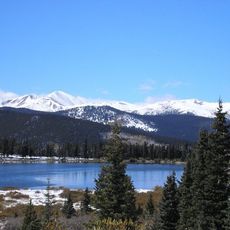
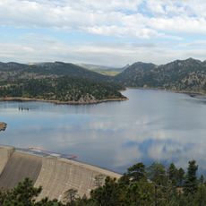
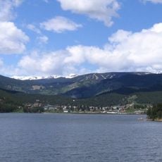
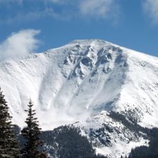
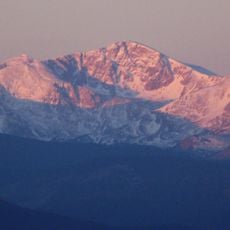
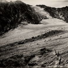
Gilpin County is an administrative division in the mountains west of Denver in north central Colorado. The area spans mountainous terrain with several peaks, including James Peak as the highest point.

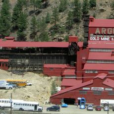
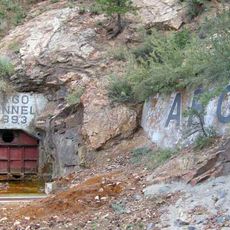
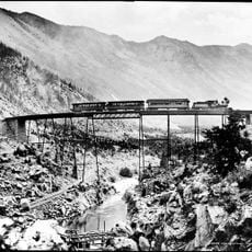
The county was established in 1861 as one of seventeen original Colorado Territory counties and named after Colonel William Gilpin, the first territorial governor. The region experienced rapid growth during the 19th-century gold rush as a mining hub.

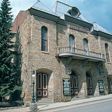
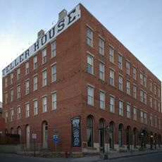
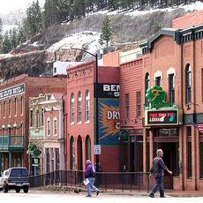
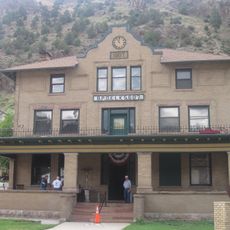
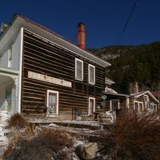
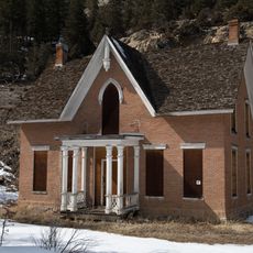
Central City and Black Hawk were once mining towns and now host casinos after Colorado legalized gambling in these locations. The historic buildings from the mining era still shape the towns' appearance and reflect their former economic purpose.

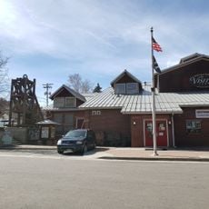
Visitors can explore the historic mining towns of Central City and Black Hawk, which are surrounded by mountains and easily accessible by road from Denver. The best season to visit is autumn, when weather conditions are mild and the landscape displays rich colors.

The county directs a portion of gambling revenue from Black Hawk and Central City toward supporting historical preservation projects across Colorado. This system allows it to sustain the region's mining heritage while funding current needs.

The community of curious travelers

AroundUs brings together thousands of curated places, local tips, and hidden gems, enriched daily by 60,000 contributors worldwide.

Start exploring
GPS coordinates
39.85867,-105.50252
Latest update
December 7, 2025 19:25
Around this place
Rollins Pass
United States of America

Rollins Pass

17.6 km
Golden Gate Canyon State Park
United States of America

Golden Gate Canyon State Park

8.4 km
Saint Mary's Glacier
United States of America

Saint Mary's Glacier

12.6 km
Echo Lake Park
United States of America

Echo Lake Park

23.9 km
Gross Reservoir
United States of America

Gross Reservoir

14.4 km
Argo Gold Mine and Mill
United States of America

Argo Gold Mine and Mill

12.9 km
Argo Tunnel
United States of America

Argo Tunnel

12.8 km
Switzerland Trail
United States of America

Switzerland Trail

18.5 km
Central City Opera House
United States of America

Central City Opera House

6.5 km
Barker Meadow Reservoir
United States of America

Barker Meadow Reservoir

11.9 km
Teller House
United States of America

Teller House

6.5 km
Parry Peak
United States of America

Parry Peak

18.2 km
Central City/Black Hawk Historic District
United States of America

Central City/Black Hawk Historic District

6.4 km
James Peak Wilderness
United States of America

James Peak Wilderness

16 km
Arapaho Glacier
United States of America

Arapaho Glacier

22.1 km
Georgetown-Silver Plume Historic District
United States of America

Georgetown-Silver Plume Historic District

25.4 km
United States of America

Mount Neva

22.9 km
Grace Episcopal Church
United States of America

Grace Episcopal Church

23.8 km
Methodist Episcopal Church
United States of America

Methodist Episcopal Church

12.9 km
Eldora Historic District
United States of America

Eldora Historic District

11.8 km
Idaho Springs Downtown Commercial District
United States of America

Idaho Springs Downtown Commercial District

13 km
Elks Lodge No. 607
United States of America

Elks Lodge No. 607

12.9 km
Gold Miner Hotel
United States of America

Gold Miner Hotel

11.7 km
Toll House
United States of America

Toll House

24.3 km
Visitor Center
United States of America

Visitor Center

13 km
Silver Lake
United States of America

Silver Lake

12.1 km
Devil's Gate High Bridge
United States of America

Devil's Gate High Bridge

24.6 km
Miner Street Bridge
United States of America

Miner Street Bridge

13 km
Show the full map
Reviews
Share your experience

No review yet

Discussions
Start a discussion...

No discussion yet

« Gilpin County - Administrative division in north central Colorado, United States » is provided by Around Us (aroundus.com). Images and texts are derived from Wikimedia project under a Creative Commons license. You are allowed to copy, distribute, and modify copies of this page, under the conditions set by the license, as long as this note is clearly visible.

Discover hidden gems everywhere you go!

From secret cafés to breathtaking viewpoints, skip the crowded tourist spots and find places that match your style. Our app makes it easy with voice search, smart filtering, route optimization, and insider tips from travelers worldwide. Download now for the complete mobile experience.

Around Us App Screenshot

A unique approach to discovering new places

Le Figaro

All the places worth exploring

France Info

A tailor-made excursion in just a few clicks

20 Minutes

Around Us
Travel Guide & Maps
Download

Send to your phone

QR Code
1

Open the camera app on your mobile.

2

Point at the QR code with your camera. A notification will appear.

3

Tap the notification to open the link.