Chest opened
+${chestReward.xp} XP
Explorer
NOUVEAU ×${chestReward.collectible.quantity}
tapez pour fermer
Chest locked

Open chests in the app

Around Us is built for your phone — chests unlock when you walk, explore and capture nearby places.

Enable Location

We need your location to show you interesting places around you

Discover nearby places

Find interesting locations and hidden gems around you

Precise directions

Get accurate directions and distances to places

Your location is never shared with other users. It's only used when you tap the location button.

Log in to your account

Start exploring — it's free

Trusted by 72,883 travelers worldwide

Continue with Google
Continue with Apple
or

We will send you a code to connect

By continuing, you accept our Terms and Conditions and our Privacy Policy

Check your inbox

We've sent a pincode in your inbox. Please enter the code below.

Otis Peak
Discussion Reviews Photo
1.4k Popularity

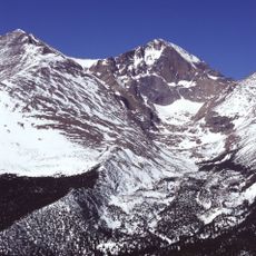
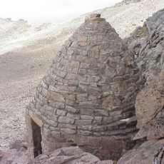
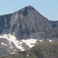
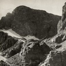
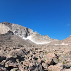
Otis Peak, Mountain peak in Rocky Mountain National Park, Colorado, United States.

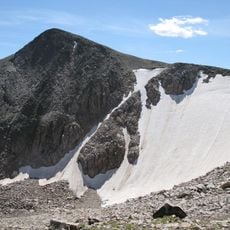
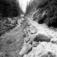
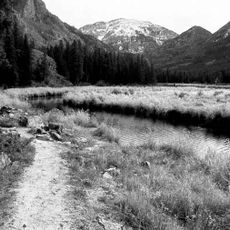
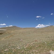
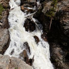
Otis Peak is a mountain in Rocky Mountain National Park that rises to approximately 12,500 feet with steep, rocky slopes. The summit stands within the boundaries of Grand and Larimer Counties, offering exposed terrain throughout the climb.

The mountain received its official name in 1932 from the United States Board on Geographic Names, honoring Dr. Edward Osgood Otis, a tuberculosis specialist. This designation reflects the era's recognition of medical advancement and scientific achievement.

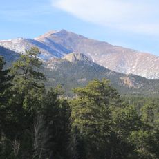
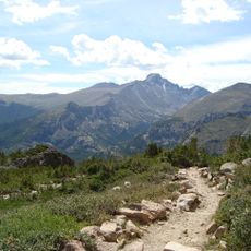
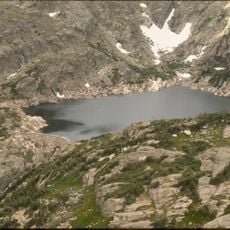
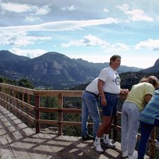
The mountain stands as a representation of Colorado's high-altitude wilderness, drawing mountaineers and nature enthusiasts throughout different seasons.

Visitors need a permit from Rocky Mountain National Park and should prepare for rapid weather changes at this elevation. Conditions can shift within minutes, so warm clothing and protection from wind are essential at all times.

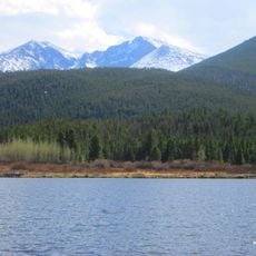
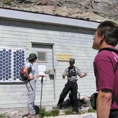
Beneath the peak runs the Alva B. Adams Tunnel, which carries water from Grand Lake across the Continental Divide to eastern Colorado. This water system is a hidden engineering feat that most visitors never realize exists while they hike.

The community of curious travelers

AroundUs brings together thousands of curated places, local tips, and hidden gems, enriched daily by 60,000 contributors worldwide.

Start exploring
Location
GPS coordinates
40.29221,-105.68056
Latest update
December 14, 2025 16:44
Around this place
Longs Peak
United States of America

Longs Peak

6.9 km
Mount Meeker
United States of America

Mount Meeker

8.1 km
Bear Lake Trailhead
United States of America

Bear Lake Trailhead

3.7 km
Andrews Glacier
United States of America

Andrews Glacier

596 m
Agnes Vaille Shelter
United States of America

Agnes Vaille Shelter

6.1 km
Tyndall Glacier
United States of America

Tyndall Glacier

1.6 km
Flattop Mountain Trail
United States of America

Flattop Mountain Trail

2.4 km
East Longs Peak Trail – Longs Peak Trail – Keyhole Route – Shelf Trail
United States of America

East Longs Peak Trail – Longs Peak Trail – Keyhole Route – Shelf Trail

7.1 km
Fern Lake Trail
United States of America

Fern Lake Trail

8.2 km
Mount Julian
United States of America

Mount Julian

10.9 km
Moraine Park Museum and Amphitheater
United States of America

Moraine Park Museum and Amphitheater

11 km
East Inlet Trail
United States of America

East Inlet Trail

11.7 km
Taylor Peak
United States of America

Taylor Peak

1.9 km
United States of America

Mount Alice

6.1 km
Fern Lake Patrol Cabin
United States of America

Fern Lake Patrol Cabin

5.1 km
William Allen White Cabins
United States of America

William Allen White Cabins

10.9 km
Glacier Basin Campground Ranger Station
United States of America

Glacier Basin Campground Ranger Station

8.4 km
Beatrice Willard Alpine Tundra Research Plots
United States of America

Beatrice Willard Alpine Tundra Research Plots

11.8 km
Thunder Lake Patrol Cabin
United States of America

Thunder Lake Patrol Cabin

8.3 km
Moraine Park Discovery Center
United States of America

Moraine Park Discovery Center

11 km
Lily Lake
United States of America

Lily Lake

12 km
Longs Peak Trailhead
United States of America

Longs Peak Trailhead

10.8 km
Bluebird Lake
United States of America

Bluebird Lake

11.4 km
Alberta Falls
United States of America

Alberta Falls

3.8 km
Fern Falls
United States of America

Fern Falls

6.2 km
Adams Falls
United States of America

Adams Falls

11.6 km
Chasm Meadow Patrol Cabin
United States of America

Chasm Meadow Patrol Cabin

7.8 km
Many Parks Curve
United States of America

Many Parks Curve

11.4 km
Show the full map
Reviews
Share your experience

No review yet

Discussions
Start a discussion...

No discussion yet

« Otis Peak - Mountain peak in Rocky Mountain National Park, Colorado, United States » is provided by Around Us (aroundus.com). Images and texts are derived from Wikimedia project under a Creative Commons license. You are allowed to copy, distribute, and modify copies of this page, under the conditions set by the license, as long as this note is clearly visible.

Discover hidden gems everywhere you go!

From secret cafés to breathtaking viewpoints, skip the crowded tourist spots and find places that match your style. Our app makes it easy with voice search, smart filtering, route optimization, and insider tips from travelers worldwide. Download now for the complete mobile experience.

Around Us App Screenshot

A unique approach to discovering new places

Le Figaro

All the places worth exploring

France Info

A tailor-made excursion in just a few clicks

20 Minutes

Around Us
Travel Guide & Maps
Download

Send to your phone

QR Code
1

Open the camera app on your mobile.

2

Point at the QR code with your camera. A notification will appear.

3

Tap the notification to open the link.